How do you calculate a routing with a pivot point?
- Henri
- octobre 17, 2025
A pivot point is a location you want the routing to pass through.
It’s a very useful way to quickly compare routing options.
For example, in this case we’ll check whether it’s better to pass inside or outside the Traffic Separation Scheme (TSS) off Cape Finisterre — a very common situation when sailing from the French Atlantic coast toward Madeira or the Canary Islands.
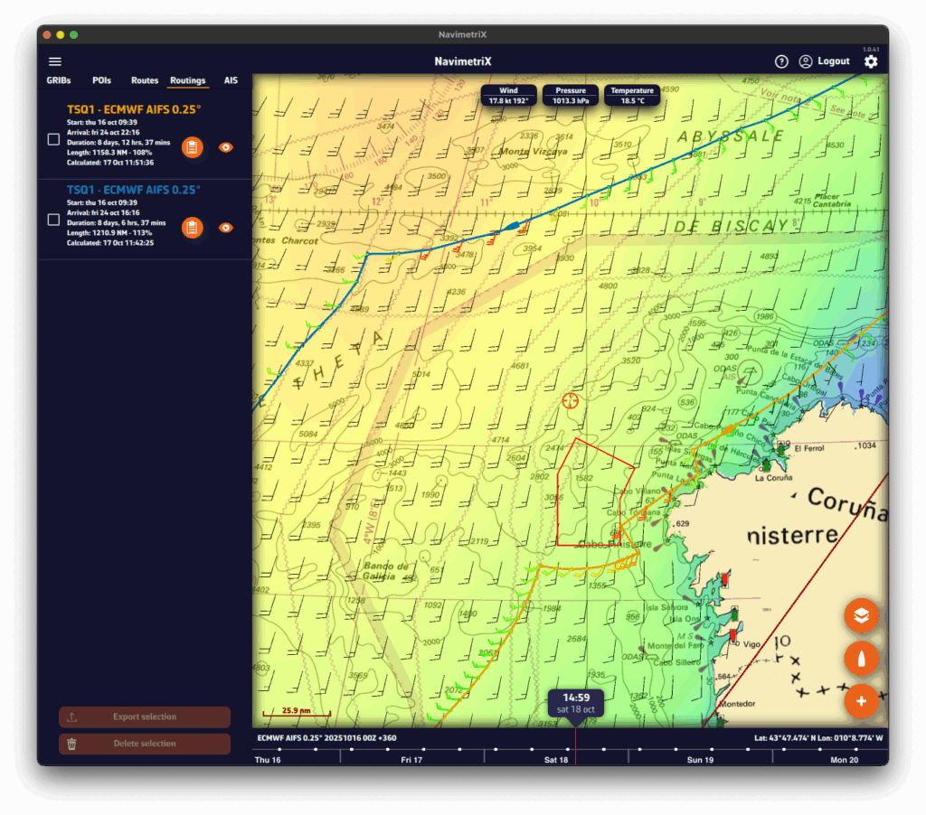
To perform a routing with a pivot point, first make sure the isochrones of the desired routing are displayed on the map.
Show or hide isochrones
- Open the Routing list via the hamburger menu (☰).
- Click on the routing whose isochrones you want to display.
- A small orange bar appears to the left of the selected routing: the isochrones are now visible on the map.
- To hide them, click again on the same routing.
Create a routing with a pivot point on a phone
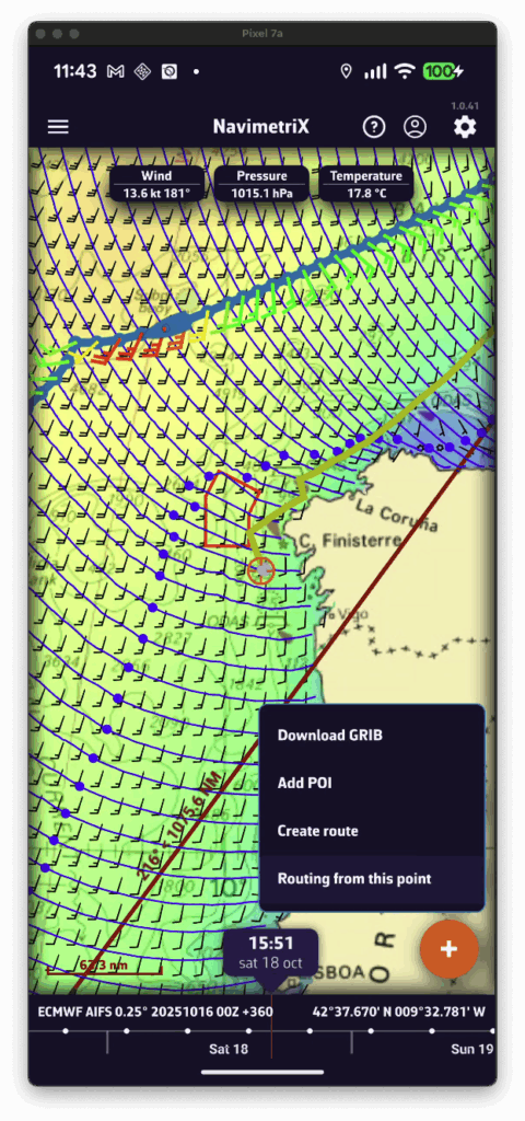
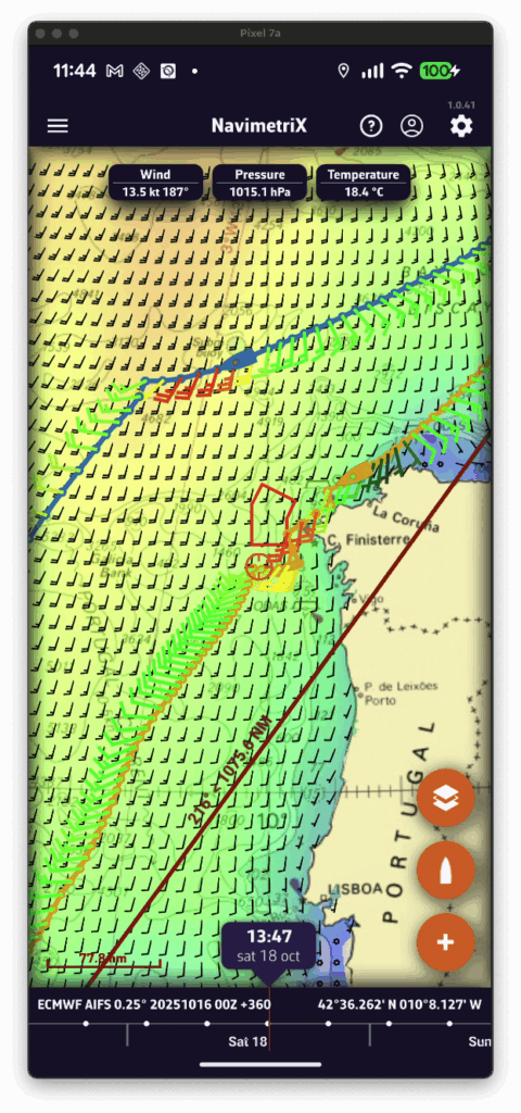
- Display the isochrones of the existing routing.
- Move the map — a yellow route automatically appears toward the center of the screen. It represents the optimal route to the currently selected point on an isochrone.
- If you want to force the route to pass through that point, press the + button and select “Route from this point” in the menu.
- A new routing is then computed starting from the selected pivot point.
Create a routing with a pivot point on a computer
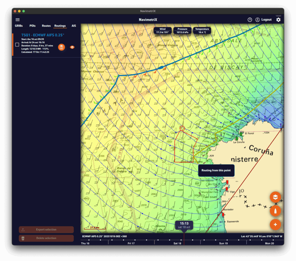
- Display the isochrones of the existing routing.
- Move the mouse — a yellow route automatically appears toward the cursor position. It represents the optimal route to the currently selected point on an isochrone.
- If you want to force the route through that point, right-click on it and choose “Route from this point” from the context menu.
- A new routing is then computed starting from the selected pivot point.