How do I download a GRIB file ?
- Henri
- octobre 16, 2025
To illustrate the process, let’s say we’re planning a 4-day passage from La Rochelle (France) to Cowes (UK).
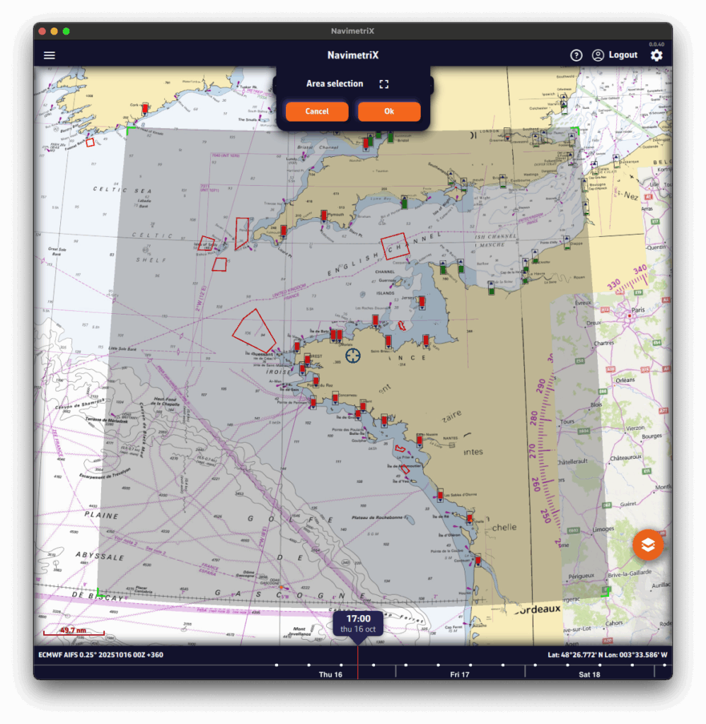
- Pan and zoom to your sailing area. Unless you’re doing an ocean crossing, pick a selection slightly larger than your route.
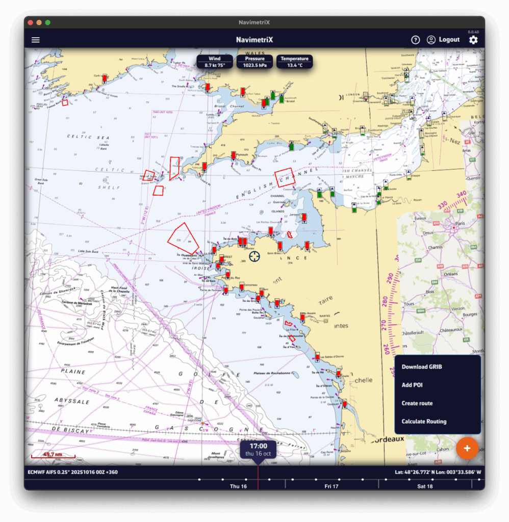
- Press the + button.
- Tap Download GRIB.
- If needed, adjust the selection using the four green corners.
- Press OK.
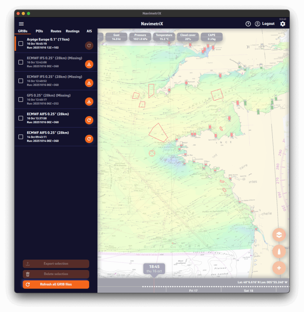
A Download GRIB window opens. The choices are filtered to your selected region.
Without the Premium option, you’re limited to the GFS model (the U.S. NOAA global atmospheric model).
- Choose the Type of data to download:
- Atmospheric
- Current
- Sea State
- Choose the Coverage:
- Global
- Regional — for trips up to ~5 days, a regional model is usually best.
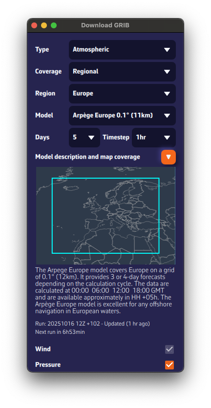
- If applicable, select the Region.
- Select the Model.
See our FAQs for guidance on models.
If unsure, choose the atmospheric global ECMWF IFS or GFS. - If needed, check the Model description & coverage map.
- Select the Days and Timestep.
If unsure, keep the defaults. - Choose the Parameters (Wind, Pressure, etc.).
If unsure, keep the defaults.
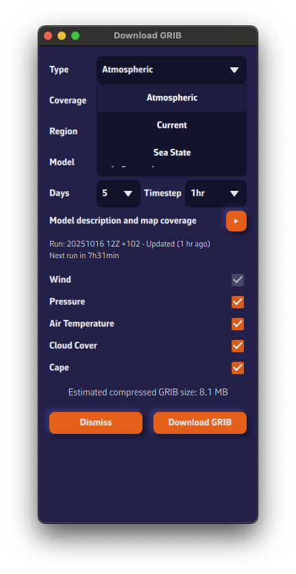
The estimated compressed GRIB size appears at the bottom. Keep it reasonable—if you see ~200 MB, you probably chose a model that’s too fine or too many parameters.
Below the model description, we show the latest model calculation time (the Run).Run: 20251016 12Z +102 means: calculated on Oct 16, 2025; initialized at 12:00 UTC (12Z); contains 102 forecast hours from that run.
We also display the estimated time until the next run is available.

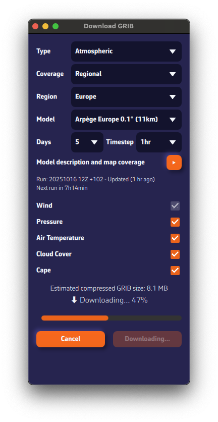
- Press Download GRIB.
- The GRIB file downloads from our fast, redundant servers.
- Once downloaded, it is:
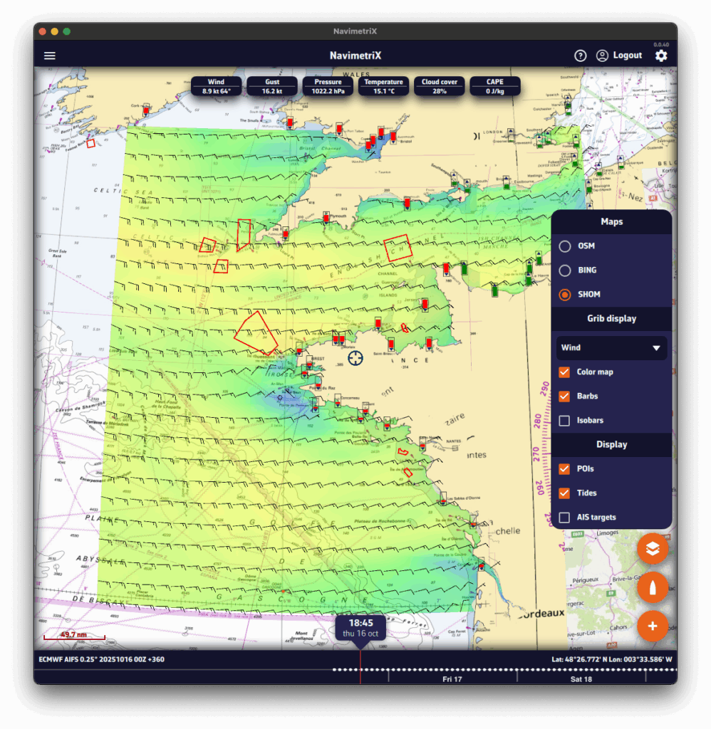
- displayed on the map. If you don’t see it, open Layers and enable Color map and Barbs.
- added to the GRIB list in the left panel. Tap the ☰ at top-left to open the lists panel.