How do I create a Point of Interest (POI) or waypoint?
- Henri
- octobre 16, 2025
The term “waypoint” doesn’t exist in NavimetriX. Instead, we use POI (Point Of Interest), a more generic term that can include many elements (targets, anchorages, beacons, race marks, etc.).
On a tablet or smartphone

Drag the map under the target on the screen, zooming in to position it accurately.

Tap the + icon in the bottom right corner of the screen and select ‘Add POI’ from the menu.
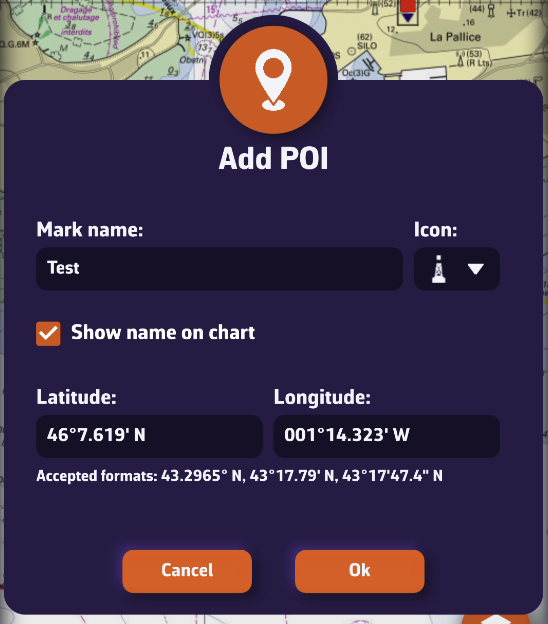
- Enter the name of the point
- Select an icon from the drop-down list
- Choose whether to display the name on the chart
- Enter a specific latitude and longitude manually
Tap OK to confirm.
On a Mac or PC
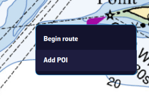
Place the mouse or trackpad pointer on the desired location on the map, without worrying about the target, and right-click. In the popup that appears, select “Add a POI”. The creation window opens as shown here.
Alternatively, you can proceed the same way as on a tablet or smartphone.
Saving
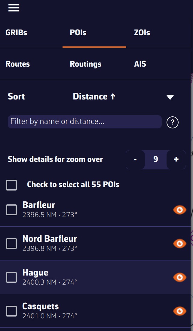
The points are saved in the POI list, located in the left sidebar of the screen, accessible via the ≡ symbol in the top-left toolbar.
You can show or hide each point individually by tapping the eye icon on the right side of the column.
Adjusting POI display

You can adjust the display so that the name and optional icon appear only from a certain zoom level, preventing the map from becoming overloaded if you have many points.