NavimetriX
NavimetriX - navigation app
The universal navigation app
All your navigation tools in one app, accessible on all your devices.

The advantages of NavimetriX
Easy to use
Always available
All the tools
Top-notch routing

At your fingertips in all circumstances
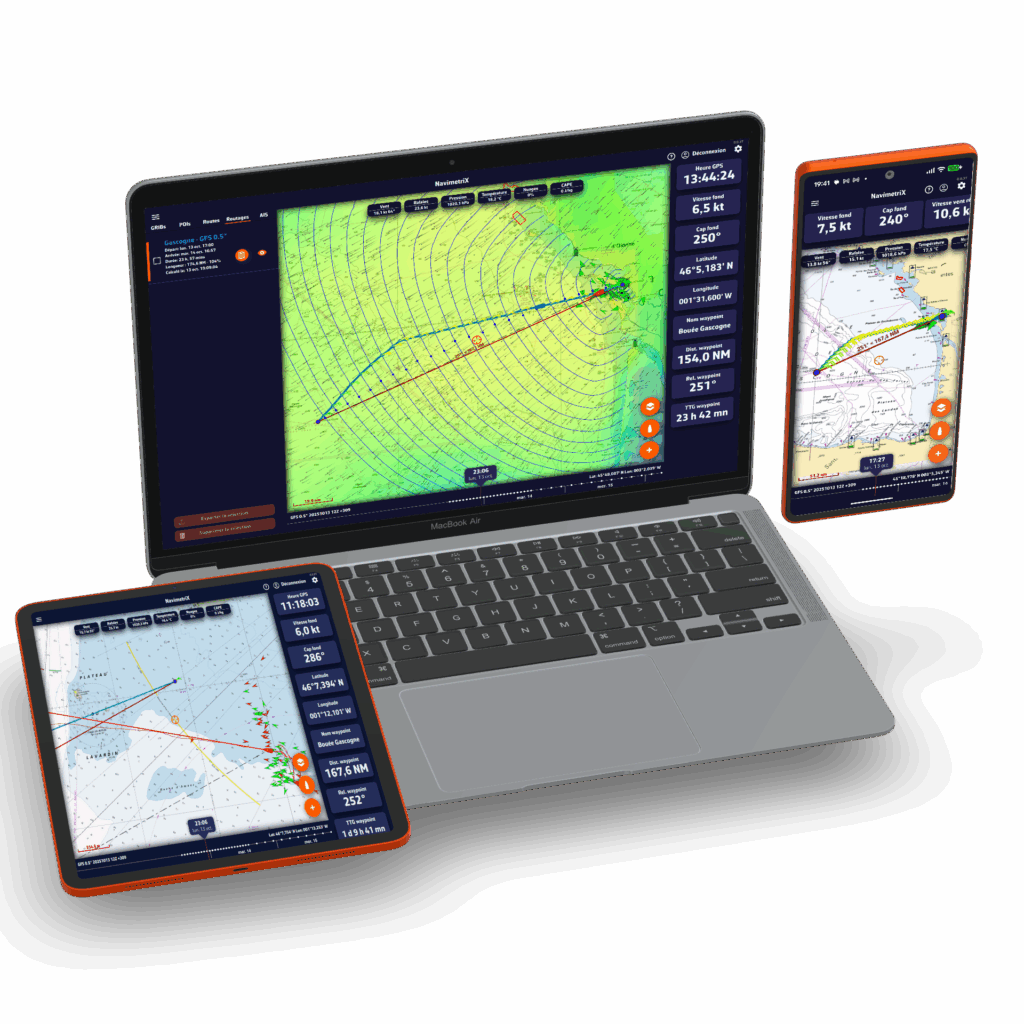
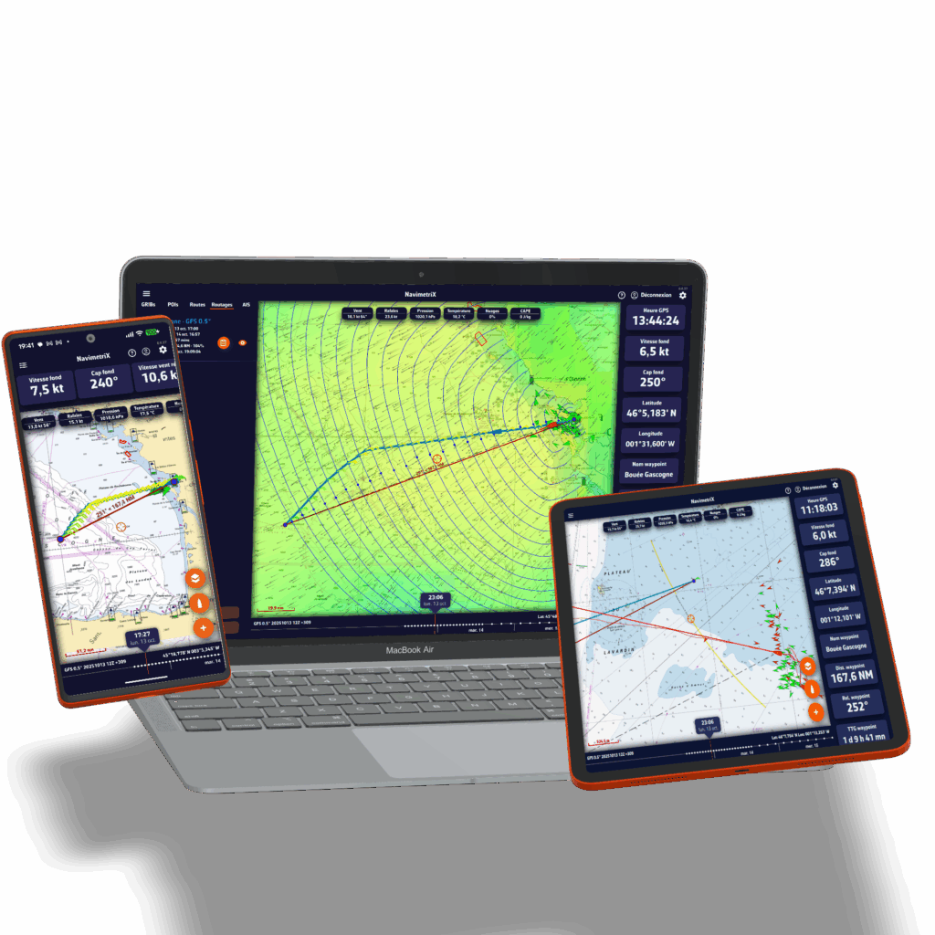
Available for all your devices
Wherever you are - on your boat, at home, on the go, or at the office - prepare your navigation. Once on board, launch the app and set sail!
Enjoy the app regardless of the device you use: your settings are saved in the cloud, allowing you to find and update your projects and navigation wherever you are.
NavimetriX works on Android, Windows, iOS, and macOS.
With its sophisticated graphics and simple user interface, NavimetriX allows you to plan your route and then follow it quickly and efficiently.
It's hard to find a more comprehensive solution for weather sources, a cutting-edge routing module, and easy-to-use, highly effective navigation tools.
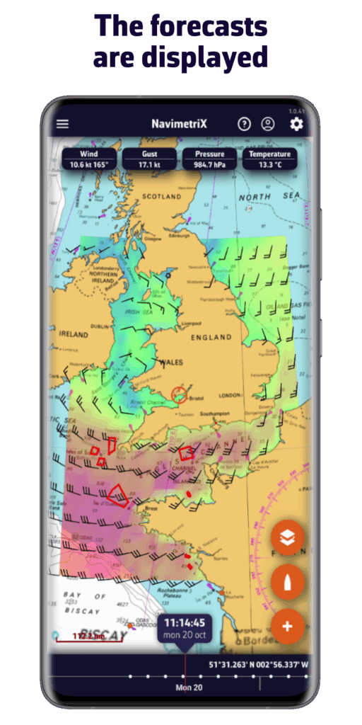
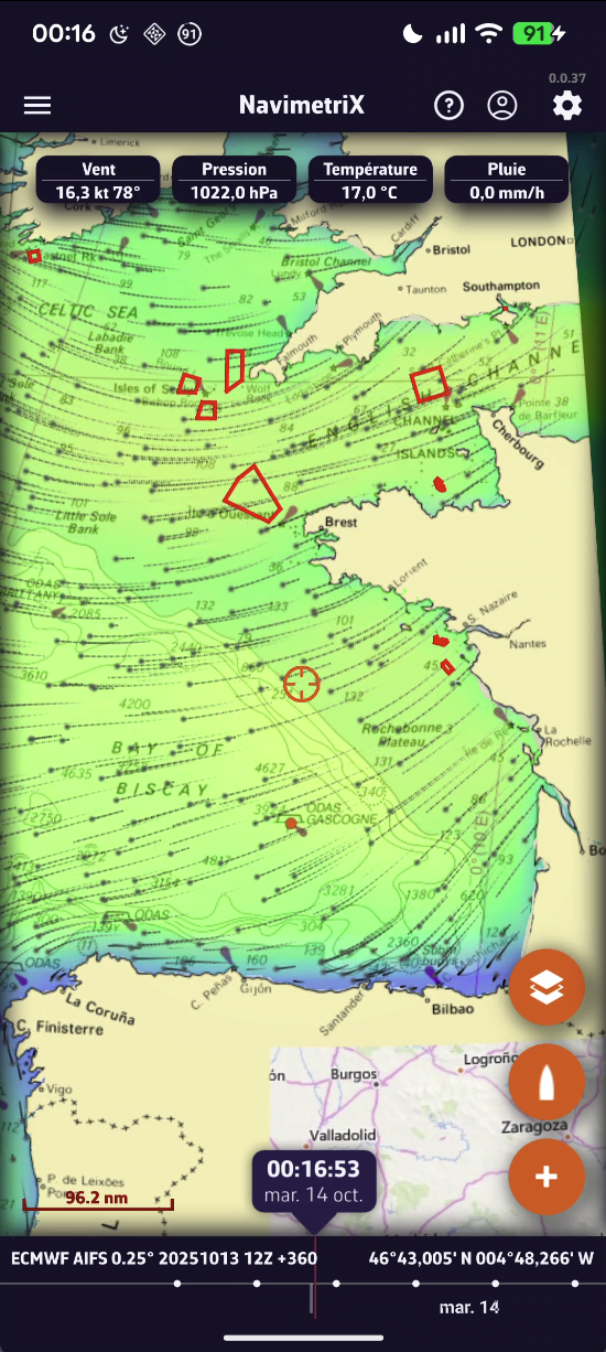
Accurate weather forecast
Accurate weather forecasts for all seas
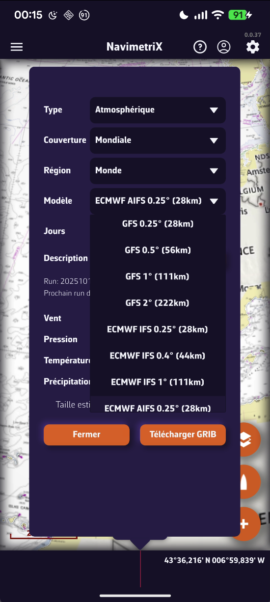
Thanks to its comprehensive library of models, you will always have access to the best forecasts, wherever you are.
- Atmospheric models: wind, gusts, pressure, etc.
- Sea state: wave height, direction, period
- Currents: oceanic and tidal
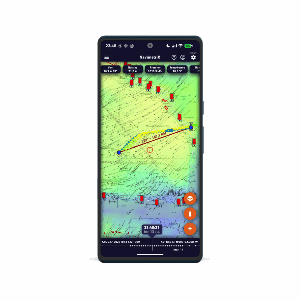
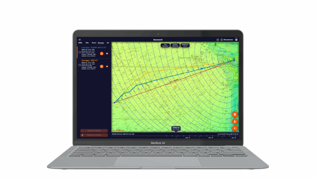

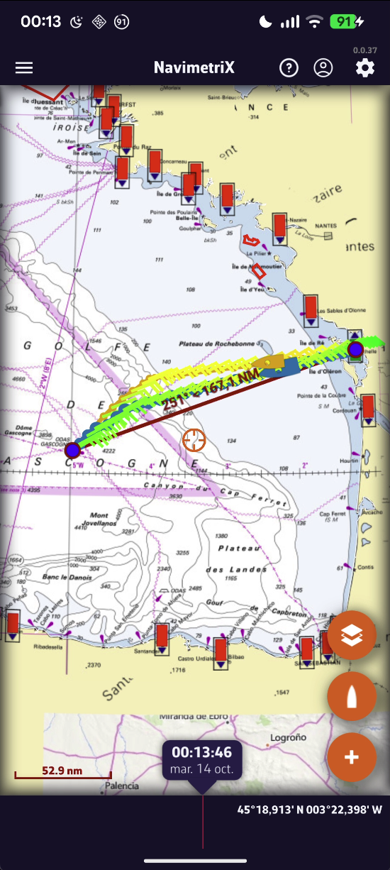
High-performance routing
Optimize your route quickly and easily
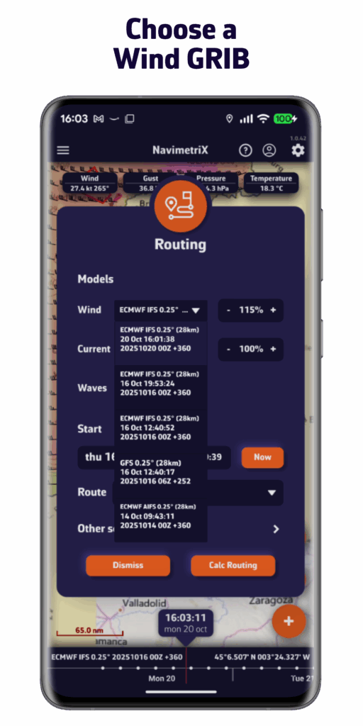
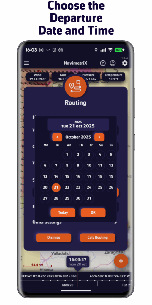
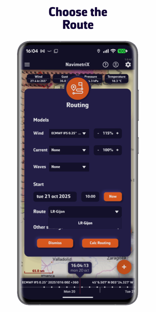
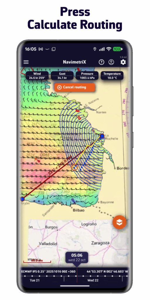
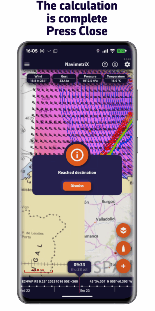
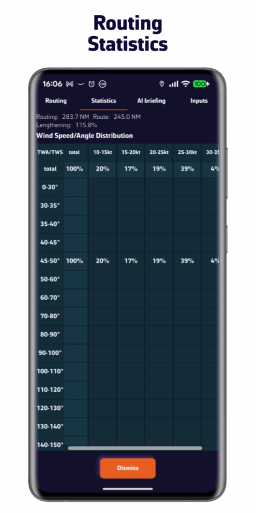
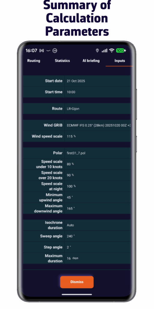
NavimetriX is capable of calculating precise routing:
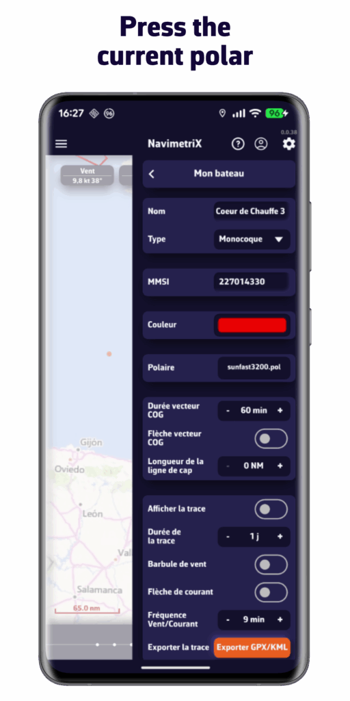
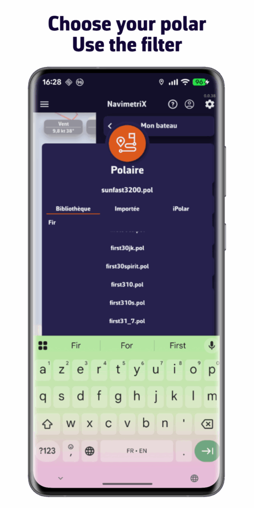
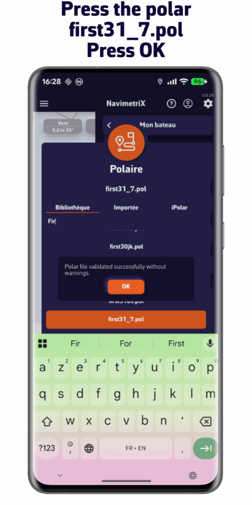
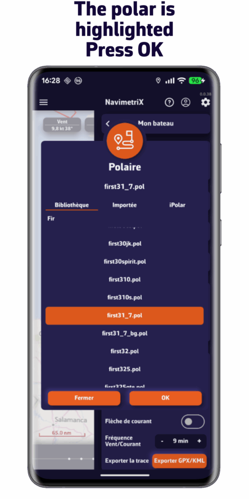
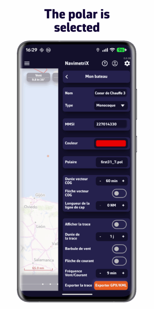
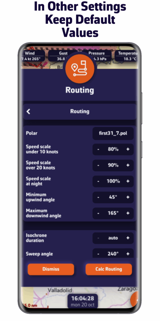
. Choose the polar for your boat from our extensive library, import it, or calculate it in just a few clicks.
. Integrate forecasts for wind, waves, and currents
. Restrict your routing based on your sailing style
. Work on your routing with pivot points
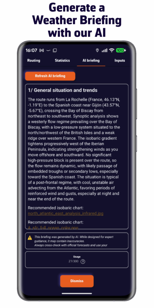
. Ask our AI to prepare a weather briefing for you.
All of this, done in no time.
Our offering
Discover our offering
FREE VERSION
€0 / Year
- Multi-platform: iOS, Android, macOS, and Windows
- 5-day weather forecast (GFS model)
- Routing 2 days maximum
- Weather visualization
- Displaying your marine charts (charts not included)
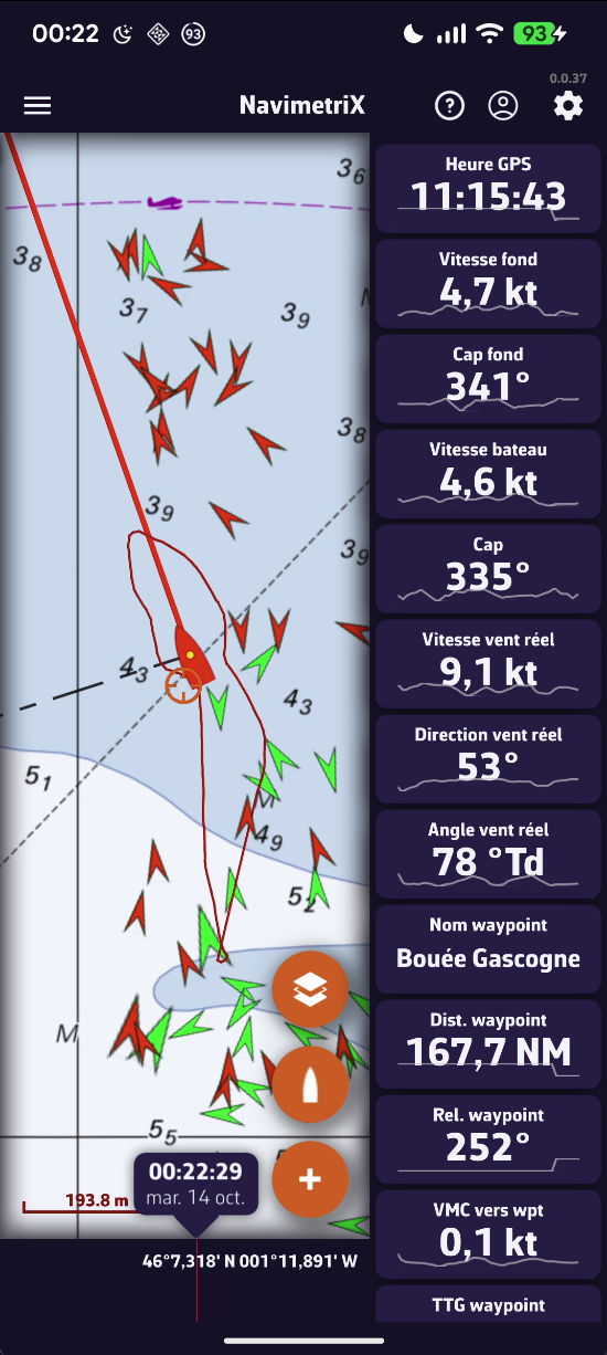
- Navigation mode
- Connection to onboard data
- Account and Cloud Synchronization
PREMIUM SUBSCRIPTION
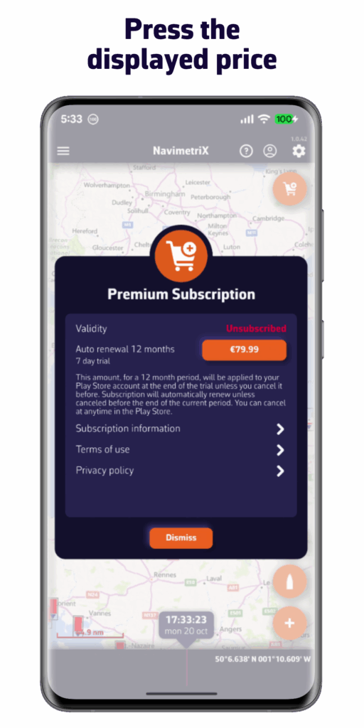
€79.99 / Year
one-week free trialAll the features of the free version plus:
- NavimetriX account
- Synchronization of all your devices
- Wide selection of weather models
- Forecasts up to 15 days
- Sea state and current forecasts
- Routing up to 15 days
- Weather briefing generated by our AI
- Navigation mode
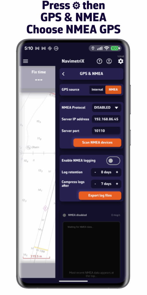
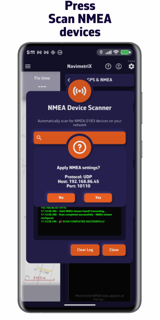
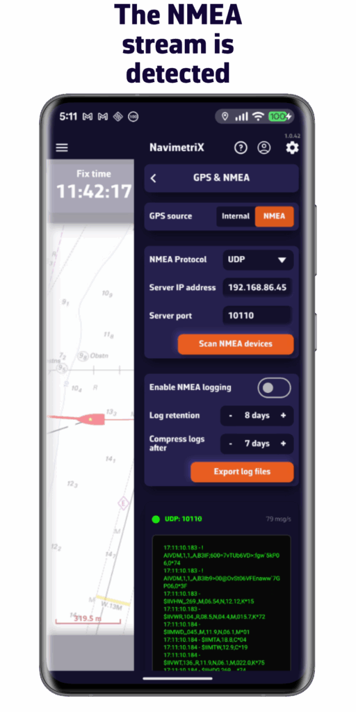
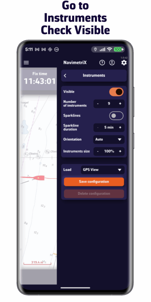
- Connection to onboard GPS and NMEA data
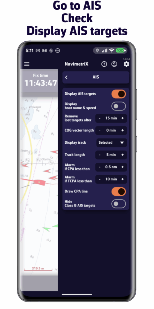
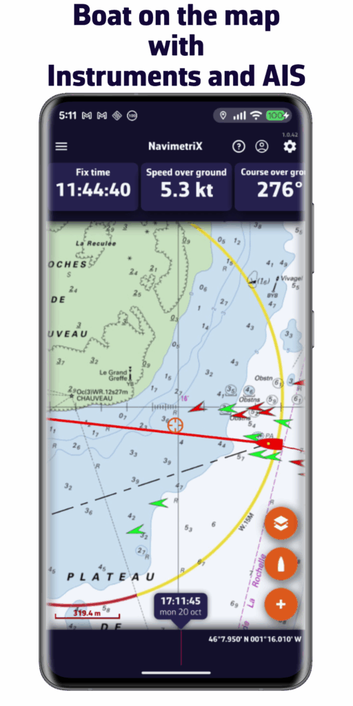
- AIS target processing
- And much more...
Frequently Asked Questions
A Question?
You will find a short tutorial on the basic functions of Navimetrix by following this link.
If you have any questions or requests, please use the contact form below. : Contact us
Before writing to us, please check our FAQ. You will probably find the answer to your question there. 😉
With a Premium subscription, you can enjoy the full benefits of the app.
In addition to all the features of the free version:
- Synchronization of all your devices with a NavimetriX account: create a route on your phone and it will be immediately added to your PC.
- Wide choice of weather models.
- Wave and current forecasts
- Forecasts up to 15 days: for global models such as the American GFS or the European IFS
- Routing up to 15 days
- Weather briefing generated by our AI
- Navigation mode
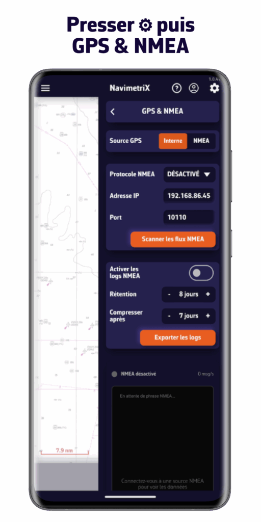
- Connection to onboard GPS and NMEA data
- AIS target processing
And much more...
You get a free 7-day trial period, so don't hesitate to try it out—you're sure to be convinced.
The Premium subscription is annual with automatic renewal.
Its price depends on the region in which you purchase it.
For example, it costs €80 per year in mainland France.
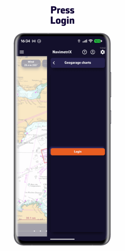
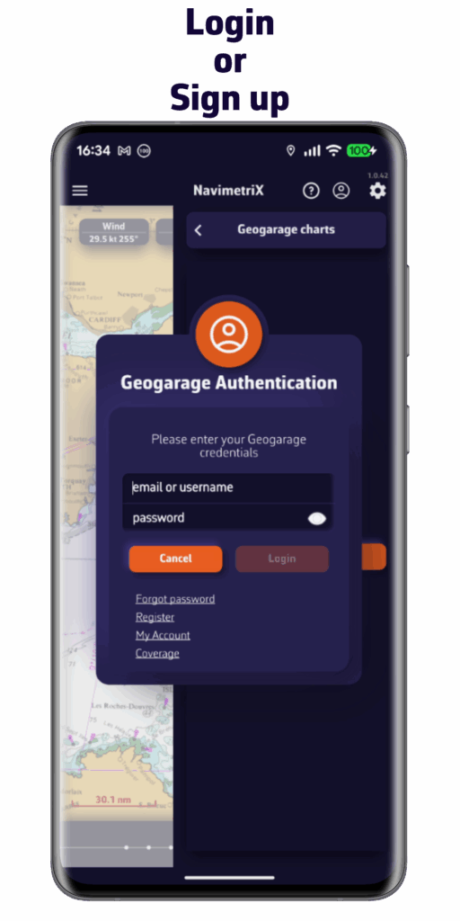
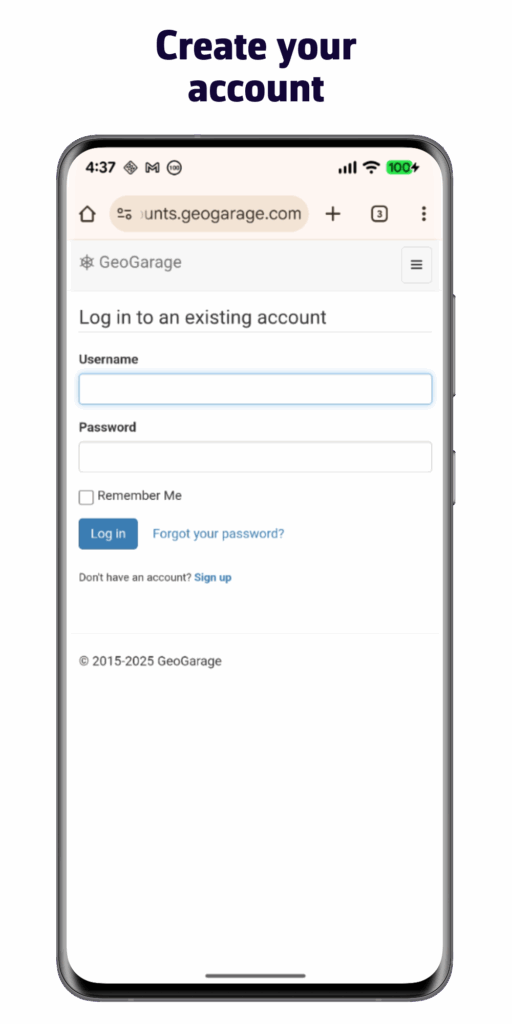
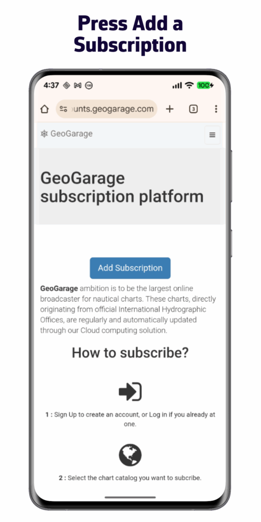
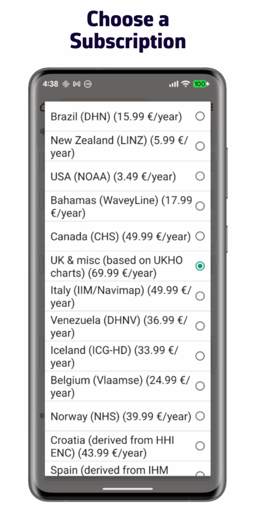
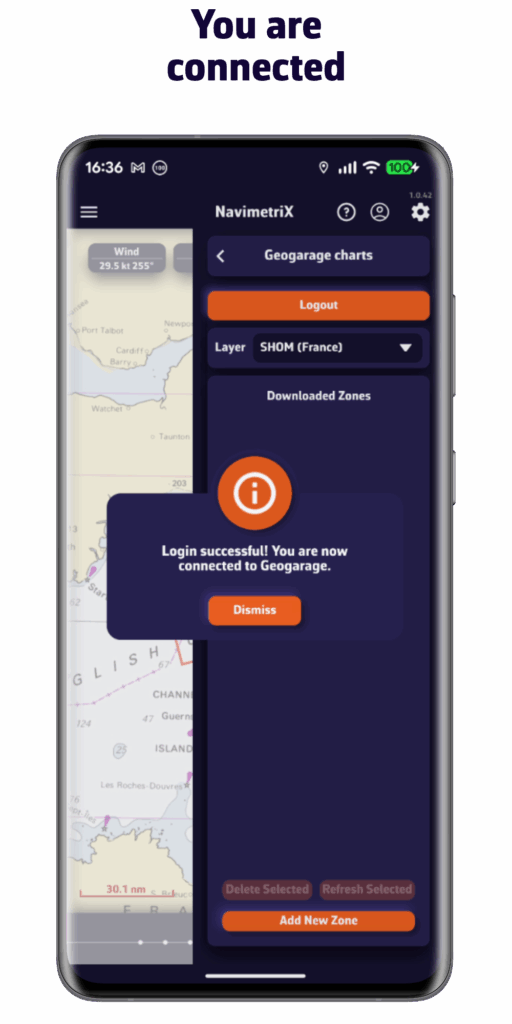
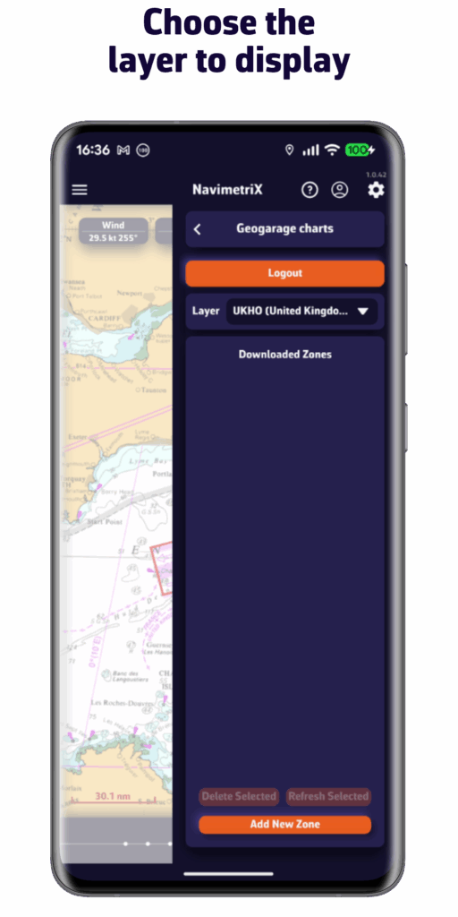
Please note that the subscription does not include nautical charts. To navigate with nautical charts, you must have a subscription to the Geogarage platform.
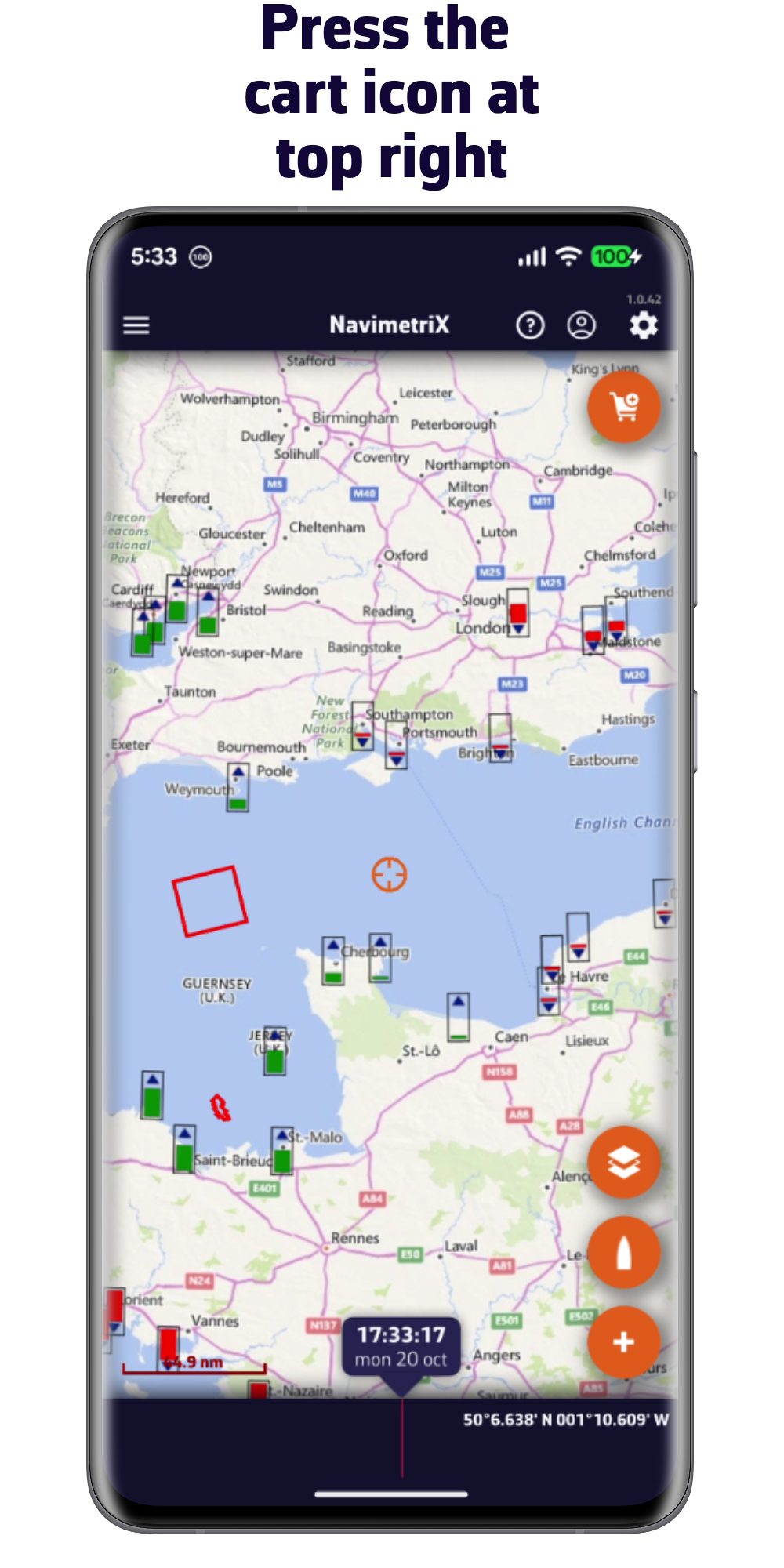
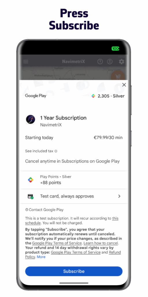
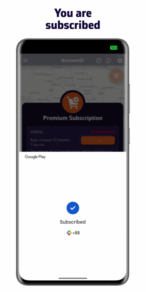
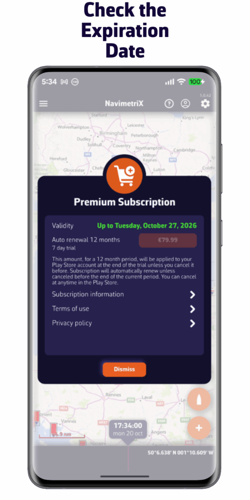
You can subscribe via the Apple App Store or Google Play Store directly from the app by pressing the “Shopping Cart” button.
Please note: You cannot subscribe from your Windows PC.
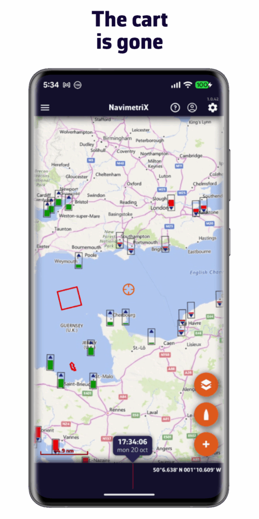
The NavimetriX interface has been designed to be clear, intuitive, and quick to use, whether on a computer, tablet, or smartphone. Here is a complete description, section by section:
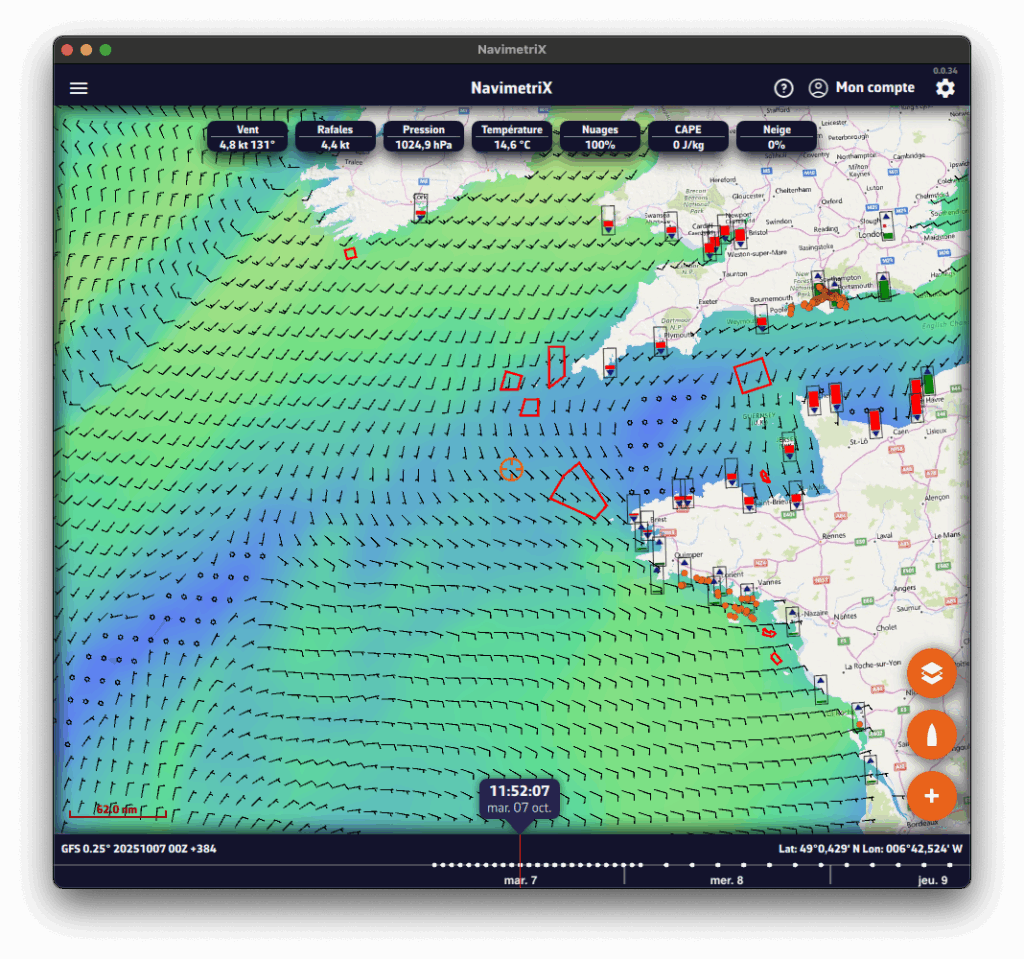
- Top right
-
- ⚙ Settings icon: opens the settings panel
- 👤Account icon: allows you to log in to your NavimetriX account, create an account, or reset your password.
-
- ? Help icon : Open the application's website, in the Frequently Asked Questions or FAQs tab.
- Top left
☰ Hamburger menu: provides access to the application's main lists:
-
- GRIB files
-
- Points of Interest (POI)
-
- Routes
-
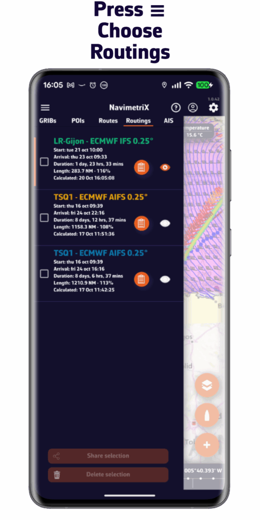
- Routings
-
- AIS targets
- Bottom left
-
- Map scale
-
- GRIB file loaded, for example :
GFS 0.25° 20251007 00Z +384
-
- GFS model
-
- 0.25° grid, approximately 26 km
-
- published by NOAA on October 7, 2025
-
- Calculated at midnight UTC, we refer to the 0-hour run or 00Z.
-
- containing 384 hours from the 00Z run. If you see +36, this indicates that the first 36 hours of this GRIB file are from the 00Z run, while the following hours are from the previous run, which was the 18Z run on October 6. This gives you access to the latest data from the run without having to wait for the entire run to be calculated. For the GFS, this saves about 3 hours.
-
- GRIB file loaded, for example :
- Below: the Timeline
-
- Displays all hours covered by the currently loaded GRIB file.
-
- Each white dot on the time bar corresponds to a time step in the GRIB file.
-
- The time displayed just above indicates the current position of the Timeline.
-
- If you click/tap on this time, the Timeline will jump to “now” and the seconds will scroll by (letting you know that you are at the current time).
-
- You can:
-
- Slide the Timeline with your finger or mouse,
-
- Click/tap on a location to move directly to a specific time.
-
- You can:
-
- The data in the GRIB file displayed is then that for the selected time.
-
- If a routing is displayed, the boat moves at the selected time along its trajectory.
-
- At the bottom right, the coordinates of the target in the center of the screen are displayed.
- Bottom right: the three orange circular buttons
-
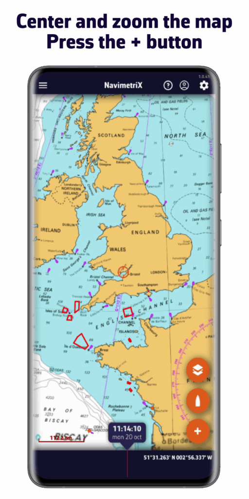
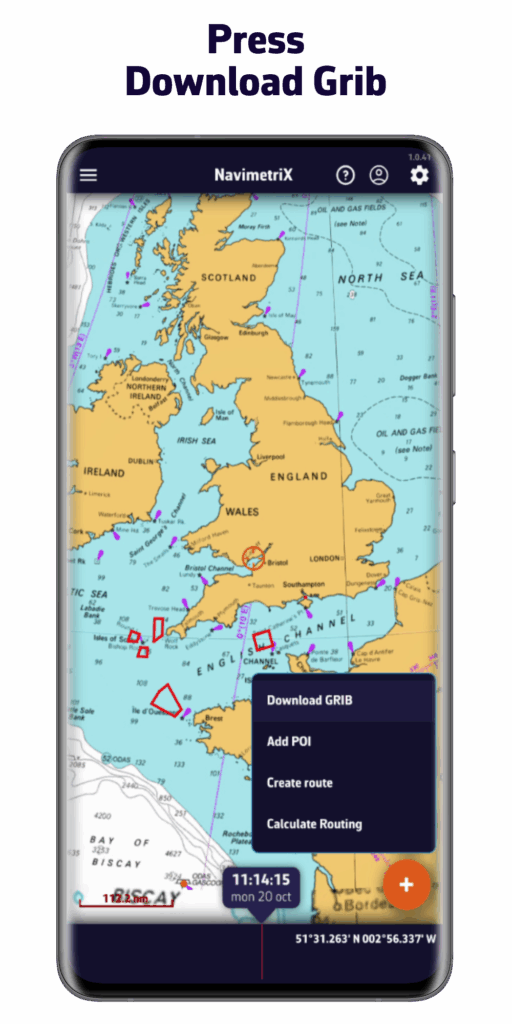
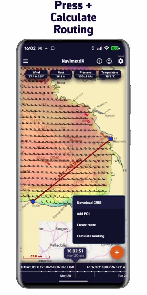
- Action Button (+)
-
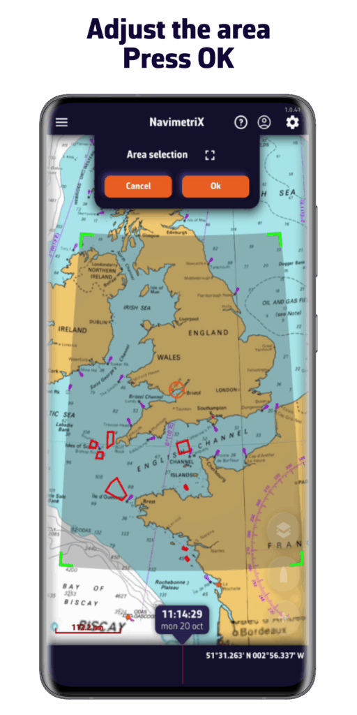
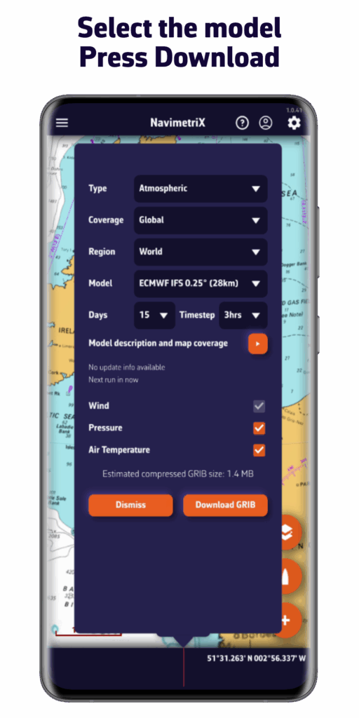
- Download a GRIB file,
-
- Add a POI,
-
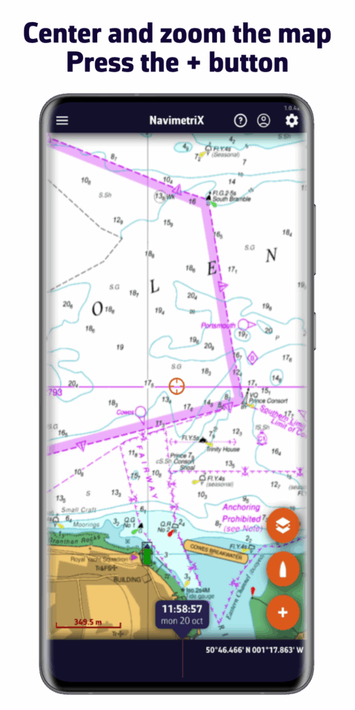
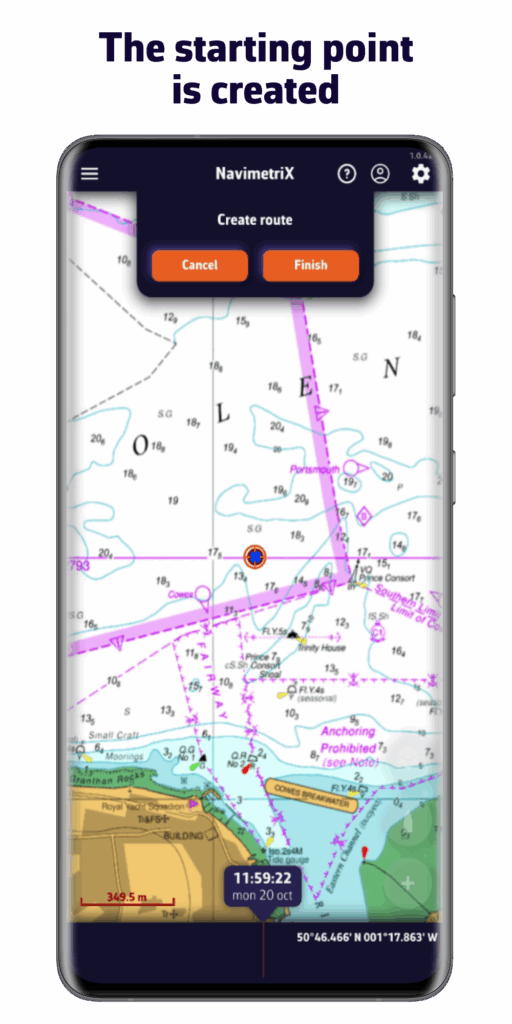
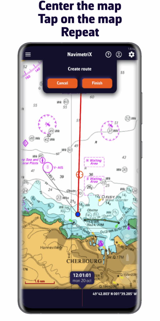
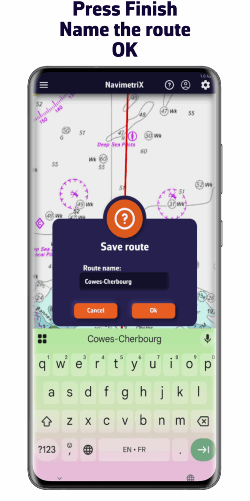
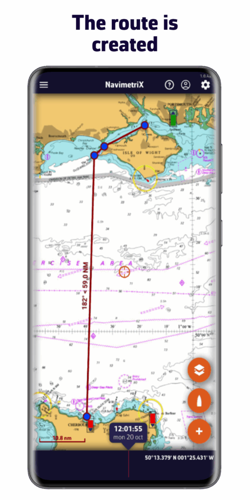
- Create a route,
-
- Calculate a routing.
-
- Action Button (+)
-
- Boat Button
-
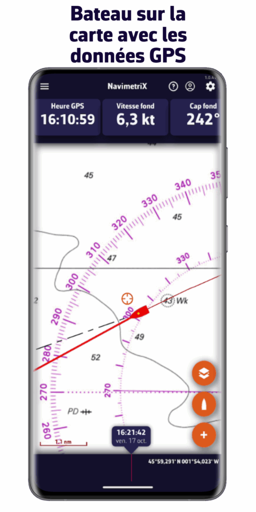
- Centers the map on the boat's position.
-
- Long press : automatically centers and zooms in for a closer view—ideal for navigation.
-
- Boat Button
-
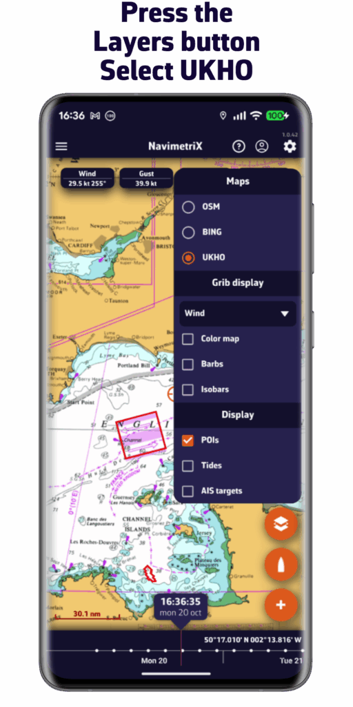
- Layers button
-
- Chart section :Allows you to choose the type of chart displayed:
-
- OpenStreetMap (par défaut)
-
- Bing Satellite
-
- Nautical charts, if available.
-
- Chart section :Allows you to choose the type of chart displayed:
-
- GRIB Display section
-
- Allows you to choose which weather parameters to display:
-
- Background color,
-
- Wind barbs,
-
- Additional data depending on the loaded model.
-
- Allows you to choose which weather parameters to display:
-
- GRIB Display section
-
- Display Section
-
- Allows you to enable or disable the display of :
-
- POI,
-
- Tracks,
-
- Tides,
-
- AIS targets.
-
- Allows you to enable or disable the display of :
-
- Display Section
-
- Layers button
- On the map
-
- Target in the center of the screen.
-
- Orange if at sea
-
- Blue if on the ground
The target's coordinates are displayed at the bottom right.
- Blue if on the ground
-
- Target in the center of the screen.
-
- Data from the GRIB file at the target at the time of the time bar
-
- Tide icons around the world
-
- Red : ebb tide.
-
- Green : rising tide.
Clicking on an icon opens the tide details with the times and heights calculated directly in the application.
- Green : rising tide.
-
- Tide icons around the world
-
- No-go zones
-
- red polygons
such as traffic separation schemes or offshore wind farm areas
- red polygons
-
- No-go zones
-
- Points of Interest (POIs)
-
- in orange
-
- Points of Interest (POIs)
 Desktop :
- macOS : Version 13 (macOS Ventura), released on October 24, 2022, and all subsequent versions.
(x86_64, x86_64h, and arm64). - Windows : Version 10 (build 1809 – 10.0.17763) or higher, Windows 11 – x86_64 and ARM64, released in October 2018.
 Mobiles :
- Android : Version 9 (API 28) to 15 (API 35) – arm64-v8a, x86_64, x86, and armeabi-v7a, Android 9 released in August 2018.
- iOS : Version 16 or higher (including iOS 18) – armv8, arm64, iOS 16 released in September 2022.
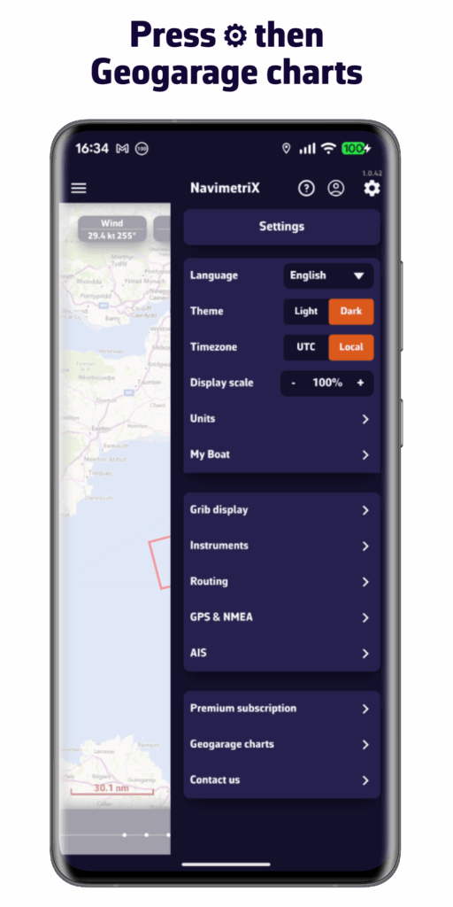
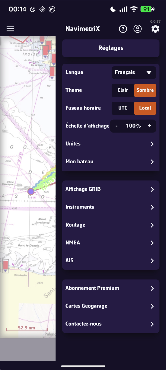
In the Settings tab, the first section concerns basic settings:
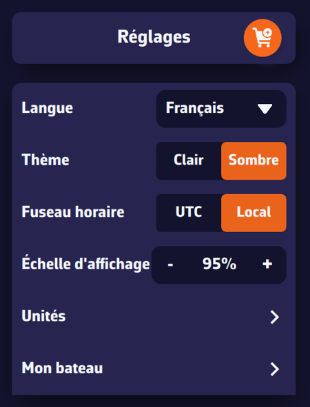
-
- Language : French, English, German, Spanish
-
- Theme : light or dark user interface
-
- Time zone :local (your device's time) or UTC (Universal Time Coordinated)
-
- Display scale : allows you to reduce or increase the default size of the objects on the map.
-
- Units : to choose according to one's preferences
-
- My boat :all parameters concerning your vessel, polar, name, type, MMSI, etc.
