Satellite images
BeginnerThe essentials
Weather satellites constantly photograph the Earth in infrared, day and night. Their image shows the actual cloud cover, to within a few tens of minutes: the cloud bands of fronts, thunderstorm clusters, clear spells. NavimetriX displays it as the base map, in place of the usual map. An Internet connection is required.
- Open the layers menu (round orange button at the bottom right).
- In the “Maps” section, choose “Realtime Satellite”.
- In the neighboring list, choose the source: “Global IR”, “High Res IR” (default) or “NOAA IR”.
- The time of the image is shown at the bottom left of the chart, above the scale.
To return to the usual map, choose another base map in the same section.
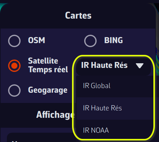 Layers menu, Maps section: Realtime Satellite and the list Global IR, High Res IR, NOAA IR
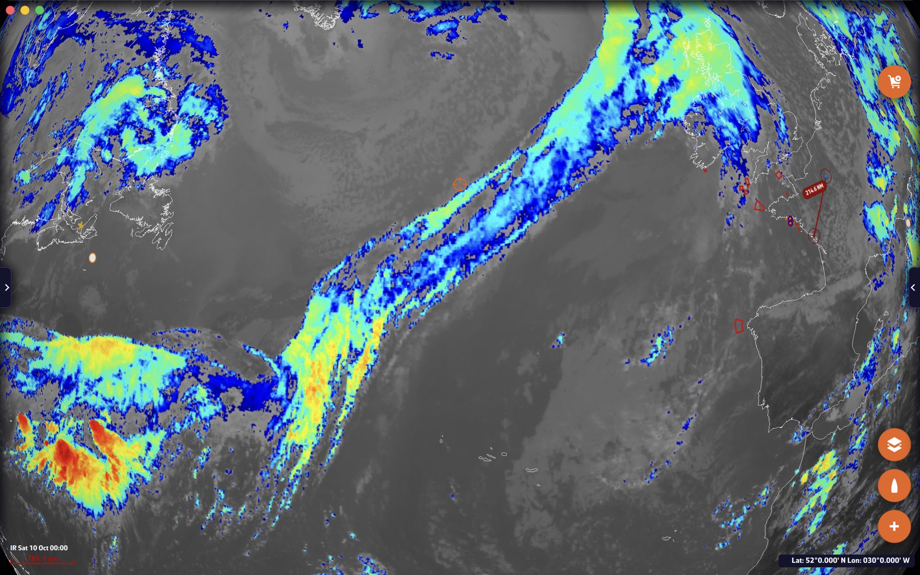 Infrared satellite image (Global IR) over the North Atlantic: a long cloud band of a front
Going further
The three sources
- High Res IR: the best image available depending on longitude. NavimetriX chooses the satellite by itself, for each part of the image: GOES-East between 100° W and 15° W, Meteosat between 15° W and 70° E, Himawari between 70° E and 170° E, GOES-West elsewhere. The label names the one at the center of the screen. The Meteosat image is colorized and is about half an hour old. Beyond 70° of latitude, none of these satellites covers the area, and the label says “not covered”.
- Global IR: a global infrared mosaic from NOAA, prepared on our servers and renewed every hour. It is less detailed: when zooming in closer than a stretch of coast such as southern Brittany, the image is simply enlarged.
- NOAA IR: NOAA’s global infrared mosaic, in grey levels, with a resolution of about 3 km, updated every hour.
NavimetriX remembers the chosen source.
The label and the update
At the bottom left of the chart, the label gives the name of the satellite (for “High Res IR”) or of the source, followed by the time of the image, in UTC or local time according to your time zone setting. NavimetriX checks every ten minutes whether a more recent image is available, and then reloads the map.
Combining layers
The satellite image remains a base map: on top of it, you can display a GRIB, a NOAA weather chart laid over the map, lightning, rain radar or weather stations. Combining a satellite image with a front chart gives an instant view of the situation. See Weather charts and Lightning and thunderstorms.
Satellite images do not require a Premium subscription.