In-situ stations and weather ships
BeginnerThe essentials
“In-situ” stations give the weather measured on the spot: buoys at sea, lighthouses and semaphores on the coast, airport stations (METAR), observation ships, and wind measured by satellite. Compared with the GRIB forecast, they tell you whether the model matches the reality of the day. An Internet connection is required.
- Open the layers menu (round orange button at the bottom right) and check that “Weather stations” is ticked, in the “Display” section. This is the default setting.
- Zoom in on your area: each station is an arrowhead oriented according to the wind direction and colored according to its strength.
- Tap a station: the “In Situ Info” window gives its latest readings.
- Tap the middle of this window to set the chart and the timeline to the station and the time of the reading, and compare with the GRIB.
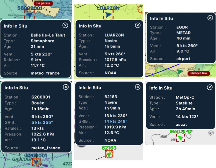 Six In Situ Info windows: semaphore, ships, METAR, buoy and satellite
Going further
The types of stations
The “Type:” line of the window shows: “Buoy”, “Coastal”, “Lighthouse”, “METAR” (airport station), “Satellite” (wind measured by the ASCAT scatterometers), “Semaphore” or “Ship”. The data is gathered on our servers from buoy networks, synoptic and METAR observations, semaphores, observation ships and satellite measurements, then refreshed every five minutes as long as the layer is displayed.
Readings more than three hours old are discarded (five hours for satellite measurements). Stations are displayed from the view of a region such as the Bay of Biscay, and are hidden while a routing is being computed and while an area is being selected.
When the view contains too many, NavimetriX draws 200 at most, keeping one station per sector of the map, in order of priority: semaphores and lighthouses, then buoys, ships and NOAA stations, satellite measurements, and finally airport stations.
The “In Situ Info” window
Depending on what the station measures, it gives: “Station:”, “Type:”, “Age:” (“just now”, in minutes or hours), “Wind:” (strength and direction), “Gust:”, “Pressure:”, “Water:” and “Air:” (temperatures), “Visibility:” and “Source:”. The units are fixed: knots, hectopascals, degrees Celsius and miles, whatever your unit settings. The window can be moved by dragging it.
Comparing with the GRIB
Tap the middle of the window, without dragging it. If the time of the reading is within the period of the displayed GRIB and the station is within its area, NavimetriX:
- centers the chart on the station;
- sets the timeline to the time of the reading;
- adds a “GRIB:” line with the forecast wind strength and direction at that place and time.
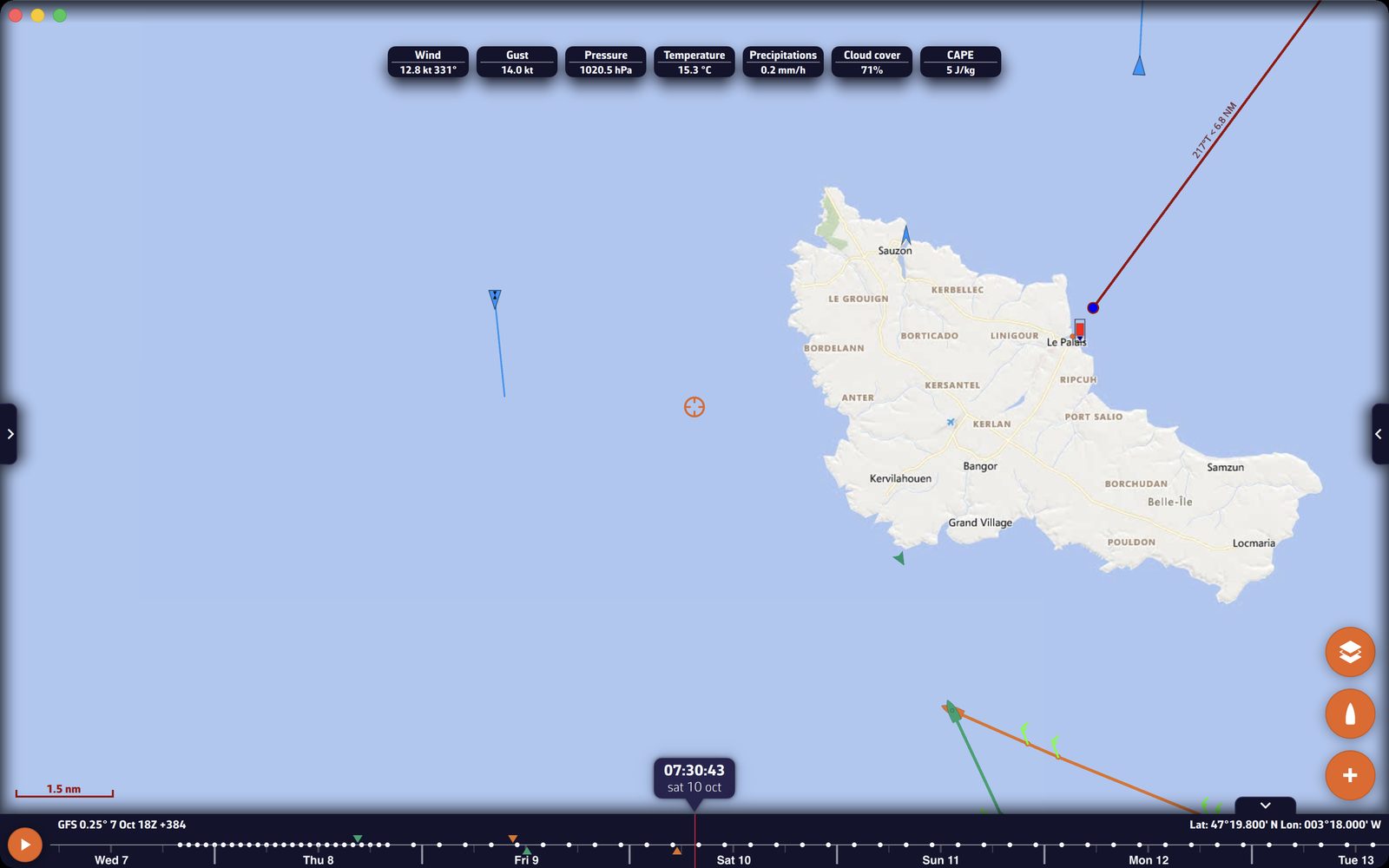 The “In Situ Info” window of a semaphore after a tap in the middle: the “GRIB:” line gives the forecast wind, next to the measured wind
You thus compare the measurement and the forecast directly. A consistent discrepancy from one station to the next is a good clue for choosing between two models.
AIS weather ships and stations (in cyan)
Some ships, buoys and coastal stations broadcast their weather measurements over AIS (message 8, meteorological and hydrological data). NavimetriX draws them in cyan: a class A or B vessel, or a square for a base station or an aid to navigation. At small scales, where ordinary AIS targets are hidden, these weather targets remain visible.
Tap one of these targets: its AIS card has a “Weather” block with, depending on what it broadcasts, “Wind:”, “Wind direction:”, “Gust:”, “Pressure:”, “Water temp:”, “Air temp:”, “Current:” and “Current direction:”.
Displaying AIS targets, whether received by your receiver or over the Internet, requires the Premium subscription. See Navigation: GPS, NMEA and AIS.
Sharing the weather aboard
The “Share weather data” setting (right drawer, “AIS”) sends every ten seconds the weather measured by your instruments: mean true wind and its direction, gust and its direction, pressure, air and water temperatures. It goes over the Internet to our servers, as an AIS 8 message: no AIS transponder is needed. On by default, sending requires:
- the Premium subscription;
- a true wind computed by NavimetriX from your instruments (NMEA link, the onboard instrument protocol) and a valid position;
- not being in demo mode, following another boat or in replay.
The message carries your boat’s MMSI if it is filled in under “My Boat”, otherwise a random identifier specific to the device. This setting does not exist in the browser version.