Currents
ExpertThe essentials
NavimetriX knows two sources of current:
- current GRIBs (the “Currents” type in the download window): ocean currents and tidal currents computed by models (Copernicus, SHOM, IFREMER, BSH, NCOM…). They require the Premium subscription and are downloaded like any other GRIB;
- the SHOM tidal current atlas (Service hydrographique et océanographique de la Marine, the French navy’s hydrographic and oceanographic service), for the French coasts of the English Channel and the Atlantic. It is downloaded once and for all at installation and then works without a connection.
Both are displayed as arrows or particles and are used in routing.
- SHOM atlas: open the layers menu (round orange button at the bottom right) and tick “Current atlases”. Zoom in on the coast: the atlas only appears from a coastal scale.
- Current GRIBs: display the file from the “GRIBs” tab of the left drawer; the “Currents” parameter is displayed.
- Drag the timeline to follow the turn of the tide and the hours of strong current.
- To choose between arrows and particles, open the right drawer, “Forecast display”, “Currents” section.
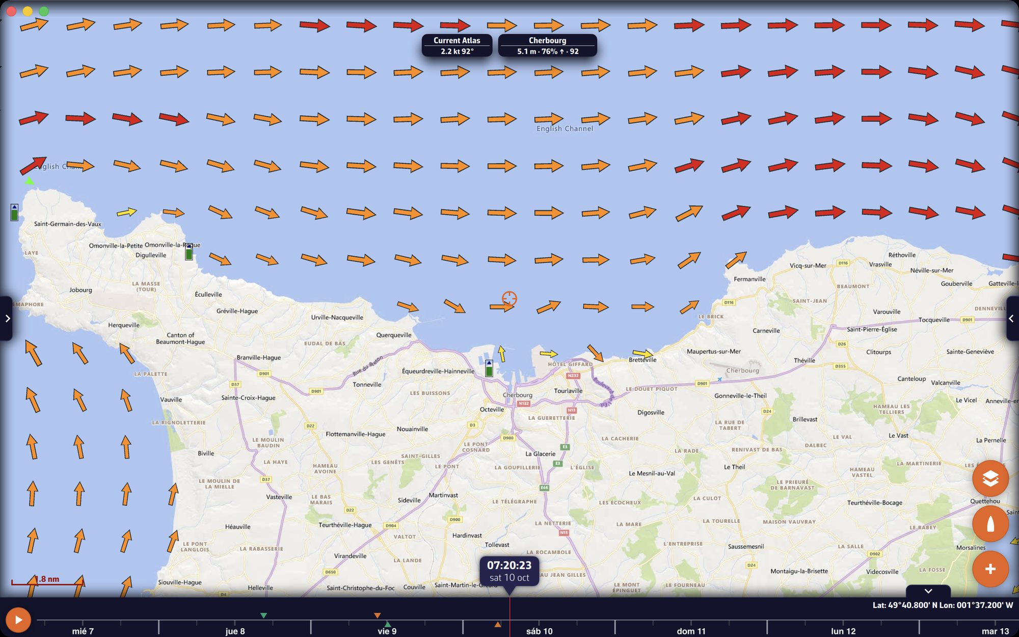 Tidal current atlas as arrows colored according to the strength of the current
Going further
The SHOM tidal current atlas
The atlas gives the tidal current at any point of its zones, at any time. NavimetriX computes it from two reference states, neap tides and spring tides, which it interpolates according to the tidal coefficient (from 45 to 95), as a function of the time of high or low water at the reference port of each zone. Tides are computed within the application: the atlas works offline, and for any date.
- Zones: the SHOM atlases cover the French coasts of the English Channel and the Atlantic, from the Strait of Dover to the Bay of Biscay, with detailed atlases (Bay of the Seine, Normand-Breton gulf, northern Brittany, Iroise, southern Brittany, Vendée-Gironde…). Where several atlases overlap, the finest one prevails.
- Download: about 20 MB, when the application is installed, then with each new version of the data. In the browser version, it is done in the background after startup.
- Zoom: nothing is displayed when you zoom out too far (small scales): zoom in to a coastal view.
- Timeline: with the atlas displayed, the timeline covers seven days before and seven days after today, even without a GRIB.
Arrows: they are colored according to the strength of the current.
| Current | Color |
|---|---|
| less than 1 knot | yellow |
| 1 to 3 knots | orange |
| 3 to 5 knots | red |
| more than 5 knots | dark red |
The colorblind mode uses a variant of these colors. The length of the arrows grows up to 3 knots. No arrow is drawn on land, nor below 0.05 knot.
Particles: they are cyan, which distinguishes them from the black particles of a GRIB displayed at the same time, and they are never drawn on land.
Value under the center: the “Current Atlas” badge at the top of the chart gives the speed and direction of the current at the center of the screen (not at the target). It disappears over land.
You can overlay the atlas and a high-resolution current GRIB (IFREMER for example) to compare them by dragging the timeline.
Current GRIBs
With a current GRIB displayed, the color map gives the strength of the current, from blue to magenta, over 0 to 5 knots. The arrows are black (white on the BING background), and their size follows the speed. The color map of currents is not masked over land.
The catalog offers global ocean current models (Copernicus, RTOFS, SMOC which adds the tide) and finer regional tidal current models (SHOM, IFREMER, Copernicus IBI and Mediterranean, BSH in the North Sea and the Baltic, NCOM and MSC in North America…). See the list in the FAQ.
The “Currents” settings
Right drawer, “Forecast display”, “Currents” section. These settings apply to current GRIBs and to the SHOM atlas.
| Setting | Values | Default |
|---|---|---|
| “Currents display” | “Particles” or “Arrows” | Particles |
| “Particle density” | 25 to 300%, in steps of 25 (also sets the density of the atlas arrows) | 100% |
| “Particle length” | 25 to 150%, in steps of 25 | 100% |
| “Color map style” | “Gradient” or “Iso areas” | Gradient |
| “Transparency” | 0 to 100%, in steps of 5 | 50% |
| “Iso areas step” | 0.1 to 5.0 knots | 0.2 knot |
| “Speed values” | on or off | off |
“Speed values” writes the current speed next to the arrows, at large scales. In “Energy saving” mode (Settings, “General”), currents are always drawn as arrows.
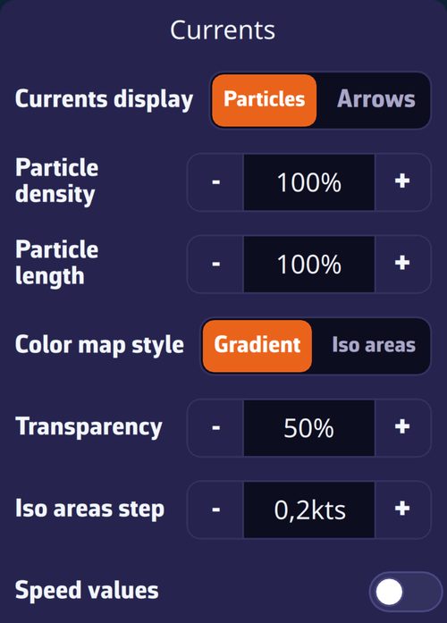 Forecast display drawer, Currents section
Currents in routing
In the routing window, the “Current” row offers “None”, “SHOM atlases”, then your current GRIBs. A coefficient, from 80 to 150% (100% by default), on the same row, increases or decreases the current taken into account. The magic wand of the “Suggested models” automatically chooses the SHOM atlas for coastal navigation when it covers the area. Outside the atlas zones, it provides no current. See Weather routing.