Routings started from the chart
BeginnerThe essentials
When underway, you sometimes want to know right away how to get over there. Several entries start a routing from the boat, at the current time, without setting a date or a route:
- Switch to Navigation mode (“Navigation” switch at the top of the left drawer): the boat must have a position.
- Display on the chart a wind GRIB that covers the boat and the target point.
- Choose an entry:
- on computer, right-click on the chart then “Route to this point”;
- on all devices, “+” button then “Route to the target” (the target is by default the centre of the screen);
- in a POI’s menu, “Route to this POI”.
The calculation uses the settings of your last routing: current, waves, polar, C-MAP options. If something is missing, a message says what.
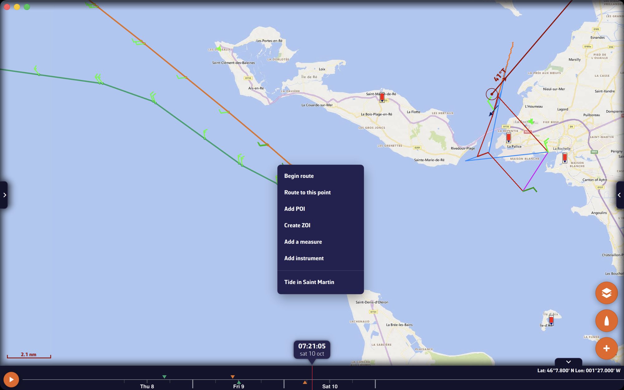 The chart menu with “Route to this point” and the resulting routing
Going further
Route to this point, to the target
“Route to this point” (right-click, computer) and “Route to the target” (“+” menu) start the calculation directly, without a window.
- The point of “Route to this point” becomes a POI when the calculation starts. It carries the date and time of the click (for example “Oct 7, 09:22”, followed by “UTC” if the app is set to UTC) and has no icon: its name is enough to find it. The routing has the same name.
- The target of “Route to the target” is that of the navigation tools: the centre of the screen by default, or the position fixed in its settings (see Navigation tools on the chart).
- The wind GRIB is the one displayed on the chart. Failing that, it is that of the last routing, provided it is on this device.
- The route is not saved in the list of routes: it lives in the routing, under a name starting with an arrow (“→Oct 7, 09:22”, or “→47°30N 3°05W” for the target).
What is checked before the calculation, with the message displayed if it is not the case:
| Condition | Message |
|---|---|
| Navigation mode on | “A routing to a point starts from the boat, now. Turn on Navigation mode first.” |
| No other calculation in progress | “A routing is already being calculated. Wait for it to finish, or stop it.” |
| Boat position known (live position or last position received; never the approximate position from the IP address) | “The boat position is not known, so no routing can start from the boat.” |
| Point more than 0.1 NM from the boat | “This point is less than 0.1 NM from the boat.” |
| A wind GRIB on the device | “No wind GRIB to route with. …” or “The wind GRIB of the last routing is not on this device. …” |
| The boat and the point inside the GRIB’s area | “The boat is outside the area of the … wind GRIB. …” or “This point is outside the area of the … wind GRIB. …” |
| The forecast covers the current time | “The … forecast runs from … to …, not now. Download a more recent forecast, then route again.” |
The best start search does not apply to these routings: they start now.
Route to this POI
“Route to this POI”, in a POI’s menu, goes through the “Routing” window:
- The app creates in the list of routes a two-point route, from the boat (“Start”) to the POI, named “→” followed by the POI’s name. If this route already exists, it is updated rather than duplicated.
- The “Routing” window opens on this route, with “Now from my position” on and the POI as “Next Waypoint”.
- Check the GRIBs and tap “Calc Routing”.
A boat position is required. If the app only has the last position received (the GPS link has dropped), the route starts from that position, at the time set in the window.
Calculate a routing from a route’s menu
Tap (or click) a route on the chart, then “Calculate routing” in its menu: the “Routing” window opens with that route chosen. What follows is described in Start a routing.
Route from a pivot point
To force a new routing through an isochrone point and compare two options, see Study your routing and pivot points.
Recalculate a routing
In the “Routings” tab, a routing’s ⋮ menu offers “Recalculate”. The entry is for when a more recent forecast is available:
- it takes the routing’s route (in its current state, if you have edited it since), its weather files and its start time;
- it downloads again the GRIBs for which a more recent run exists;
- it starts the calculation with your current settings.
A routing that started from the boat restarts from the current position, now. The differences from the original routing can then be read in the “Inputs” tab of the routing’s details (see Read a routing).
When recalculation is not possible, the entry is greyed out and the reason is written below it:
| Reason shown | Meaning |
|---|---|
| “a calculation is running” | another calculation is running |
| “inputs not recorded” | routing too old, its inputs were not kept |
| “ensemble routing” | recalculation does not apply to ensemble routings |
| “route deleted” | the routing’s route no longer exists |
| “no boat position” | routing that started from the boat, with no current position |
| “several wind files” | multi-GRIB routing, its files cannot be found again |
| “no weather file” or “wind file missing” | the wind GRIB is no longer in the list |
| “start outside the weather file” | the wind GRIB found does not cover the start |
| “no newer weather data” | no more recent run exists |
| “start in the past” | the start time has already passed |
| “start beyond the new run” | the new run does not cover the start time |