Device GPS and external GPS
BeginnerThe essentials
NavimetriX takes the boat’s position either from the device’s GPS (phone, tablet) or from an NMEA stream (navigation instruments, USB or Bluetooth GPS, Wi-Fi gateway). The choice is made in the right-hand “Settings” drawer, “GPS & NMEA” section, “GPS source” row:
- “Internal”: the device’s GPS (default setting on phone and tablet);
- “NMEA”: the position from the NMEA stream (default setting on computer, which has no GPS).
To navigate with your phone’s GPS:
- Check that the “GPS source” is set to “Internal”.
- Allow location access for NavimetriX when the system asks.
- Turn on the “Navigation” switch at the top of the left drawer (Premium subscription).
- The arrow to the right of “Navigation” turns green when the position is good.
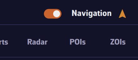 The Navigation switch turned on and the GPS indicator
Going further
Navigation mode and GPS
Outside Navigation mode, the device’s GPS only provides a position every 30 seconds. In Navigation mode, it switches to one position per second (every 2 seconds in power-saving mode), in high accuracy on mobile. When you turn it on, a “Navigation Mode ON” window reminds you of these changes.
On Android, a permanent notification keeps the GPS, NMEA and alarms alive when the app goes to the background. On phones and tablets, the app checks when you turn it on that background location permissions are granted and guides you if they are not.
The accuracy indicator
The small arrow to the right of the “Navigation” switch shows the position status:
| Color | Meaning |
|---|---|
| Gray | Navigation mode off |
| Green (blue in color-blind mode) | accuracy of 15 m or better, or accuracy not provided by the source |
| Orange | accuracy between 15 and 50 m (the shade slides from green to red) |
| Red | accuracy of 50 m or worse, no position for 10 seconds, or no first position yet |
The indicator applies to the position source in use, internal GPS or NMEA. To be warned of a loss of position, set the corresponding alarm (see Navigation alarms).
Satellites
The “GNSS satellites” instrument draws the sky as seen by the receiver: each satellite in its place (azimuth, elevation), colored by constellation (GPS, GLONASS, Galileo, BeiDou, QZSS), distinguishing those used to compute the position. The “Satellites in view” and “Satellites used” tiles give the counts.
- With the internal GPS, this data only exists on Android. iOS does not provide it, and a computer has no receiver: the values stay at “—”.
- With an NMEA GPS, it comes from the receiver’s sentences (GSV, GGA, GSA).
Only the satellites of the position source in use are displayed. To add the instrument, see Instrument types.
USB GPS on a computer
USB GPS devices (“GPS mice”) work on macOS, Windows and Linux. NavimetriX reads the NMEA sentences the GPS sends on its serial port. NMEA requires the Premium subscription.
- Install the GPS driver if needed (often FTDI or Prolific).
- In “Settings”, “GPS & NMEA”, tap “Scan NMEA devices”, then “Start Scan”. On a computer, the scan tries each serial port at 9600, 4800, 38400 and 115200 baud.
- Tap “Apply settings”: the port, baud rate and GPS source are set, and the “NMEA” switch is turned on.
By hand: “GPS source” on “NMEA”, “NMEA” switch on, “NMEA Protocol” on “SERIAL”, then the “Serial port” (COM3, COM4… on Windows, cu.usbserial… on Mac) and the “Baud rate”: 4800, 9600 (default), 38400 or 115200. Many NMEA 0183 GPS devices transmit at 4800.
The serial port only exists on computers: on phones and tablets, “SERIAL” is grayed out. Received sentences scroll in the “Incoming NMEA sentences” console, at the bottom of the page (see NMEA 0183 connection).
Bluetooth GPS on Windows
Once paired in Windows (“Settings”, “Bluetooth & devices”), a Bluetooth GPS appears as a COM port, for example “Standard Serial over Bluetooth link” in Device Manager. The settings are those of a USB GPS: “GPS source” on “NMEA”, “NMEA” on, “NMEA Protocol” on “SERIAL” and that COM port. If the GPS appears on two ports and the first receives nothing, try the other.
The Mac and its “position”
A Mac has no GPS: macOS deduces its position from Wi-Fi networks or the IP address. This position may center the chart at startup, but it is never taken as the boat’s position in Navigation mode. On a Mac, navigate with a USB GPS, NMEA instruments or a phone’s GPS relayed over the local network (see NMEA outputs).
The approximate position from the IP address
At the very first launch, or when no real position has been received yet, the app may request an approximate position over the Internet, deduced from the IP address, to center the chart. It keeps it for one hour at most.
This position is only a landmark:
- it is never used in Navigation mode: when you turn that mode on, it is discarded and the boat waits for a real position;
- as soon as a real position (GPS or NMEA) has been received during the session, it is never used again, even if the link drops: the boat stays at its last known position, shown as old;
- it is never used as the starting point of a routing “from the boat”.
When the NMEA source goes silent
In simple mode, with “GPS source” on “NMEA”, the device’s GPS takes over (except on a Mac in Navigation mode, see above) if the “NMEA” switch is off or if the stream no longer provides a position, and a message announces it (“Position: switched to Internal (NMEA lost)”, then “Position: back on NMEA”). Advanced mode lets you fine-tune this fallback order: see Multiple links and position source.
See also
- NMEA 0183 connection
- Multiple links and position source
- NMEA outputs (relaying the phone’s GPS to a computer)
- Instrument types
- FAQ: How do I display my phone’s GPS data?
- FAQ: Do you support USB GPS devices?
- FAQ: How do I connect a Bluetooth GPS with Windows 11?