The + Button and the Chart Menus
BeginnerThe essentials
The round “+” button  , at the bottom right of the chart, gathers the actions: download weather (a GRIB forecast file), create a POI (point of interest), a route or a zone, calculate a routing, drop anchor, measure, add an instrument. “Add POI” is placed at the centre of the screen; “Route to the target” aims at the target set in the Layers menu (the centre of the screen by default).
- Centre the chart on the area that interests you.
- Press “+”, then the desired action.
- On a computer, a right-click on the chart opens another menu, whose actions apply to the clicked point.
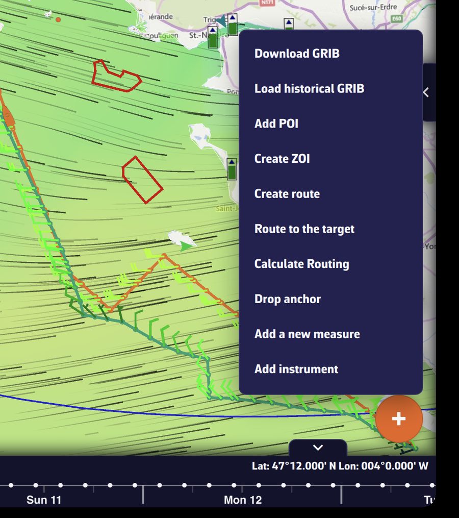 The “+” menu open above the button
Going further
The actions of the “+” menu
| Action | What it does | Condition |
|---|---|---|
| “Download GRIB” | An “Area selection” frame appears; adjust it, confirm, then choose the model. | Internet |
| “Load historical GRIB” | Same area selection, for past weather. | Premium |
| “Add POI” | Creates a point of interest at the centre of the screen. | |
| “Create ZOI” | Draws a zone of interest (no-go or information zone). | |
| “Create route” | Starts creating a route, point by point. | |
| “Route to the target” | Calculates a routing from the boat, now, to the target (the centre of the screen by default), with the settings of the last routing. | Navigation mode, boat position, wind GRIB on the device |
| “C-MAP AutoRouting” | Draws a route that follows the C-MAP chart. | C-MAP chart displayed |
| “Calculate Routing” | Opens the routing window. | a wind GRIB and at least one route |
| “Drop anchor” | Sets the anchor alarm. Turns on Navigation mode by itself, with a message. Disappears while an anchor is set: raise it first from its POI’s menu. | Premium, valid GPS position, speed over ground below 2 knots (above that, a message says the boat is still under way) |
| “Add a logbook entry” | Opens a new logbook entry, dated and positioned now. | Navigation mode, track being recorded |
| “Add a measure” | Places a ruler measuring distance and bearing. | |
| “Add instrument” | Opens the instrument gallery. Tap one, then “Add to instrument bar” or “Add to chart”. |
When a condition is missing, the app explains it rather than hiding the action. For example, “Route to the target” outside Navigation mode displays “Routing to a point starts from the boat, now. Turn on Navigation mode first”, and “Calculate Routing” without a route displays “Please create a route before launching a routing.”
When you have selected a point of a routing on the chart, “Calculate Routing” becomes “Routing from this point”.
During the replay of a track, the menu only keeps “Add POI”, “Add a logbook entry” (replay of your own tracks), “Add a measure” and “Add instrument”.
The right-click menu (computer)
A right-click on a free part of the chart opens a menu whose actions apply to the clicked point:
- “Create route”: the route begins at the first point you click;
- “Route to this point”: routing from the boat, now, to the clicked point. The point becomes a POI named after the time, and the routing carries this name. Same conditions as “Route to the target”;
- “C-MAP AutoRouting”, on a C-MAP chart;
- “Add POI”, at the clicked point;
- “Create ZOI”;
- “Add a measure”, at the clicked point;
- “Add instrument”, placed on the chart at the clicked point;
- “Tide in” followed by the name of a port, when a tidal port is within 10 miles: opens the day’s tide curve for that port.
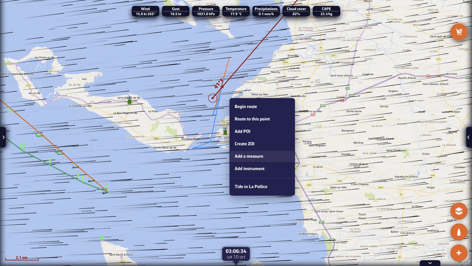 The right-click menu on the chart near La Rochelle, with “Tide in La Pallice”
On a touch screen
A phone or tablet has no right-click: use the “+” menu. “Add POI” places the POI at the centre of the screen, “Route to the target” aims at the target and “Create route” begins at the first point you tap. Two gestures specific to touch:
- a long press on an object on the chart (an AIS target, a POI…) opens its sheet or menu;
- two fingers held still for a little over half a second create a measure between the two fingers.
The menus of chart objects
- A point of a routing (isochrones displayed): tapping it offers “Routing from this point”, which restarts the routing from that point.
- The edge of a ZOI: tapping it offers “View information”, “Edit zone” and “Delete zone”.
- A C-MAP chart: a long press, or a double-click on a computer, opens the sheet of the chart object (buoy, light, hazard…). See the chapter Charts.
POIs, routes, AIS targets, measures and instruments also have their own menus, described in their chapters.