Operating Modes
BeginnerThe essentials
Ashore, when preparing a trip, NavimetriX spares the battery: the device’s GPS only gives its position every now and then, and nothing is recorded. At sea, turn on Navigation mode: position every second, track recording, alarms active. Navigation mode requires the Premium subscription.
- Open the left drawer with the chevron handle on the left edge.
- Flip the “Navigation” switch at the top of the drawer (tapping the word “Navigation” also works).
- The “Navigation Mode ON” window summarizes what changes. If needed, tick “Show instruments” and “NMEA” (reception of data from the onboard instruments), then close it.
- Back in port, flip the switch again: the track is closed and the GPS goes back to economy mode.
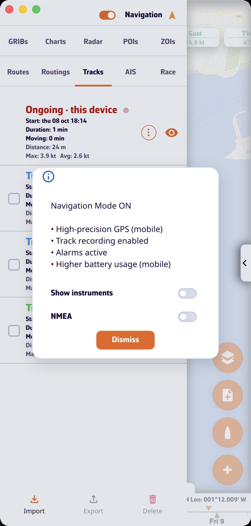 Left drawer with the “Navigation” switch on and the “Navigation Mode ON” window listing the effects, with the “Show instruments” and “NMEA” boxes
Going further
Navigation mode
| Navigation mode off | Navigation mode on | |
|---|---|---|
| Device GPS (mobile) | low accuracy, one position every 30 seconds | high accuracy, one position per second |
| Track | no recording | recorded, then closed when the mode stops |
| Alarms | disabled | active |
| Battery (mobile) | saving | increased consumption |
- Without a subscription, the switch immediately goes back off and the “Premium Feature” window opens.
- The arrow icon, to the right of the word “Navigation”, indicates the position quality in Navigation mode: green for an accuracy of 15 m or better (blue with the colourblind-friendly colours), from orange to red up to 50 m, red with no position or when the GPS stream is interrupted.
- The window’s boxes “Show instruments” and “NMEA” are remembered separately for turning the mode on and off: the window offers your last choice again.
- On Android, a foreground service keeps the GPS, NMEA and alarms active with the screen off; its notification shows the position, speed over ground and course over ground. The screen stays on as long as the mode is active.
- On iPhone and iPad, Navigation mode asks for precise location.
- The add-to-logbook button appears above the boat button during recording.
- In the browser, Navigation mode does not exist.
On activation, on phones and tablets, the app checks the system permissions. If any are missing, the “Almost ready” window lists the settings to fix, each with a “Fix” button: location permission, precise location, “Always” location (iOS), notifications and battery optimization (Android). “Continue” overrides for the session, “Cancel” gives up Navigation mode. See Preparing your tablet or smartphone.
Automatic stop in port. One hour after activation (six hours if you turned it on inland, on a lake for example), Navigation mode stops by itself if the GPS position stays ashore, with land all around within a 1 km radius, for one minute. An approximate position (without a real GPS) never triggers this stop, and an armed anchor alarm prevents it.
Anchor alarm. If an anchor alarm is armed, turning off Navigation mode disarms it: the app asks for confirmation (“Turn off” or “Keep watching”).
Instruments outside Navigation mode
You do not need Navigation mode to read the wind or depth at the pontoon: if the instruments are displayed and an NMEA stream arrives from the onboard instruments, their values update once per second, as long as the app is in the foreground. Outside Navigation mode, there is no track, no alarms and no history sparklines in the tiles.
Power saving
Settings > “General” > “Power” > “Energy saving” (off by default) lightens the device’s workload, useful on battery:
- in Navigation mode, the instruments refresh twice per second instead of about thirty times;
- the device’s GPS gives a position every two seconds instead of every second;
- alarms are checked once per second instead of twice;
- the animated particles disappear: wind is drawn as barbs, currents as arrows;
- on Android, the Navigation mode notification updates every 15 seconds instead of 5.
This setting is specific to each device. It does not exist in the browser version.
Screen standby on Android. By tapping the arrow icon to the right of the word “Navigation”, you dim the screen to the maximum without turning it off: Wi-Fi stays active and NMEA reception continues. A tap anywhere (“Touch the screen to reactivate”) restores the brightness.
Demo mode
Demo mode replays a recorded passage, with moving AIS targets (simulated vessels, as shown by the Automatic Identification System), to discover the app at home. It goes through NMEA reception and therefore requires the Premium subscription.
- Open Settings > “GPS & NMEA”.
- In the “NMEA Protocol” list, choose “DEMO”. The “NMEA” switch turns on by itself.
The app then closes the Settings, clears the current track, creates a POI (point of interest) “Gascogne” and starts a “Goto” to it, switches the GPS source to NMEA, turns on Navigation mode, displays the instruments and opens the AIS tab (the left drawer opens on tablet and computer). The “Demo mode” label is displayed for a few seconds and the chart centres on the simulated boat. You can select AIS targets, read their information and follow the instruments.
To stop, turn off the “NMEA” switch, turn off Navigation mode, or choose another protocol. The app removes the “Gascogne” POI and the “Goto”, and restores the protocol, GPS source and Navigation mode from before the demo. Demo data is never relayed on the network or sent over the Internet.
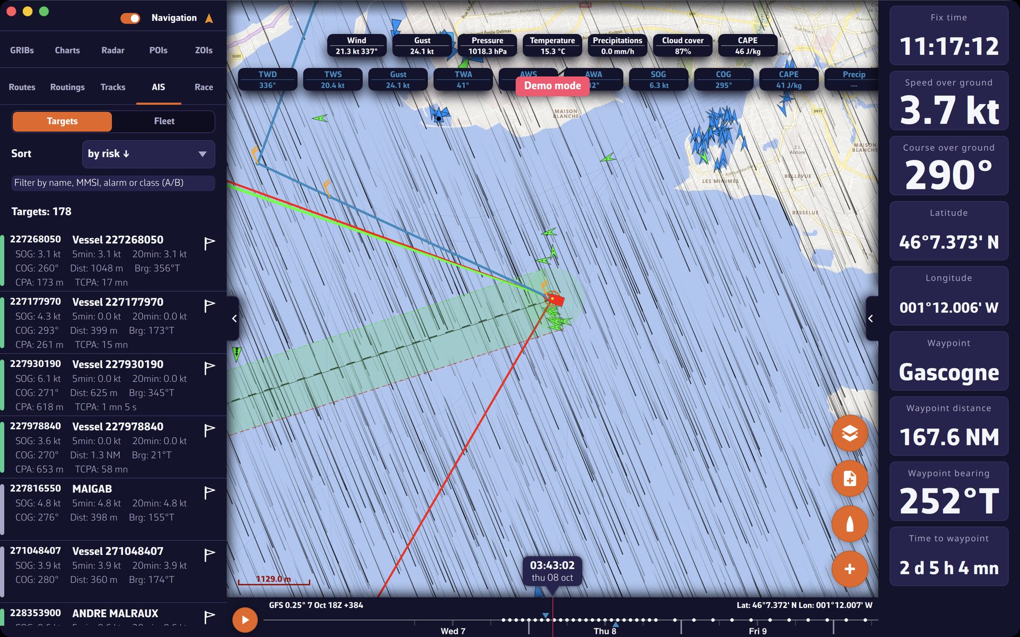 Demo mode: simulated boat, AIS targets and the AIS tab open