C-MAP chart settings
ExpertThe essentials
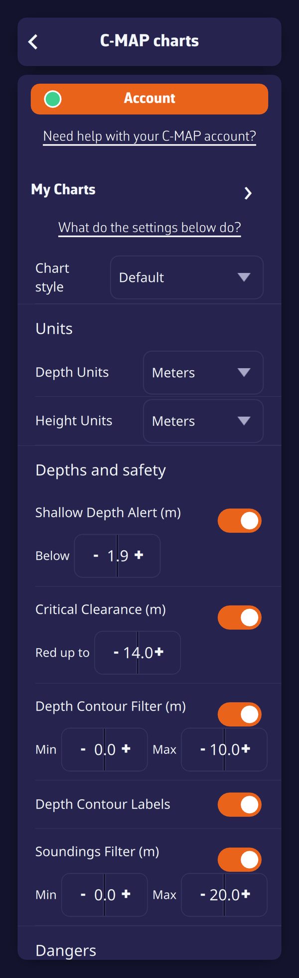 Top of the C-MAP settings: chart style, units, depths and safety
The C-MAP settings change the presentation of C-MAP charts, and only of them: weather, routes and AIS targets are not affected. They are in Settings, “C-MAP Charts”, under the “Account” and “My Charts” buttons. The dot on the “Account” button shows the state of your C-MAP account (green: signed in and device registered; orange: registration not confirmed; red: not signed in): it only concerns the download of new zones, never the display of charts already downloaded (see C-MAP charts: purchase, account and zones). When you are signed in to your NavimetriX account, they follow you to your other devices.
- Open Settings, then “C-MAP Charts”.
- At the top, choose the “Chart style”.
- Adjust the “Units”, “Depths and safety”, “Dangers”, “Seabed”, “Additional layers” and “Display” sections.
- At the bottom, choose the “Cartography type”.
- For the most-used layers, save time with the three quick buttons placed to the right of “C-MAP” in the layers menu.
The “What do the settings below do?” link opens the FAQ C-MAP chart settings, which shows each setting in pictures, before and after.
Going further
Chart style and cartography type
- “Chart style”: “Default” (day presentation), “Night”, “NOAA” (presentation of US charts) or “NOAA Night”. With the application’s “Night” theme, NavimetriX automatically switches to the night variant of the chosen style, then switches back when you leave the theme (see Base maps and orientation). Since the theme is specific to the device, this switch is not passed on to your other devices.
- “Cartography type”: “C-MAP cartography” (default value, all the C-MAP content) or “ENC charts only”. This second choice only displays the official electronic navigational charts (ENC) of the hydrographic services, without content specific to C-MAP such as high-resolution bathymetry and shaded relief.
The sections
The list of settings is provided by the C-MAP chart engine; their names may therefore change with versions of this engine. Each depth or height value is entered in the unit shown in its title, the one chosen under “Units”.
| Section | What you set there |
|---|---|
| “Units” | Units of depth (meters, feet or fathoms) and height (meters or feet) |
| “Depths and safety” | Shallow-water alert (red hatching below the depth set in “Below”), critical air draft (bridges in red up to the value of “Red up to”), depth contour filters and labels, soundings filter |
| “Dangers” | Filters for wrecks, rocks and obstructions: “Hide deeper than” a depth |
| “Seabed” | Seabed area (nature of the seabed in colors, with its legend), crowd-sourced seabed hardness |
| “Additional layers” | High-resolution bathymetry, crowd-sourced bathymetry, crowd-sourced vegetation, shaded relief and its opacity, satellite imagery and its opacity |
| “Display” | Marine protected areas, national text, magnification of text and symbols |
A few rules to know:
- Danger filters: a danger whose depth is not known is never hidden, and a danger that uncovers at low tide remains displayed. These filters lighten the chart, they do not replace a safety margin.
- Greyed-out rows: a greyed-out row has no effect for now, usually because it depends on a switch that is off (crowd-sourced bathymetry requires high-resolution bathymetry, for example).
- REVEAL X layers: seabed area, seabed hardness, crowd-sourced vegetation, shaded relief and satellite imagery, with their opacities, are sold with REVEAL X charts. If your account has no valid REVEAL X chart, these rows are greyed out. If you have charts of both types, they stay active but are only displayed on REVEAL X charts. An expired REVEAL X chart no longer counts.
The quick buttons in the layers menu
When “C-MAP” is the active base map, three buttons appear to its right in the “Maps” section of the layers menu. An orange button signals an enabled layer.
- Satellite (image icon, REVEAL X): satellite images, over land only: at sea, the nautical chart remains visible. To cover the sea too, choose “Enabled” in the C-MAP settings page, “Satellite imagery” row.
- Relief (mountain icon, REVEAL X): shaded relief of the land and the seabed.
- HRB (grid icon): high-resolution bathymetry, that is, C-MAP’s detailed depth contours.
Satellite and relief both shade the land: enabling one disables the other. High-resolution bathymetry is independent. These buttons change the same settings as the “C-MAP Charts” page. Without a valid REVEAL X chart, satellite and relief are greyed out. In this case, as with charts of both types, the note “Satellite and relief: REVEAL X charts only” appears under the row.
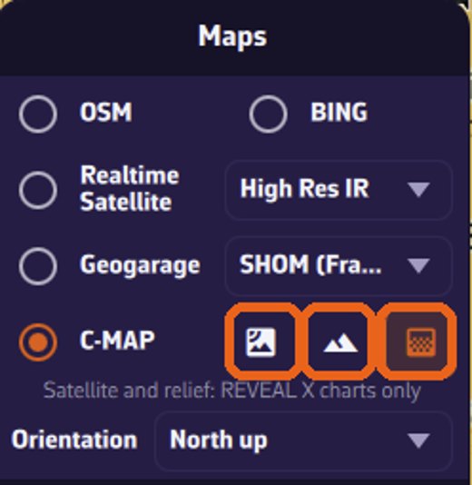 The three quick buttons to the right of C-MAP: satellite, relief, high-resolution bathymetry
Returning to the default presentation
Turn off the alerts and filters, choose the “Default” style and the “C-MAP cartography” type.