Base maps and orientation
BeginnerThe essentials
The base map is the image on which NavimetriX draws the weather, routes, POIs and AIS targets. You choose it in the layers menu, which also lets you orient the map. These two choices are specific to each device: changing the base map on the tablet changes nothing on the computer.
- Tap the round orange layers button at the bottom right of the chart (on a phone in landscape, it moves to a top corner of the screen).
- In the “Maps” section, choose the base map: “OSM”, “BING”, “Realtime Satellite”, “Geogarage” or “C-MAP”.
- Still in “Maps”, the “Orientation” list chooses what is at the top of the screen: “North up”, “Course up (COG)”, “Heading up (HDG)” or “Waypoint up (BTW)”.
- In the “Display” section of the same menu, the “Lat/lon grid” checkbox overlays a graduated grid of latitudes and longitudes.
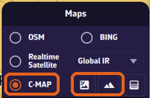 Maps section of the layers menu: OSM, BING, Realtime Satellite, C-MAP
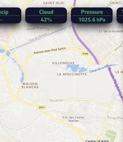 Maps section of the layers menu: base maps and the Orientation list unfolded (North up, Course up, Heading up, Waypoint up)
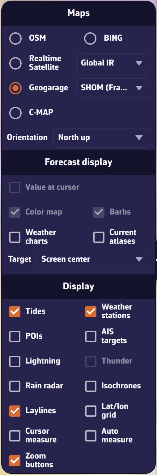 Layers menu on a phone, with the Geogarage (SHOM) base map selected: the map list includes OSM, Bing, Realtime Satellite, Geogarage and C-MAP
Going further
The available base maps
- “OSM”: the default base map, a map of land and coastline with shaded relief. It is a general base map, not a nautical chart: no soundings or buoyage.
- “BING”: satellite images (aerial photographs) of land and coasts.
- “Realtime Satellite”: recent infrared images of the clouds. The list on the right chooses the source: “Global IR”, “High Res IR” or “NOAA IR”. NavimetriX remembers the last source chosen. These images belong to weather: see Satellite images.
- “Geogarage”: the nautical charts of hydrographic services (SHOM, NOAA, BSH and the British service…) you subscribe to with Geogarage. The row only appears once you are connected to your Geogarage account, with at least one subscribed layer; the list on the right chooses the layer. See Geogarage charts.
- “C-MAP”: the C-MAP DISCOVER X or REVEAL X vector charts. When this base map is active, three buttons appear to its right: satellite, relief and high-resolution bathymetry. Satellite and relief are reserved for REVEAL X charts. See C-MAP charts: purchase, account and zones and C-MAP chart settings.
Shaded relief of the land and the seabed only exists in C-MAP REVEAL X charts; on the other base maps, only “OSM” shades the land relief.
On “OSM”, “BING” and the Geogarage base maps, NavimetriX also draws a coastline when you zoom out strongly, to keep the outline of the land readable. It always draws it on infrared images, never on C-MAP, which draws its own coast.
Map orientation
| Choice | What is at the top of the screen | Data used |
|---|---|---|
| “North up” | north (default value) | none |
| “Course up (COG)” | the boat’s course over ground | COG (Course Over Ground, the course followed relative to the ground, given by the GPS) |
| “Heading up (HDG)” | the boat’s heading | HDG (Heading, the compass heading, received over NMEA) |
| “Waypoint up (BTW)” | the direction of the active waypoint | BTW (Bearing To Waypoint, the bearing of the next waypoint) |
The map turns smoothly and only follows changes of at least 1°, so it does not jitter. As long as the chosen data is missing (no GPS, no NMEA heading, no active waypoint), the map stays north up. The HDG heading requires a compass connected over NMEA (see NMEA 0183 connection); the BTW bearing requires navigating to a POI or following a route (see Navigating to a POI and following a route).
The orientation is saved on the device and restored at the next launch.
Latitude and longitude grid
The “Lat/lon grid” checkbox in the “Display” section draws the parallels and meridians with their values. The grid spacing follows the zoom: 10° in a wide view, then 5°, then 1° up close. It does not go below one degree.
Charts in night mode
The “Night” theme is chosen in Settings, on the “Theme” row (“Light”, “Dark” or “Night”). It is a setting specific to each device. With the “Night” theme, charts darken to preserve night vision:
- C-MAP switches to the night variant of the chosen style: “Default” becomes “Night”, “NOAA” becomes “NOAA Night”. The original style returns when you leave the “Night” theme.
- Geogarage: the colors of the charts are inverted (white becomes black), then slightly darkened.
- “OSM”, “BING” and infrared images keep their colors, under a more pronounced dark veil.
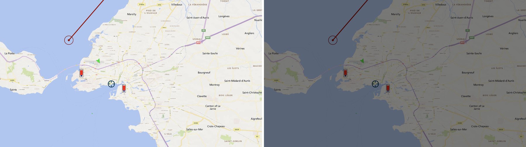 The same harbor, La Rochelle, with the Light theme on the left and the Night theme on the right, on the OSM base map: under the Night theme, the map remains readable under a dark veil