Global models cover the entire planet. Regional models only cover an area: make sure it includes your whole passage.
Checking the coverage in the app
- In the Download GRIB window, with Regional coverage, the Model list only offers the models that cover the selected area.
- Tap the small triangle on the Model description and map coverage line to show a map of the area covered by the chosen model.
The online coverage map
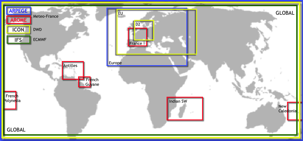
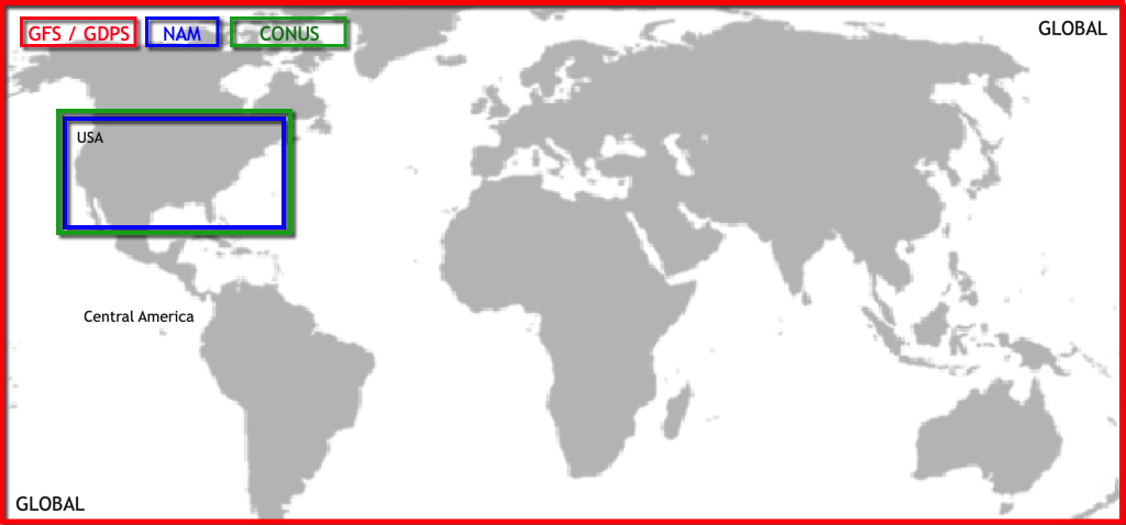
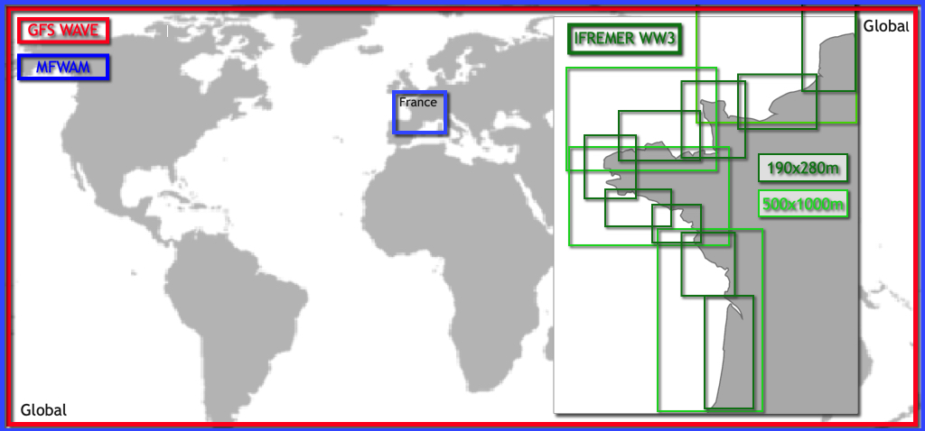
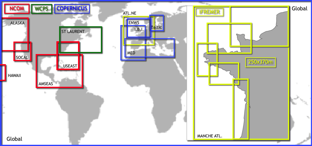
Our Regional Models Coverage page draws the area of each regional model. Hover over the map to see the models available at a given point.
Regional models by area
Atmospheric models
- Mainland France and neighbouring countries: Arome, Arome HD
- Europe and the Mediterranean: Arpège Europe, ICON Europe
- Germany and neighbouring countries: ICON D2
- British Isles and the Channel: UKV
- Netherlands and southern North Sea: HARMONIE
- Scandinavia and the Baltic: MET Nordic
- Italy and surrounding seas: ICON-2I, WRF LaMMA
- Adriatic: ALADIN-HR
- Cyprus: WRF Cyprus
- French overseas territories: Arome Antilles, Arome Guyane, Arome Polynésie, Arome Calédonie, Arome Réunion-Mayotte
- United States: NAM, HRRR CONUS
Wave models
- Coasts of mainland France: MFWAM France
- Channel and French Atlantic coast: IFREMER WW3, 13 areas from 190 m to 500 m
- Mediterranean: Copernicus Med Waves
- North Sea, Baltic, Channel and Celtic Sea: DMI WAM
- Overseas: IFREMER WW3 Antilles, Guadeloupe-Martinique, Martinique, Nouvelle-Calédonie and Réunion
Current models
- Channel and French Atlantic coast: SHOM Manche-Gascogne, IFREMER (8 areas, from 250 m to 3 km)
- North-western Mediterranean: SHOM Méditerranée Nord
- Mediterranean: Copernicus MED
- Iberia, Biscay and Ireland: Copernicus IBI
- European North-West Shelf (North Sea, Channel): Copernicus ENWS
- Baltic: Copernicus BALTIC
- German Bight and Western Baltic: BSH (2 areas)
- Saint Lawrence: MSC Saint Laurent
- US coasts, Caribbean, Hawaii and Alaska: NCOM (5 areas)
All other models (GFS, ECMWF, ICON Global, GDPS, Arpège Monde, GFS Wave, MFWAM Global, Copernicus Global, RTOFS…) are global.
Coverage maps
European atmospheric models
American atmospheric models
Wave models
Current models
See also: It’s great to have so many models to choose from, but which one should I choose?