By default, when you display an atmospheric GRIB file on the map, wind is shown (barbs or particles, with the colour gradient). But your GRIB file contains many other parameters: precipitation, cloud cover, temperature, pressure, gusts, CAPE, etc.
To change the parameter displayed as a colour overlay on the map:
- Tap the round orange layers button at the bottom right of the screen.
- In the menu that opens, find the Forecast display section.
- Tap the drop-down menu (showing "Wind" by default) to see the parameters contained in the file. For a typical atmospheric GRIB:
- Wind
- Gust
- Delta Gust (if the file contains both wind and gusts)
- Pressure
- Temperature
- Precipitations
- Cloud cover
- CAPE
- Select the desired parameter (e.g. "Precipitations" or "Cloud cover"): the map updates immediately with the corresponding colour gradient.
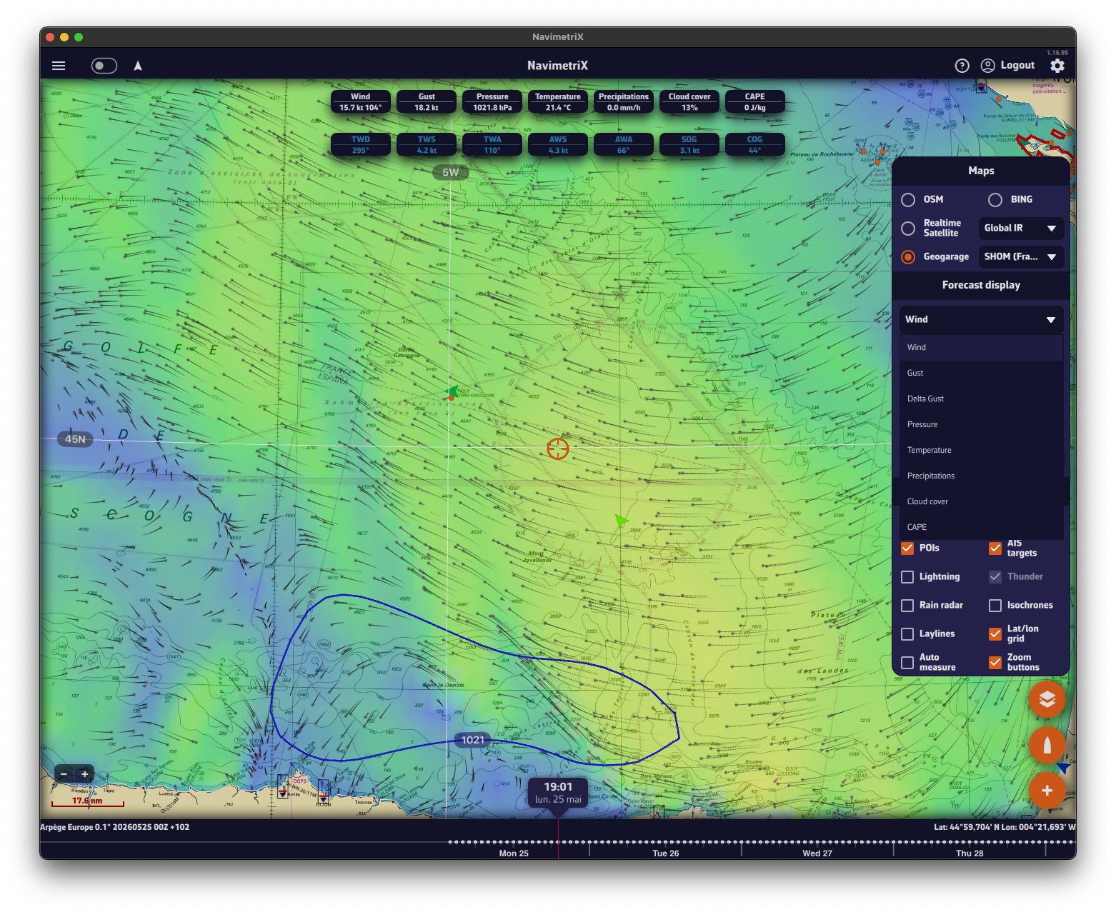
Tip: once the parameter is selected, use the timeline bar at the bottom of the screen to scroll through hours and see how precipitation, cloud cover or any other parameter evolves over the entire area covered by your GRIB file.
Note: for a wave GRIB, the drop-down offers a single entry, Waves. Height, direction and period are shown in the value labels at the top of the screen. See How do I display waves?
The parameters available in the drop-down depend on the data contained in your GRIB file. If you do not see "Precipitations" or "Cloud cover" in the list, make sure you ticked those parameters when downloading the GRIB file.