To illustrate the process, let’s say we’re planning a 4-day passage from La Rochelle (France) to Cowes (UK).
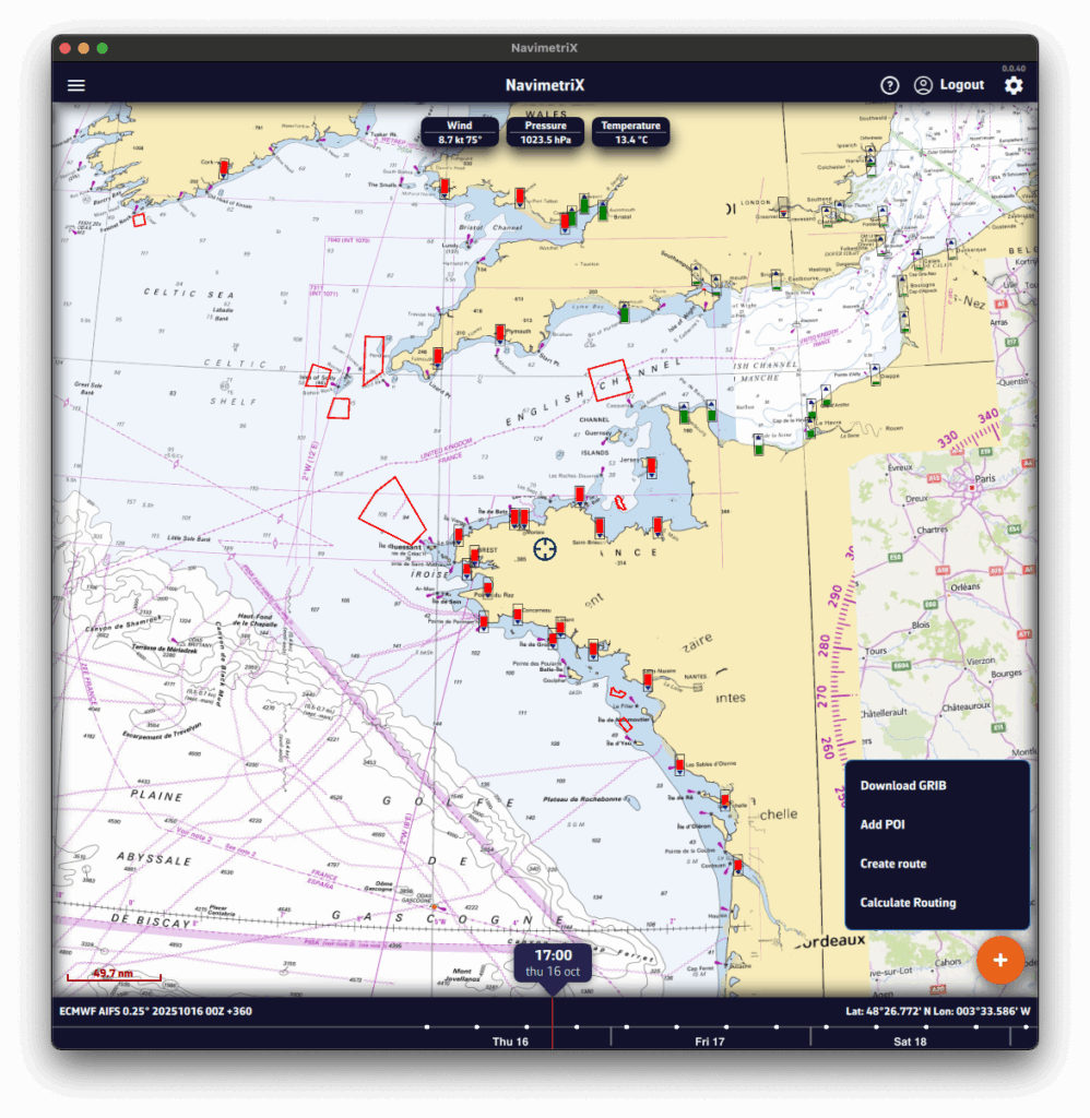
- Pan and zoom to your sailing area. Unless you’re doing an ocean crossing, pick a selection slightly larger than your route.
- Press the round orange + button at the bottom right.
- Tap Download GRIB.
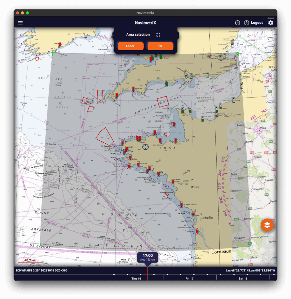
- The Area selection banner appears at the top of the screen. If needed, adjust the selection using the four green corners.
- Press OK. To let NavimetriX pick the models for you, tap the magic wand in the banner instead (see Suggested models below).
A Download GRIB window opens. The choices are filtered to your selected area.
Without the Premium option, you’re limited to the GFS model (the U.S. NOAA global atmospheric model): only the Atmospheric type and Global coverage are offered.
- Choose the Type of data to download:
- Atmospheric
- Current
- Sea State
- Ensemble (ensemble models: GEFS, ECMWF IFS ENS)
- Observations (ASCAT) (satellite-measured wind)
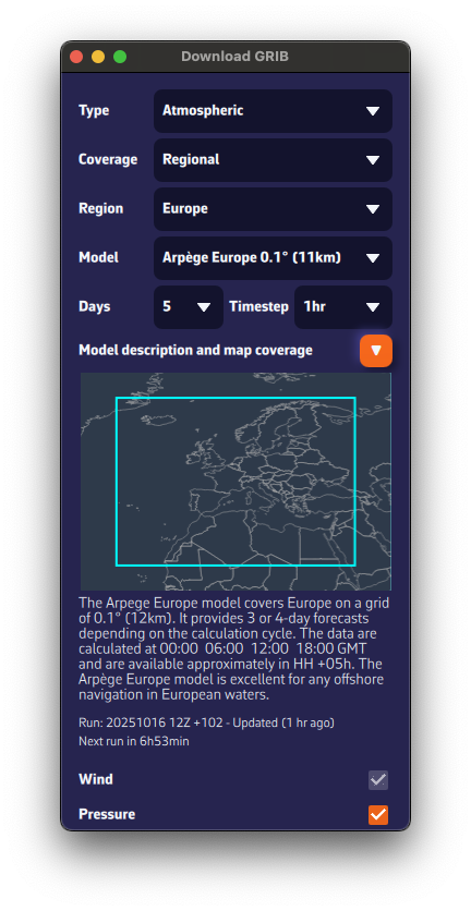
- Choose the Coverage:
- Global
- Regional: for trips up to about 5 days, a regional model is usually best.
- If applicable, select the Region.
- Select the Model.
See our FAQs for guidance on models.
If unsure, choose the atmospheric global ECMWF IFS or GFS. - If needed, check the Model description and map coverage.
- Select the Days and Timestep.
If unsure, keep the defaults. - Tick the parameters to download (Wind, Pressure, etc.).
If unsure, keep the defaults.
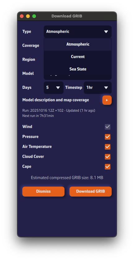
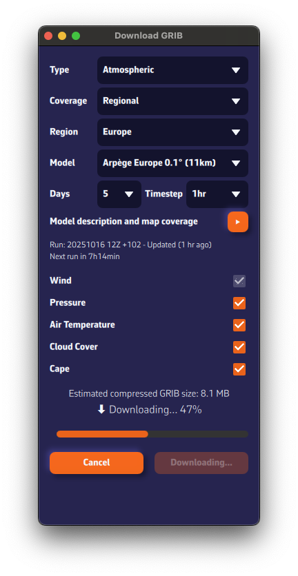
The estimated compressed GRIB size appears at the bottom. Keep it reasonable: if you see about 200 MB, you probably chose a model that’s too fine or too many parameters.
Below the model description, we show the latest model calculation time (the Run).Run: 20251016 12Z +102 means: calculated on Oct 16, 2025; initialized at 12:00 UTC (12Z); contains 102 forecast hours from that run.
We also display the estimated time until the next run is available.

- Press Download GRIB.
- The GRIB file downloads from our fast, redundant servers.
- Once downloaded, it is:
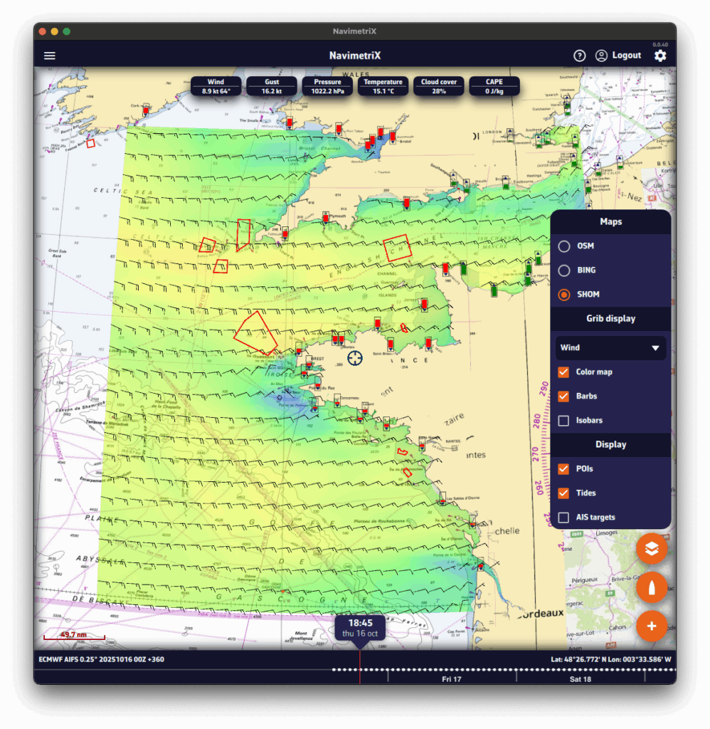
- displayed on the map. If you don’t see it, tap the round orange layers button and tick Color map and Particles (the box reads Barbs if you chose that wind display).
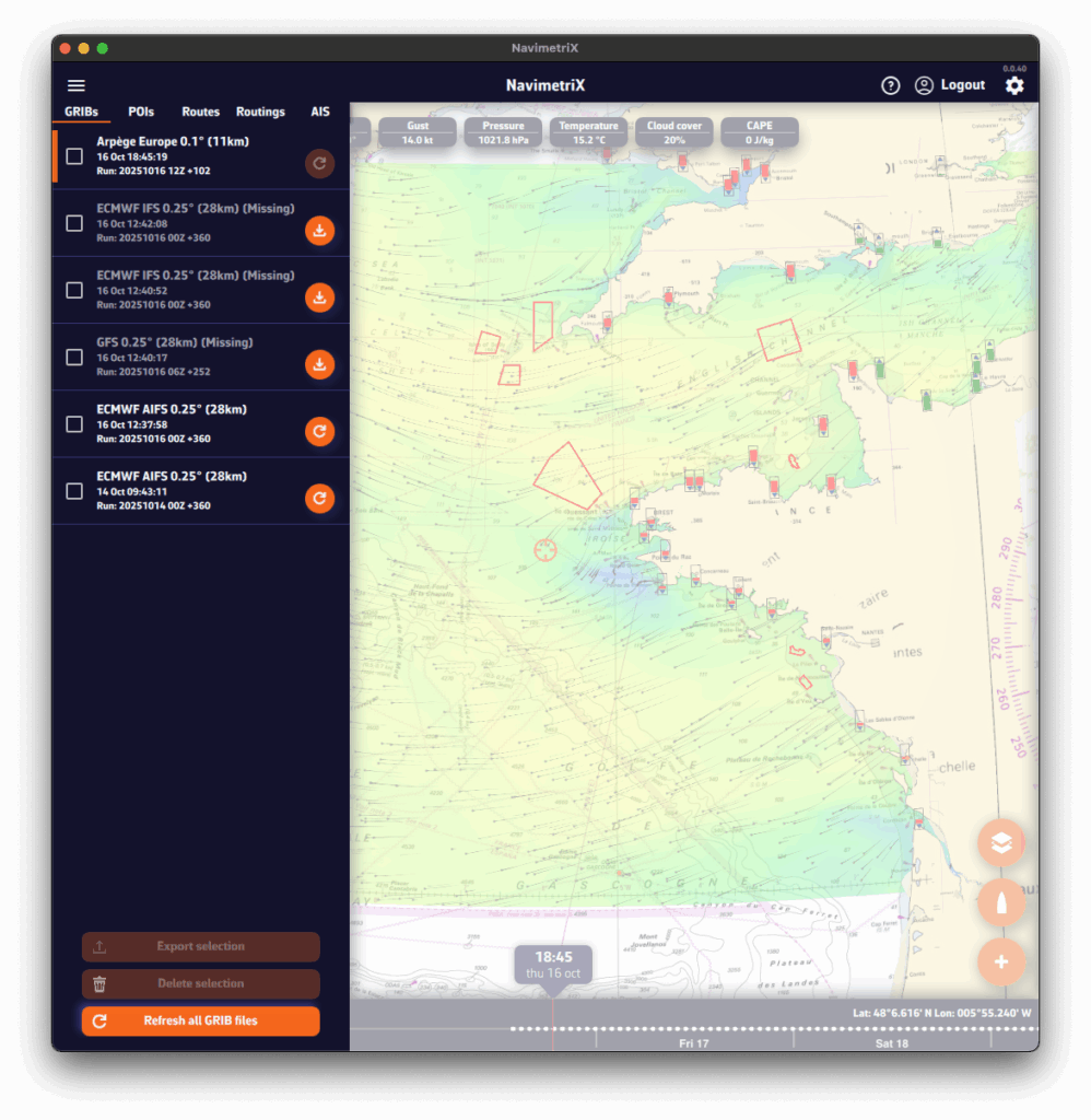
- added to the list in the GRIBs tab of the left panel: open it with the chevron handle (›) on the left edge of the screen.
Suggested models: let NavimetriX choose
In the Area selection banner, the magic wand analyses the area you drew and opens the Suggested models window. It proposes a combination suited to the area:
- Wind: the suggested model, with its coverage (regional or global) and forecast range. A list lets you pick another one, and the + button adds more wind models to compare.
- Current: the SHOM tidal atlas in coastal tidal areas, a current GRIB, or None.
- Waves: a wave model, ticked by default for an offshore passage, optional for coastal sailing.
Each line can be ticked or unticked. An optional Zone name (8 characters at most) is shown in front of these GRIBs’ names in the list. The Download button fetches the missing files, displays the wind on the chart and sets the chosen current and waves as routing sources.