Wind Settings
Open Settings by tapping the chevron handle (‹) on the right edge of the screen, then select Forecast display.
- Wind display
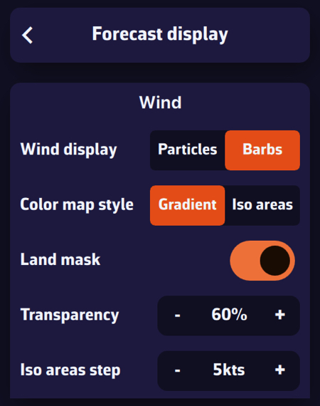
In the Wind section, select Particles or Barbs. Animated particles show the wind flow but consume more system resources and therefore battery: best avoided while sailing. Vectors and barbs are the classic meteorological representation of wind direction and strength. They are placed on the grid points of the GRIB file, further apart when you zoom out, and are more resource-efficient.
Particle density (25 to 300 %, 100 % by default) sets how many particles are shown, and Particle length (25 to 150 %) the length of their trail.
The Gradient style represents wind strength using a rainbow colour scale, from blue (light or calm winds) to magenta (strong winds), through shades of green, yellow, orange and red. Especially suitable for wind data.
The Iso areas style displays the data with the same colours but as bands of equal value. It also suits wave height well.
The Land mask, on by default, hides the colour map and the barbs over land: only the sea is coloured. Turn it off to keep the wind data visible over land too, for instance to keep a continuous sea/land display when sailing among islands. When you zoom in very close (a harbour view or closer), the colour map disappears altogether, sea included.
Transparency allows you to adjust the colour overlay depending on the background (satellite map or nautical chart).
Iso areas step sets the width of the bands of the Iso areas style, in knots.
Energy saving: when this mode is on (Settings, General, Power section), particles are switched off and the chart shows barbs. The Wind display, Particle density and Particle length rows are then greyed out; your choice comes back when you turn the mode off.
Wind Display
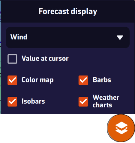
On the map, the round orange layers button at the bottom right of the screen lets you choose what to display.
In the Forecast display section, the drop-down menu allows you to select which data to display. If a weather GRIB (for example an IFS model) is displayed, Wind will be selected by default. You can enable or disable the Color map, the Particles or Barbs (the box is named after the mode set above), and the Isobars (lines of equal atmospheric pressure).
If you have displayed a wave GRIB file, you can enable or disable the Color map and the wave direction Arrows.
This section automatically adapts to the type of GRIB file displayed on the screen: weather, waves, or currents.