Principle
An isochrone ("same time") is a line joining all the positions the boat can reach in the same amount of time from its starting point.
To get from point A (the start) to point B (the finish), the routing applies the boat's speed polar to the forecast wind (speed and direction) and, if you selected them, to the current and the sea state. It takes into account the constraints you have set: zones to avoid, wind and wave limits, manoeuvre penalties, and so on.
How does it work?
- From the start, the app works out where the boat would be after one time step, for a large number of headings. The line joining these positions is the first isochrone.
- From the points of this isochrone, the calculation starts again for the next step, and so on until a point reaches the finish.
- The app then traces that point's path back to the start: this is the optimal route.
From each point, the headings tried cover the whole horizon every 5°, plus the key angles of the polar (best VMG upwind and downwind) and the heading that leads to the finish around the land. To keep the calculation fast, a point that reaches an area another point has already reached earlier is dropped.
The "Sweep angle" and "Step angle" settings of earlier versions are gone: this method no longer needs them.
The route found is then refined: the app removes needless course changes and moves the others as long as this brings the arrival time forward. This is why a tack on the route does not necessarily fall on an isochrone.
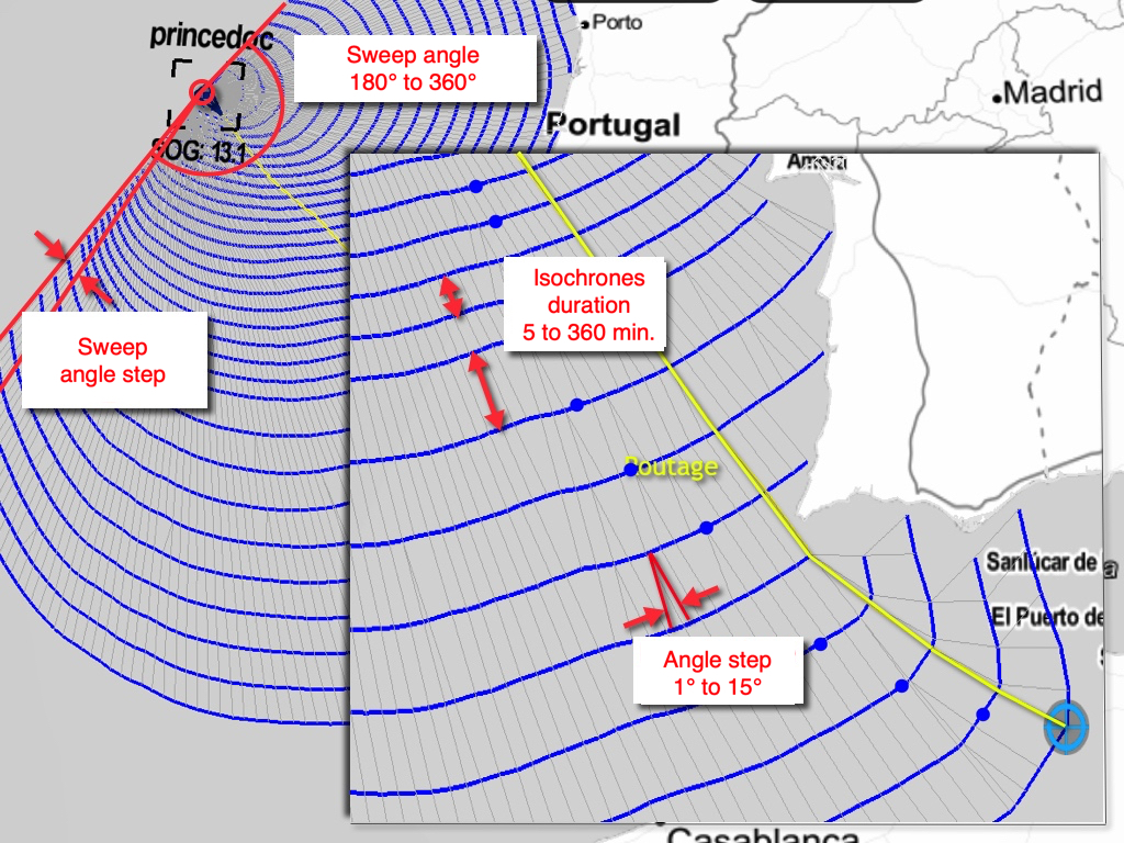
Isochrone time step
This is the time between two isochrones. It is set in the settings drawer, Routing section, "Isochrone duration" row: auto by default, or a fixed value of up to 360 minutes in 5-minute increments.
In auto mode, the app chooses the step itself: short at the start (20 minutes for the first hour), then longer and longer along the passage, up to 6 hours after five days at sea. It is also shortened on short route legs. We recommend keeping auto mode. A short step gives more accuracy but takes more computing.
The blue dot on each isochrone
On each isochrone, a blue dot marks the point the best route passes through. If the route does not pass through it, the dot marks the point closest to the finish, measured as distance over water. These points serve as pivot points to test another route option.
The other routing settings (polar, efficiencies, manoeuvre penalties, engine, zones, wind and wave limits) are described in How do I calculate a routing? What are the different settings?