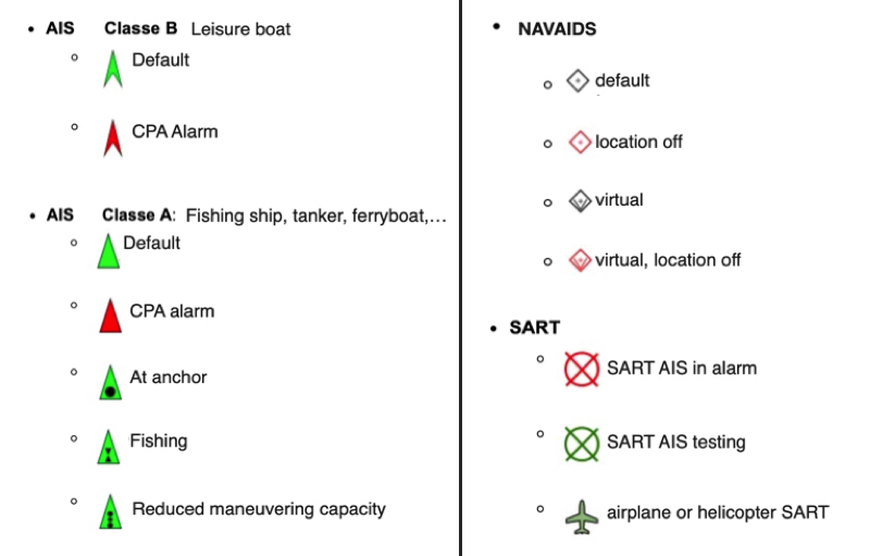
You can display several types of icons on the chart: AIS targets, navigation aids (NavAids), SART (Search And Rescue) distress beacons, AIS targets via the Internet, and “in-situ” weather data stations.
AIS Targets, NavAids, SART
AIS Target over Internet
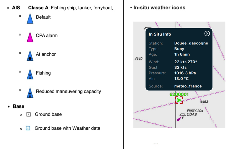
Weather station 'in-situ'
To know more, read our FAQ: How to display "in-situ" weather stations