In short
- NavimetriX displays the C-MAP DISCOVER X and REVEAL X charts, bought as a Digital License.
- You buy them from C-MAP, on xstore.c-map.com/charts, with a free C-MAP account.
- One chart works on 2 computers or chart plotters and on as many phones and tablets as you need.
- The price includes 12 months of downloads and updates. After that, the charts you have downloaded keep working, with no time limit.
Which C-MAP charts are compatible?
Only the X generation of C-MAP charts: DISCOVER X and REVEAL X. C-MAP explains this generation on its page The X generation of charts.
The older C-MAP charts (DISCOVER and REVEAL without the X, 4D, MAX…) do not work in NavimetriX. Look for the X in the product name.
REVEAL X contains everything in DISCOVER X, plus extra layers:
| DISCOVER X | REVEAL X | |
|---|---|---|
| Vector navigation charts, harbour and approach details, marinas | ✔ | ✔ |
| High-resolution bathymetry, custom depth shading | ✔ | ✔ |
| Tides and currents | ✔ | ✔ |
| Day and night modes | ✔ | ✔ |
| Satellite imagery (shown in NavimetriX) | ✔ | |
| Shaded relief of the coast and the seabed (shown in NavimetriX) | ✔ | |
| Vegetation and seabed hardness layers (shown in NavimetriX) | ✔ | |
| Example price, Central and West Europe (22 September 2026) | €159 / £111.44 | €249 / £174.52 |
Which one should I choose? DISCOVER X has everything you need to navigate. Choose REVEAL X if you want the satellite view, the relief and the seabed layers. Prices depend on the region and the country of the store.
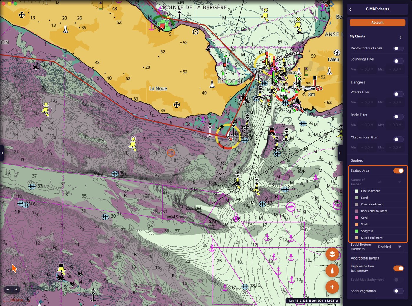
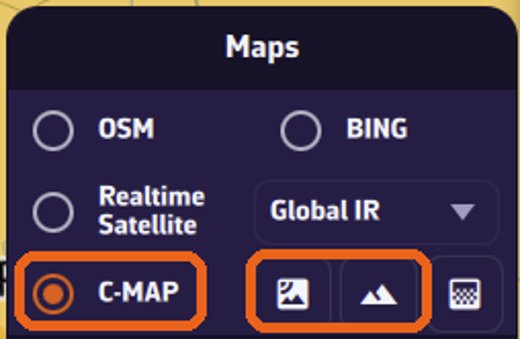
In NavimetriX, the REVEAL X layers are switched on from the layers menu, next to "C-MAP": the first button shows the satellite imagery, the second the shaded relief. The seabed layers are switched on in the C-MAP settings, "Seabed" section.
If you only have DISCOVER X charts, these buttons and settings are greyed out. If you have both types, they stay active, but the REVEAL X layers only show over your REVEAL X charts, not over the DISCOVER X ones.
Check the coverage before buying
Open the C-MAP chart viewer, then search for your harbour in the search box at the top left, or zoom in on your sailing area, to see the detail of the C-MAP charts.
Note: the chart viewer gives a preview of what is available. What you see there may not be exactly the same as the chart you download in NavimetriX.
How to buy a chart, step by step
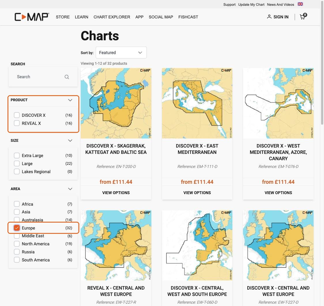
Step 1: go to the right store. Open xstore.c-map.com/charts. C-MAP has several websites; this is the store that sells the X charts as a Digital License. Use the filters on the left: Product (DISCOVER X or REVEAL X) and Area. The flag at the top right changes the country, the language and the currency.
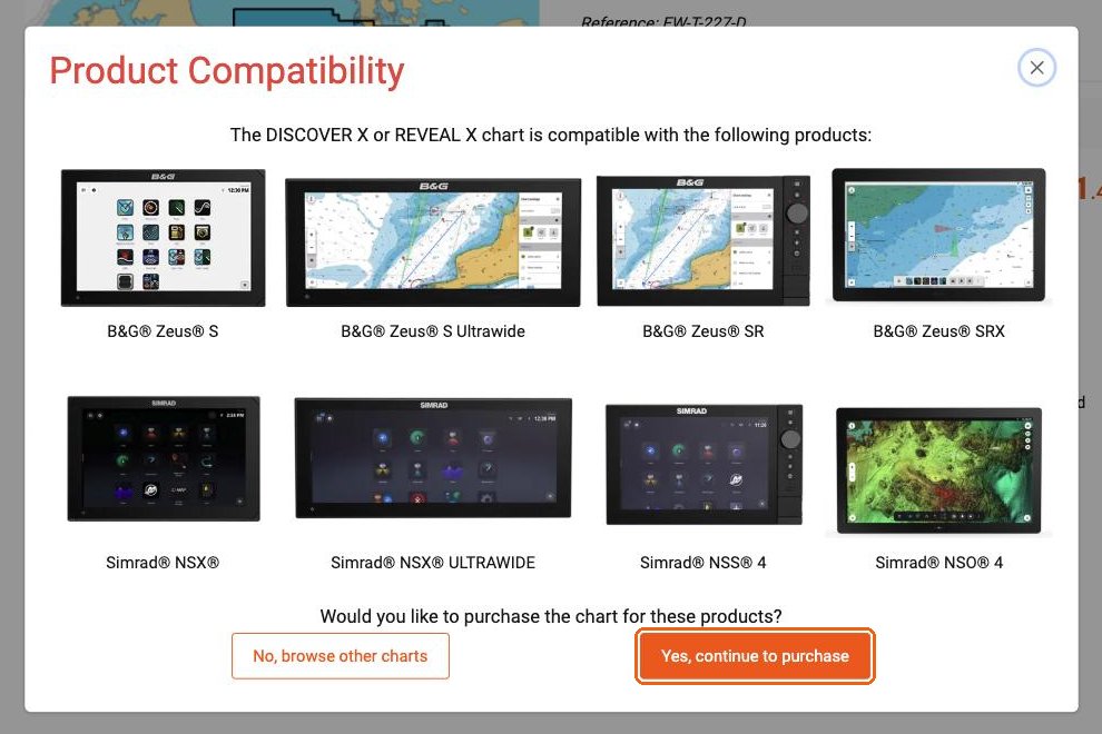
Step 2: ignore the "Product Compatibility" window. The first time you open a chart, C-MAP shows a window that only lists B&G and Simrad chart plotters. NavimetriX is not in this list yet, but it is compatible. Click "Yes, continue to purchase".
Step 3: choose "Digital License". On the product page, next to "Media Type", select Digital License, not Micro SD. The line "System requirement: a compatible chart plotter is required" does not apply to NavimetriX. Then click "Add to cart" and pay.
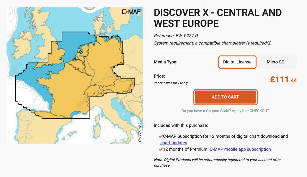
The chart is added to your C-MAP account automatically after the purchase.
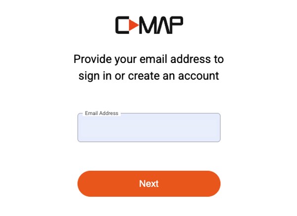
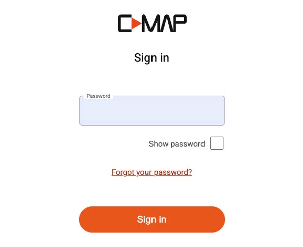
Your C-MAP account. When you click "Sign in" on the store, or when you pay, C-MAP asks for your email address. The same page is used to sign in or create an account: enter your email, then follow the steps. Remember this email and password: you will use them in NavimetriX.
The purchase also includes "12 months of Premium C-MAP mobile app subscription". This concerns C-MAP's own app. You do not need it to use your chart in NavimetriX.
Using your chart in NavimetriX
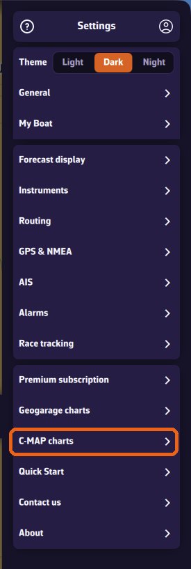
1. Open the C-MAP settings. Open the settings panel, then "C-MAP charts".
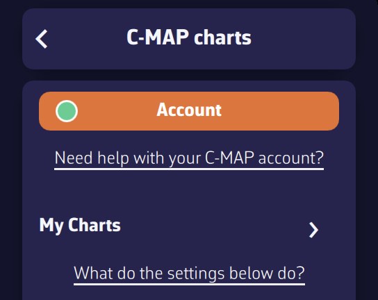
2. Sign in. Tap "Account", then "Sign in to C-MAP". A C-MAP page opens in your browser: enter the email and password of your C-MAP account, then come back to NavimetriX.
Once signed in, the window shows your email and "✓ Device registered to this account". If it says "Device not registered", tap "Register this device".
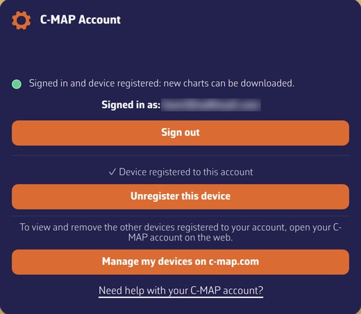
The dot on the "Account" button shows the status at a glance: green = signed in and device registered (you can download new zones); orange = signed in, but the registration of the device is not confirmed (for example if C-MAP does not respond); red = not signed in. Zones you have already downloaded are displayed in all cases: only downloading new zones depends on it.
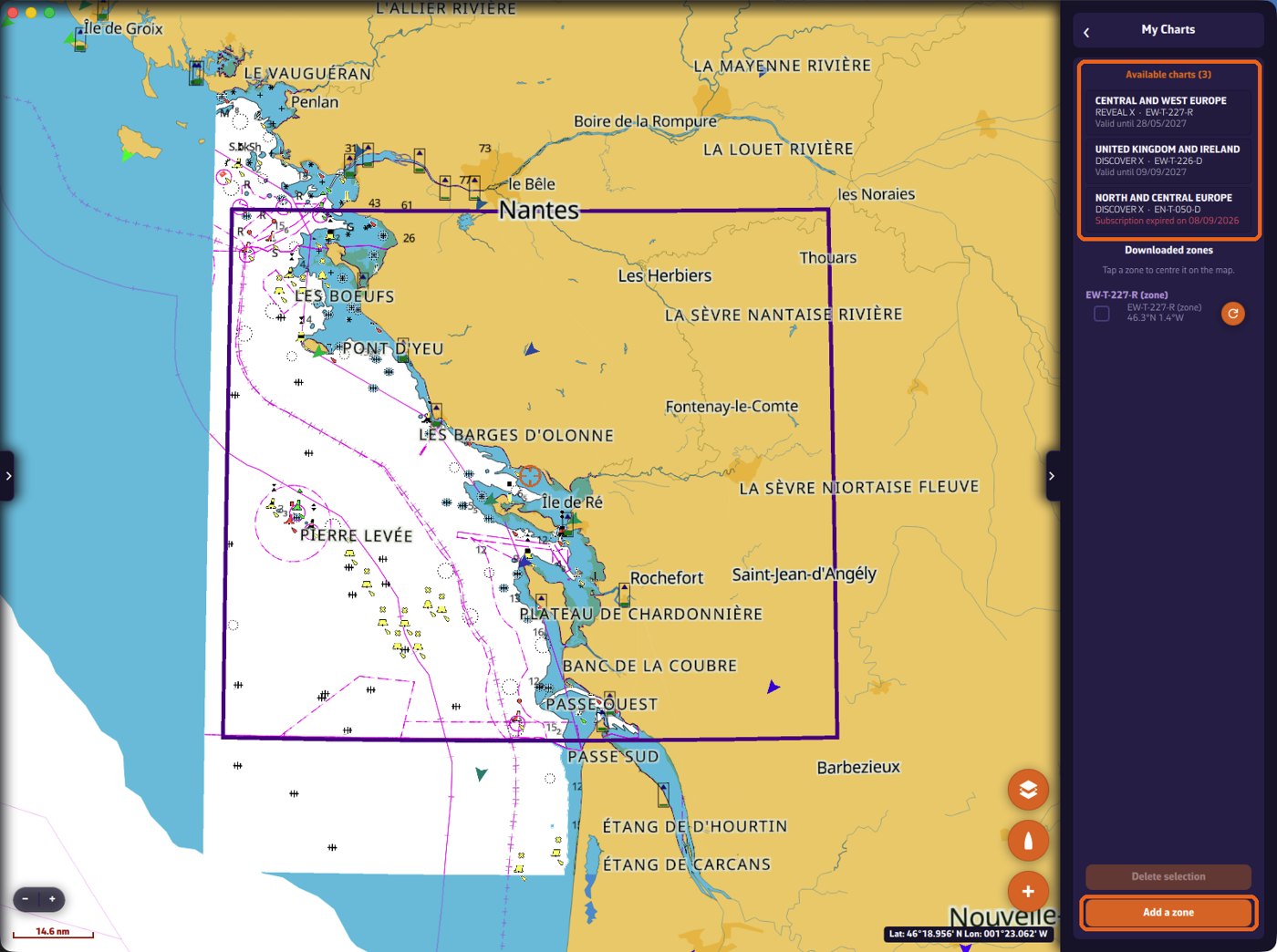
3. Download a zone. Charts are not downloaded whole: you choose the zones you need. Open "My Charts". The charts you own are listed at the top, with their type (REVEAL X or DISCOVER X), their code and their end-of-subscription date. The same code appears on the zones you download from that chart. Tap "Add a zone".
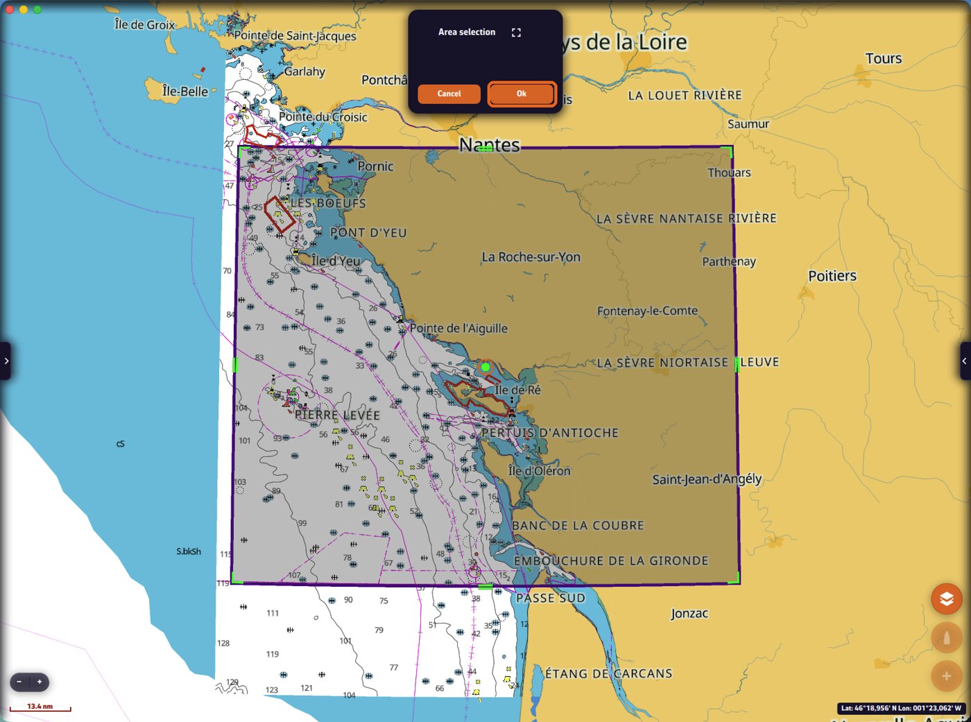
A rectangle appears on the map. Move and resize it with the green handles so it covers your sailing area, then tap OK.
If several of your charts cover the zone, NavimetriX asks which one to use. Then choose the layers to download and tap "Download". "Navigation charts" is the essential layer. Satellite images and shaded relief (REVEAL X only) are larger: on a phone, keep them for the areas where you really want them.
A banner shows the progress. You can keep using the app meanwhile.
Once the download is finished, the detailed chart is displayed inside the zone, even with no Internet connection. The zone is listed in "My Charts" and its outline is drawn on the map. The round refresh button next to a zone updates it (see below).
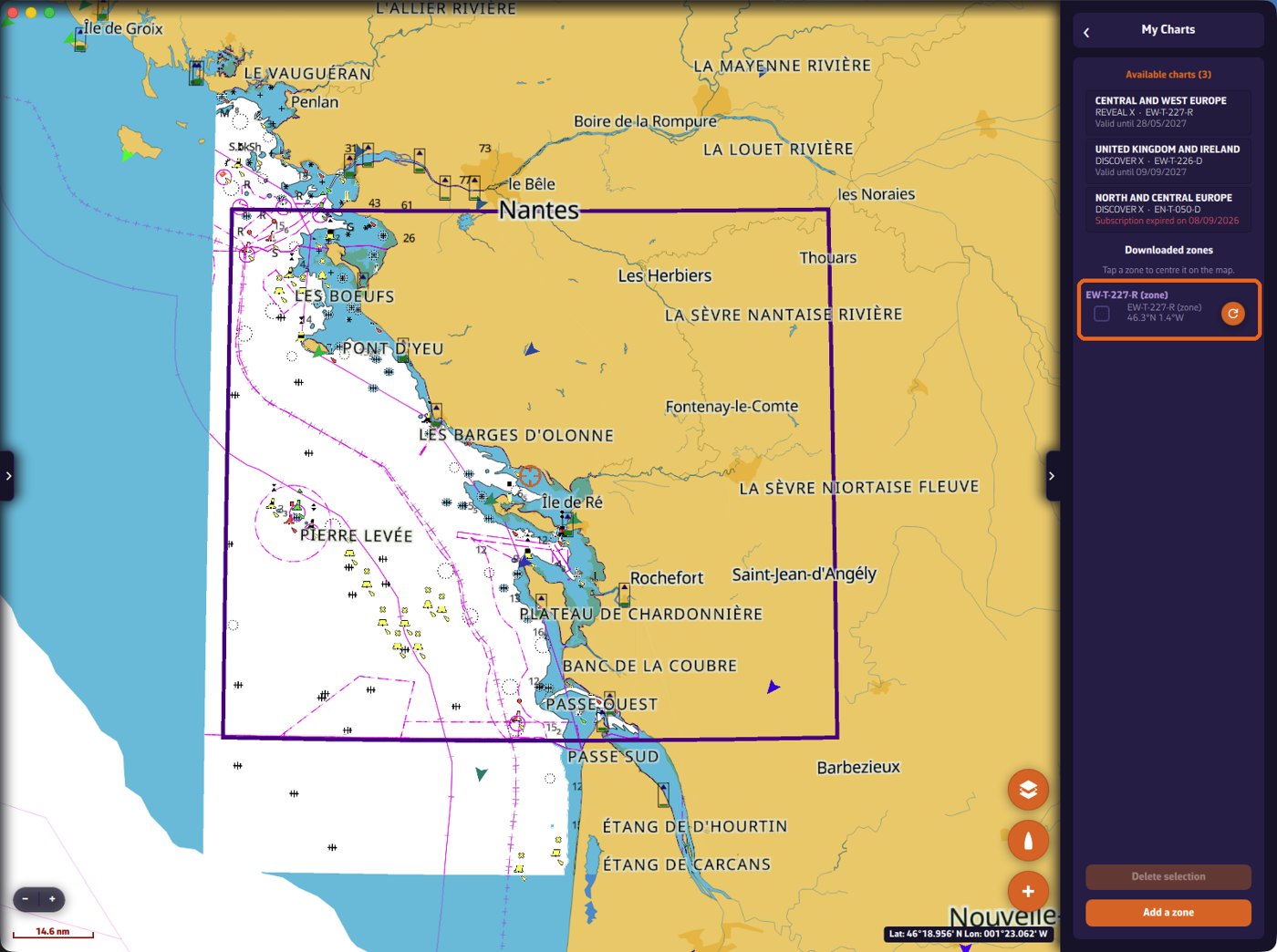
Adding layers later, or updating a zone. To add the satellite images or the relief to a zone you have already downloaded, or to update it, open "My Charts" and tap the round refresh button to the right of the zone. NavimetriX analyses the zone ("Analyzing zone…"), then lists the layers you can add or update. Tick them and tap "Download" (with no layer ticked, this button reads "Save" and only saves the zone name). Do not use "Add a zone" for this.
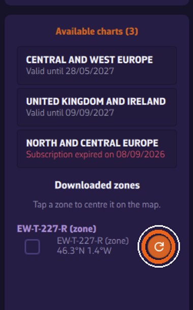
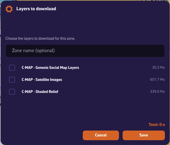
Chart settings. Every C-MAP display setting (depth alerts, filters, seabed, relief, satellite…) is explained, with screenshots, on the page C-MAP chart settings in NavimetriX.
On how many devices can I use my chart?
- 2 computers or chart plotters: Windows PC, Mac, Linux, and B&G or Simrad chart plotters all count in these 2 places.
- Phones and tablets (iPhone, iPad, Android): as many as you need.
To free a place, tap "Unregister this device" in the C-MAP Account window of that device. This removes the charts and zones from that device. The button "Manage my devices on c-map.com" opens your C-MAP account, where you can see and remove the other devices.
What happens after 12 months?
The price of a chart includes 12 months of downloads and updates. C-MAP confirmed to us (22 September 2026):
- The zones you have already downloaded keep working, with no time limit, with all their functions: chart display, object information, search, tides and currents. Your charts do not stop at sea.
- Without an active subscription, you cannot download new zones and you do not receive updates any more.
- To download and update again, you extend or renew the subscription, at half the chart's price (see below).
"My Charts" shows the end date of each chart. When the subscription has ended, the date is shown in red ("Subscription expired on…").
Our advice: before the end of the 12 months, download every zone you may need, on every device you use.
Extending or renewing your subscription at half price
This is done on the C-MAP store, not in NavimetriX. Sign in to xstore.c-map.com, click your name at the top right, then "My Account" and "My Charts". The "Digital License Charts" section lists your charts, each with the end date of its subscription and one or two buttons:
- "EXTEND SUBSCRIPTION": the subscription is still running.
- "RENEW SUBSCRIPTION": the subscription has ended (date in red).
- "UPGRADE TO REVEAL X": on a DISCOVER X chart, to switch to REVEAL X.
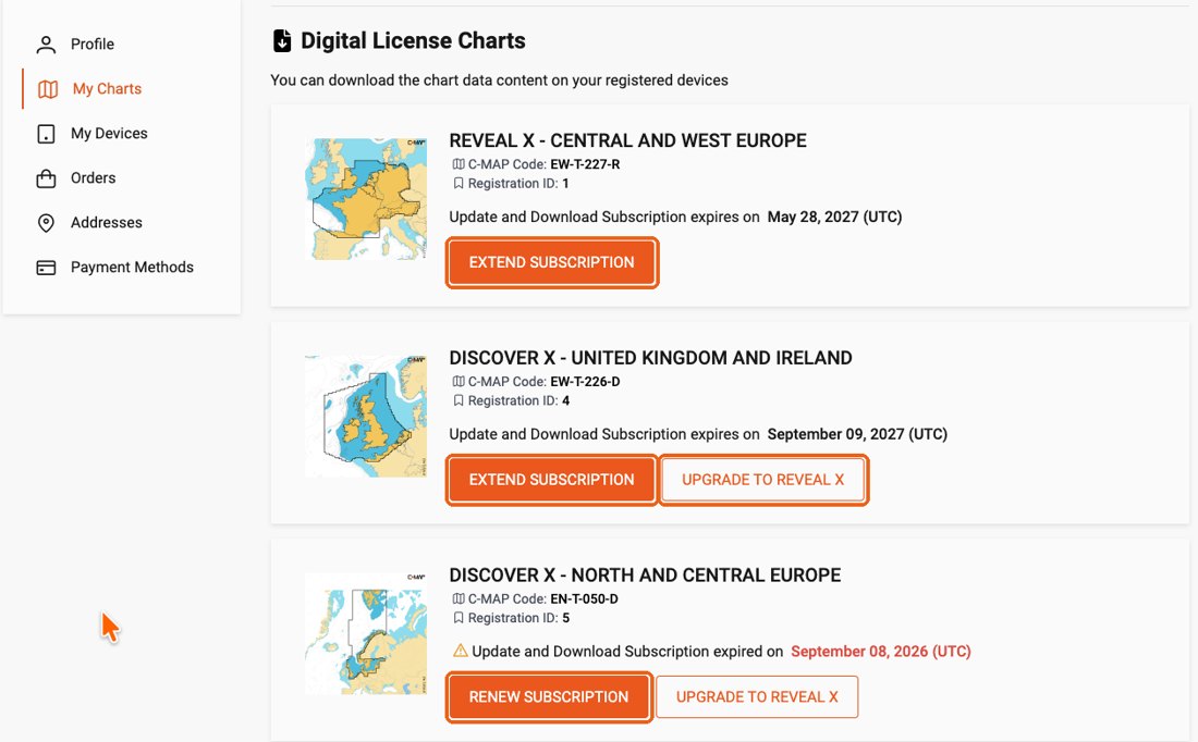
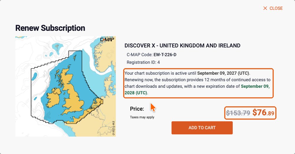
Extend (subscription still running). The 12 months are added to the current end date, so you lose nothing by extending early. In this example, a subscription running until 9 September 2027 is extended to 9 September 2028. The window is titled "Renew Subscription" even in this case.
Renew (subscription ended). The 12 months start on the day you renew. In this example, a subscription that ended on 8 September 2026, renewed on 23 September 2026, runs until 23 September 2027.
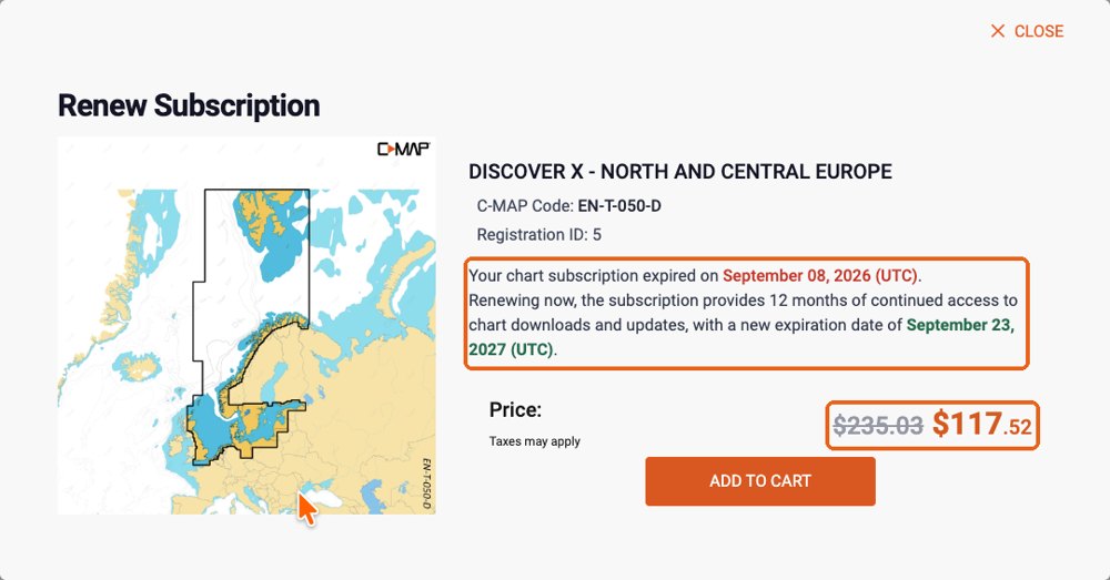
In both cases the full price is struck through and you pay half, shown in orange. Click "Add to cart" and pay. The store shows prices in the currency of the country selected at the top right.
After upgrading DISCOVER X to REVEAL X
An upgrade replaces your chart with a new one: its reference changes (for example EW-T-227-D becomes EW-T-227-R) and the DISCOVER X subscription ends on the day of the upgrade. If NavimetriX then still shows the old chart as "Subscription expired":
- Quit NavimetriX completely and open it again, connected to the Internet, then open "C-MAP charts" → "My Charts". The REVEAL X chart should appear with its new end date.
- If it still does not appear: "Account" → "Unregister this device", then "Register this device". This deletes the zones downloaded on this device: download them again afterwards.
Practical cases after the end of the subscription
I change my phone or tablet. The zones cannot be moved to the new device, and the new device cannot download them without an active subscription. C-MAP customer care handles a phone change case by case.
I change my computer. Same answer: the new computer cannot receive the charts while the subscription has ended.
The app is reinstalled, or the phone is reset or repaired. On a phone or tablet, the downloaded zones are lost and can only be downloaded again with an active subscription. On a computer, the charts may still work in some cases, as long as the computer is recognised as the same device.
While the subscription is active, none of this is a problem: you can download your zones again at any time, on any registered device.
Where to ask for help
For the NavimetriX side (signing in, downloading, displaying), contact us through the app ("Contact us" in the settings). For your C-MAP account or a purchase, contact C-MAP support.