What's new in version 2.0: C-MAP charts arrive in NavimetriX
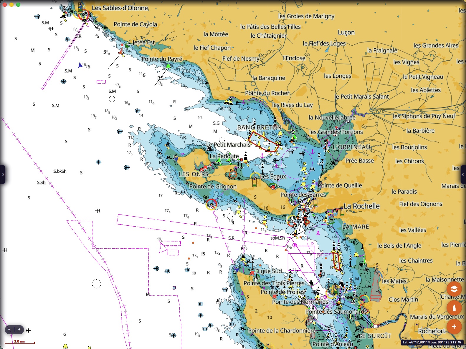
If NavimetriX changes its version number, there is a good reason: 2.0 is the C-MAP charts version. The reference marine charts of thousands of chart plotters now display in the app, on your phone, your tablet or your computer. And they do more than display: routing reads them. It avoids shallows, steers around dangers and passes cardinal marks on the right side. 2.0 also brings routing to a point without opening a window, wind sea and swell on the chart, and instruments you tune like an onboard instrument system. Here is the tour.
C-MAP charts, on all your devices
- NavimetriX displays C-MAP DISCOVER X and REVEAL X charts purchased as a Digital License. You buy them on the C-MAP store, xstore.c-map.com, then simply sign in to your C-MAP account in the “C-MAP charts” settings.
- One chart, many devices: 2 computers or chart plotters, and as many phones and tablets as you like.
- Your areas, offline: you only download what you need. Draw a rectangle on the chart (up to 300 × 300 NM), choose the layers while seeing their size, and the detailed chart displays in the area, even without Internet, offshore as well as at anchor.
- My Charts lists your charts with their type (REVEAL X or DISCOVER X), their code and the end date of their subscription, then your downloaded areas: tap one to centre it, refresh it to add a layer or to update it.
- At the end of the 12-month subscription, areas already downloaded remain usable, with no time limit.
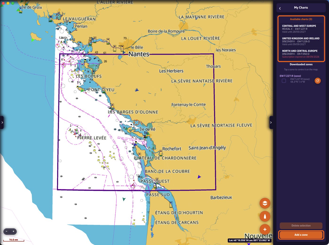
Everything, step by step, from purchase to first download: C-MAP charts in NavimetriX
A real marine chart, adjustable in detail
- Four styles: Default, Night, NOAA and NOAA Night. The chart switches to night style on its own when the app goes into night mode.
- High-resolution bathymetry and depth shading in two to six bands.
- Shallow Depth Alert: everything shallower than your threshold turns red. You see at a glance where the boat cannot go.
- Filters for soundings, wrecks, rocks, obstructions and depth contours to declutter the chart. A filter can never hide a rock that dries.
- Critical Clearance: bridges too low for your mast stand out, with their clearance readable on the symbol.
- Marine protected areas, raster charts, text and symbol size, depth and height units (metres, feet, fathoms), and even an “ENC charts only” mode to stick to official data.
- Settings apply live, without restarting, and follow your account from one device to another.
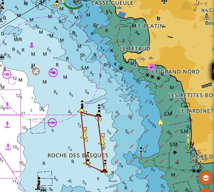
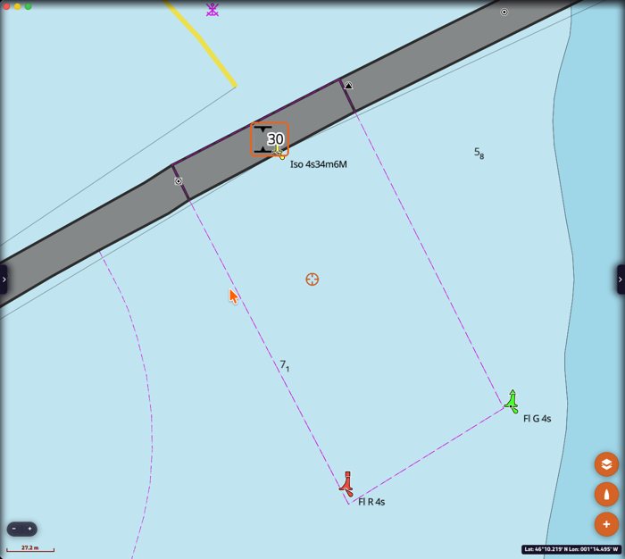
Every setting explained, with screenshots: C-MAP chart settings in NavimetriX
REVEAL X: satellite, relief and seabed
With a REVEAL X chart, three more layers change how you read an anchorage or an approach.
- Satellite imagery, over the whole chart or on land only: the beach, the slipway, the harbour car park, as they really are.
- Shaded relief of the coast and of the seabed: channels, banks and drop-offs read like a landscape.
- Nature of seabed (fine sediment, sand, rock, coral, shells, seagrass) and seabed hardness: what you need to choose where to anchor, and where the anchor will hold.
- Satellite, relief and high-resolution bathymetry switch on in one gesture, from the layers menu, and their opacity is set as a percentage.
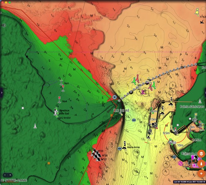
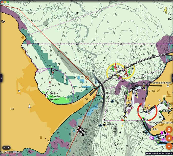
Touch the chart, it answers
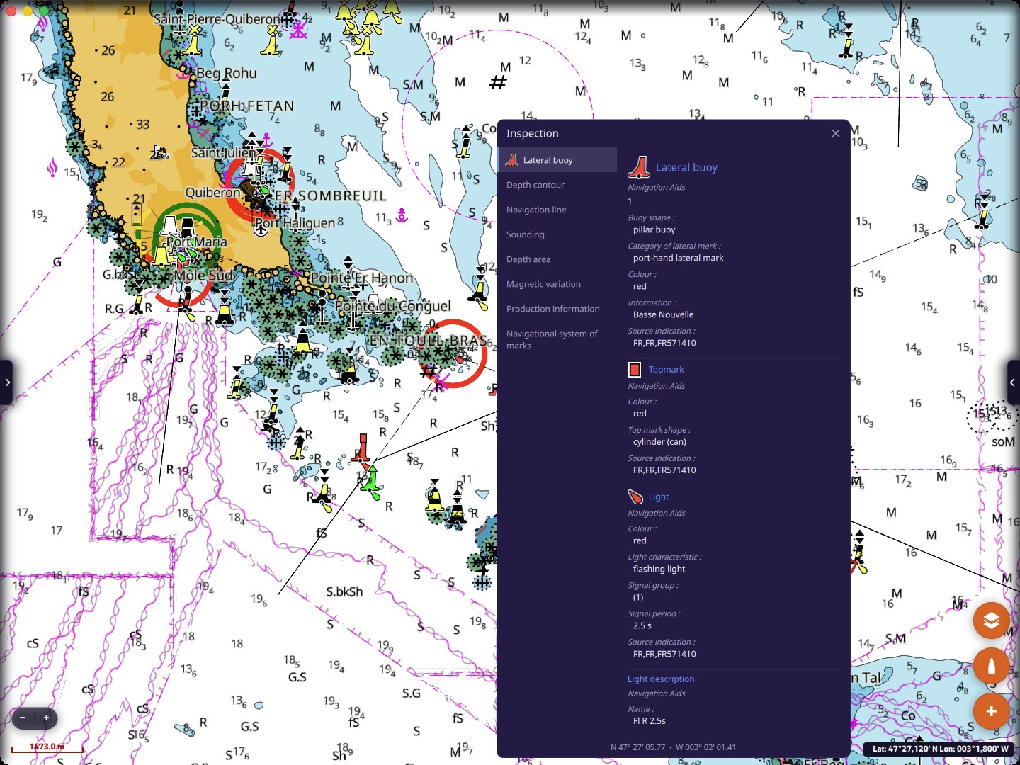
A long press (or a double-click on a computer) on the C-MAP chart opens the Inspection window: the objects under your finger, with their characteristics translated. The character of a light, a buoy and its topmark, the value of a sounding, the magnetic variation, the services of a marina… Everything the chart knows, at your fingertip.
Weather routing reads the chart
This is the big new feature of this version, and the one that took us the most work.
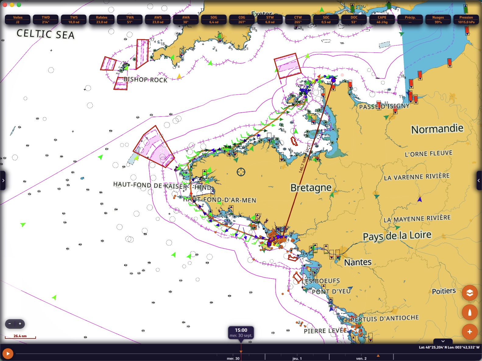
- A new routing engine, safer near the coast, that rounds headlands on its own. Try it: a routing from La Trinité to Cherbourg with a route of just two points. The router finds the way around Brittany by itself.
- Route polishing, a new approach: an isochrone routing advances in time steps, and its route keeps the mark of them, with small zigzags and tacks placed wherever the calculation happened to put them. Once the best route is found, NavimetriX polishes it: it removes unnecessary course changes and moves each tack or gybe to where it saves time. It also tries to sail the legs at the best VMG angle, upwind as well as downwind, and counts every tack and every gybe. The polished route is only kept if it arrives earlier. The result: a cleaner and better route, closer to the optimal route.
- The final route respects every constraint of the calculation: land, no-go zones, C-MAP shallows and dangers, course marks, wind and wave limits. Polishing is subject to them just like the engine, and the route is checked one last time exactly as it is drawn.
- “Avoid shallow waters (C-MAP)”: the router reads the depths of the C-MAP chart (land, depth areas, rocks, wrecks, obstructions) and only goes where your boat floats. You set the under-keel clearance (0.5 m by default) and the minimum distance to dangers (30 m by default), and you choose whether to use the tide: the lowest height of tide over the leg, at the nearest port, is then added to the charted depth.
- “Avoid restricted areas (C-MAP)”: the chart’s prohibited areas and areas to be avoided.
- “Pass cardinals on the right side (C-MAP)”: the router no longer cuts across the danger side of a cardinal mark, steers around isolated dangers, and respects lateral marks and buoyed channels wherever the chart gives the direction of buoyage.
- Course buoys become gates: a mark “to leave to port (or to starboard)” no longer pulls the route onto itself, it is passed on the correct side and in order. A mark caught in a sharp turn (55° or less between the two legs) is flagged at launch: rounding such a mark forces a detour, and NavimetriX offers to turn it into a waypoint (“Pass through and calculate”).
- Best start search: give a time window and a step, NavimetriX tries each departure time and keeps the fastest routing.
- Ensemble routing: much faster calculation.
- Tide comes into routing: height of tide and coefficient in the routing bar and graph.
- The route report gets richer, leg by leg: water depth, water under the keel, nearest danger, distance to the coast, height of tide, reference port and coefficient. A coloured cell shows at a glance which leg to watch.
- Nothing is hidden: if the C-MAP chart could not be read on part of the route covered by your charts, NavimetriX says so, and tells you why (area not downloaded on this device, server unreachable).
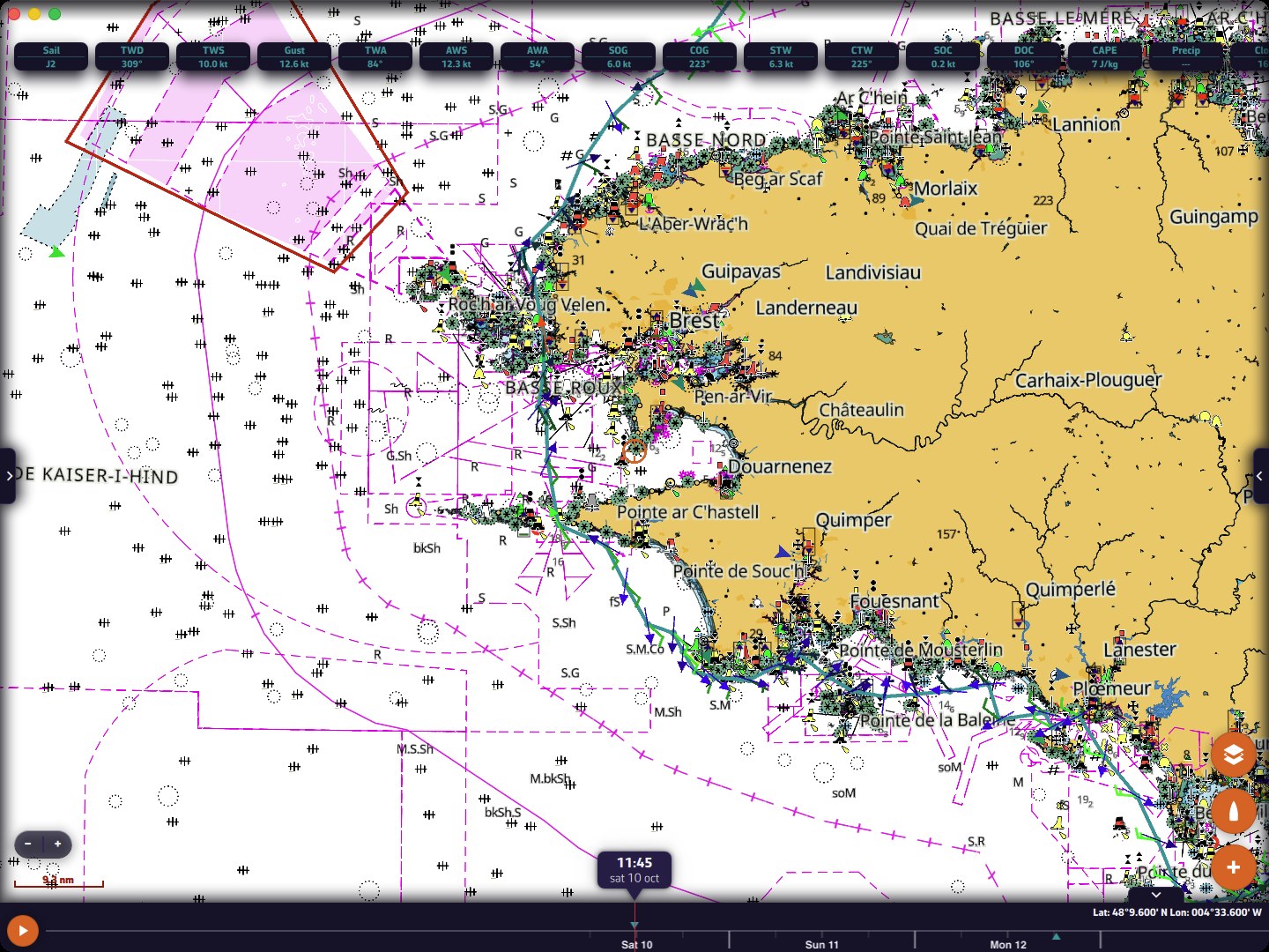
C-MAP AutoRouting
When you simply want a safe path from one point to another, C-MAP AutoRouting draws a detailed route between your waypoints, taking into account your draft and your air draft (it goes around bridges that are too low). You start it from the “+” menu, a long press on the chart, a route’s menu or a POI’s menu, and the result is saved as a separate route that you can edit.
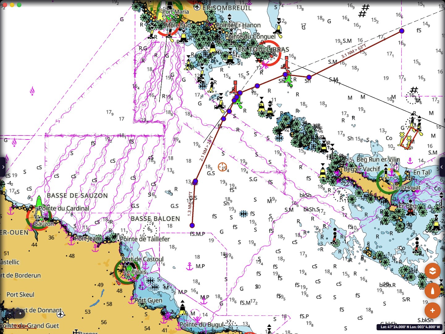
Routing to a point, without opening a window
Under way, you sometimes want to know right now how to get over there. Three entries start a routing from the boat, at the current time, with the settings of your last routing (weather file, polar, C-MAP options):
- “Route to this point”, with a right-click on the chart (computer). The point becomes a POI, named after the time of the click, and the routing carries its name.
- “Route to the target”, in the “+” menu.
- “Route to this POI”, in a POI’s menu: the routing window opens on a route from the boat to the POI, ready to calculate.
You need to be in Navigation mode, with a boat position. If something is missing (no weather file selected, point outside the GRIB area, forecast not covering the current time…), NavimetriX tells you what.
A routing can also be renamed from its menu, in the Routings tab.
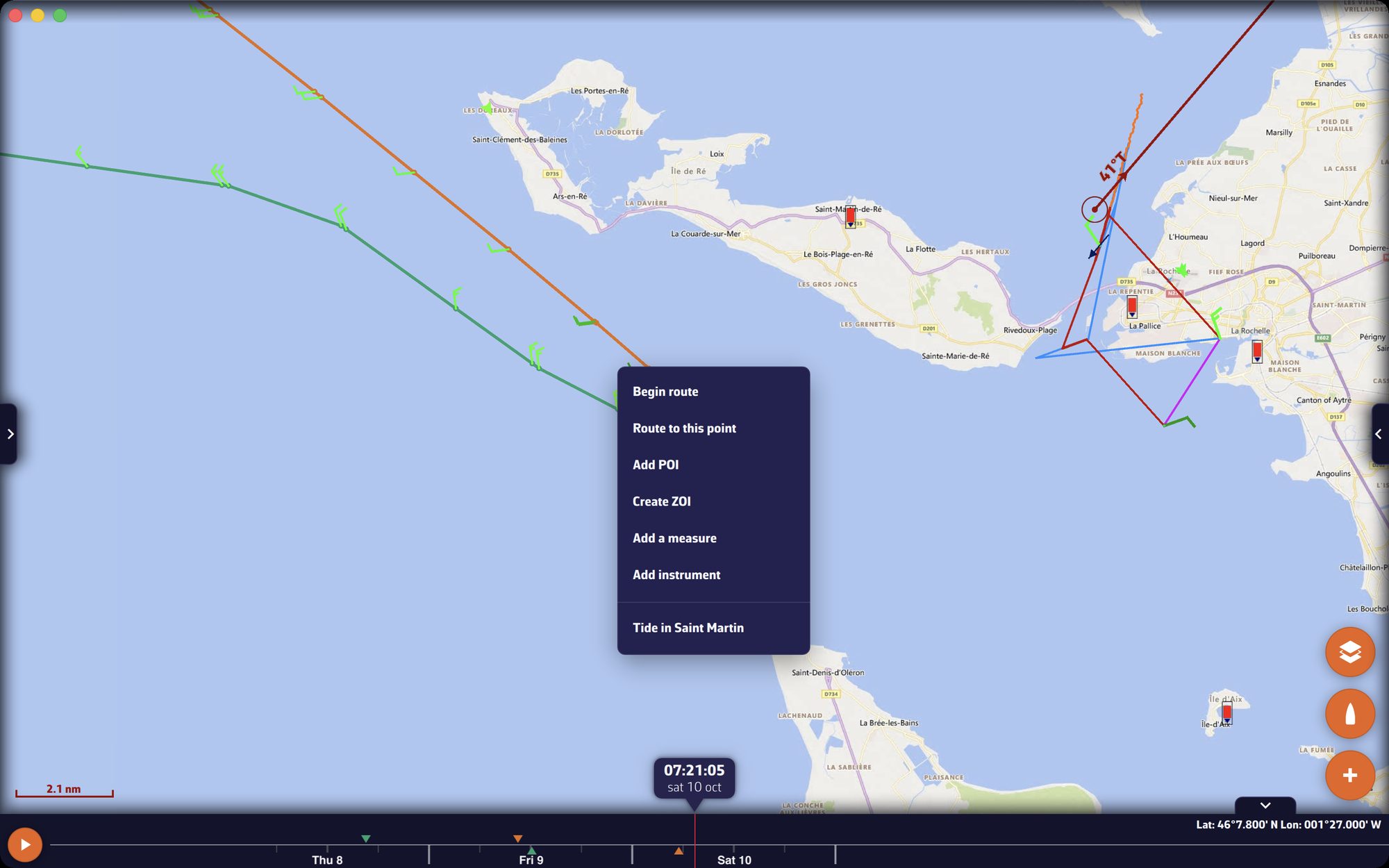
The measure also gives the time. “Auto measure” shows, after the distance and the bearing, the time to reach the target point, calculated from your speed over ground averaged over 30 seconds. On a computer, the “Cursor measure” box gives the distance, bearing and time from the boat to the cursor, and names the POI under the pointer.
One more lookout on board: the “Chart dangers ahead (C-MAP)” alarm
Under way, NavimetriX watches a sector ahead of the bow, along your course over ground and as far as you will go in the next 10 minutes (adjustable from 1 to 60 min). Rocks, wrecks, obstructions, shallows for your draft, bridges and cables too low for your air draft: at the slightest danger, the alarm sounds and tells you what, how far and in how many minutes. The watched sector is drawn on the chart, blue when the way is clear, red when it no longer is.
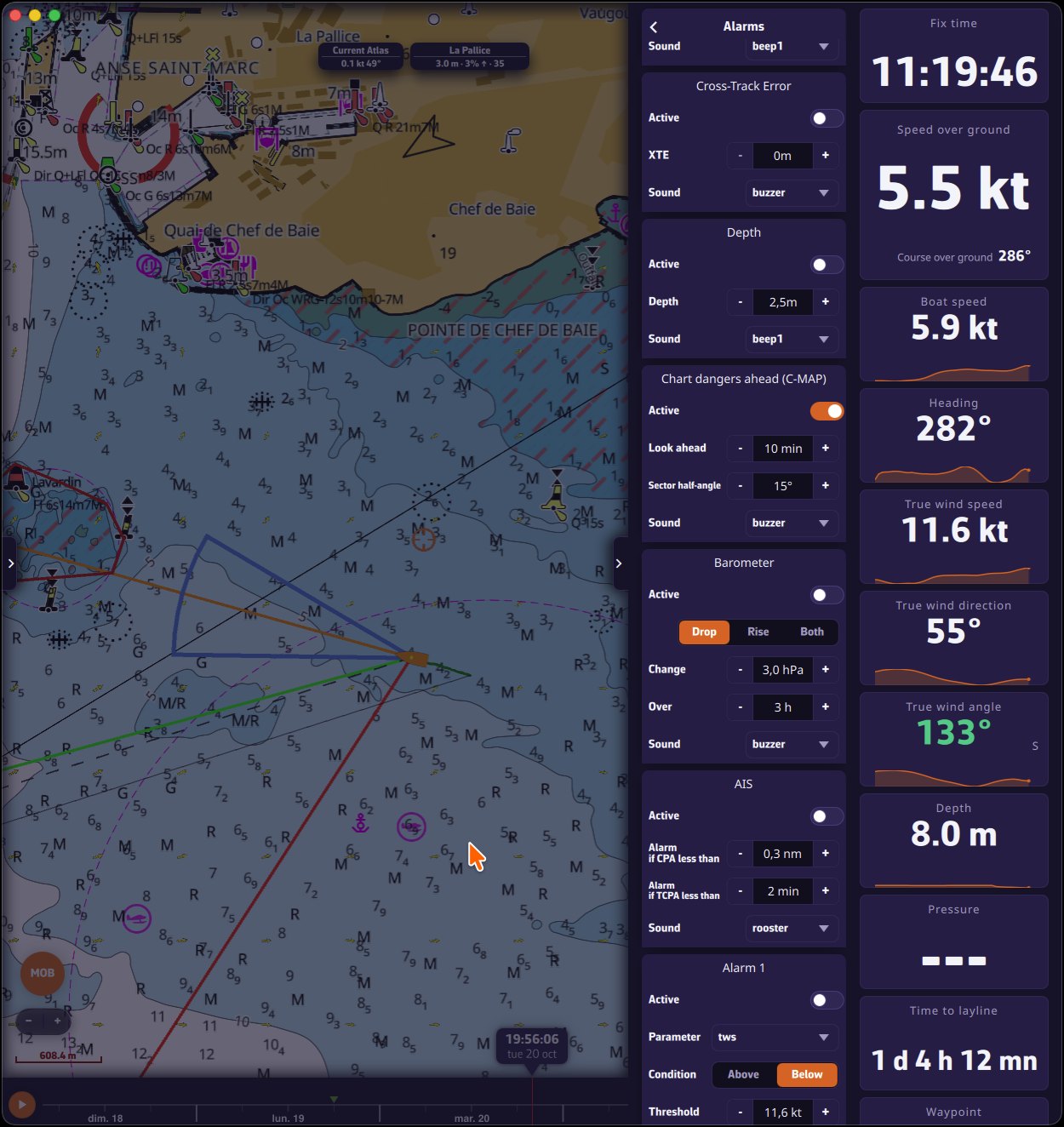
Draft and air draft are entered once and for all in “My Boat”.
Waves and currents: more detail on the chart
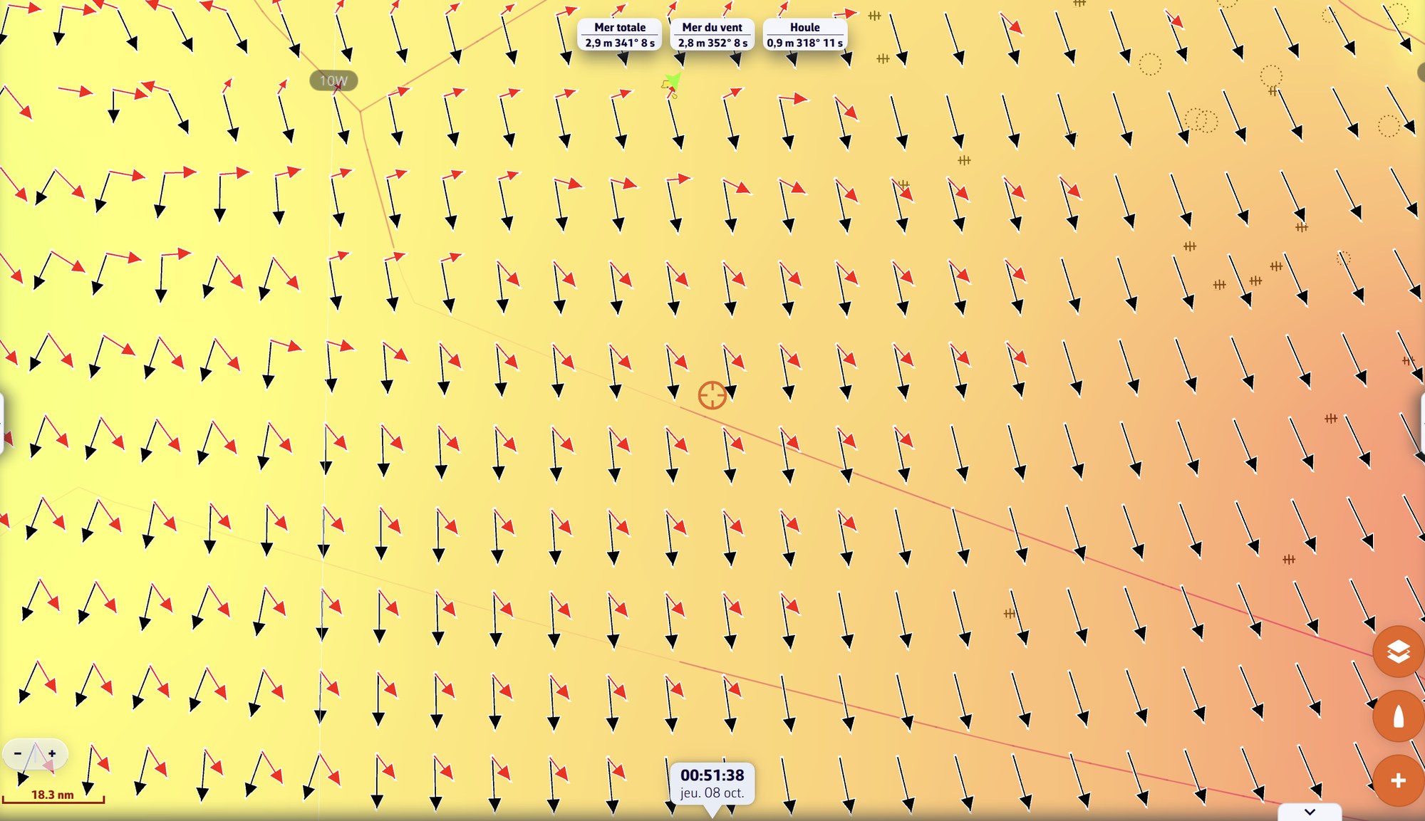
- Wind sea and swell: when the file contains them (GFS Wave, MFWAM, Copernicus, DMI WAM), they display alongside the total sea, with their height, direction and period. The direction is the one the waves come from, as for the wind.
- Two arrows: the wind sea in the chart’s colour, the swell in red, and the total sea in grey where the model gives neither. The arrows show the direction the waves travel, and their length follows their height. ECMWF Wave only gives the total sea: a single arrow, as before.
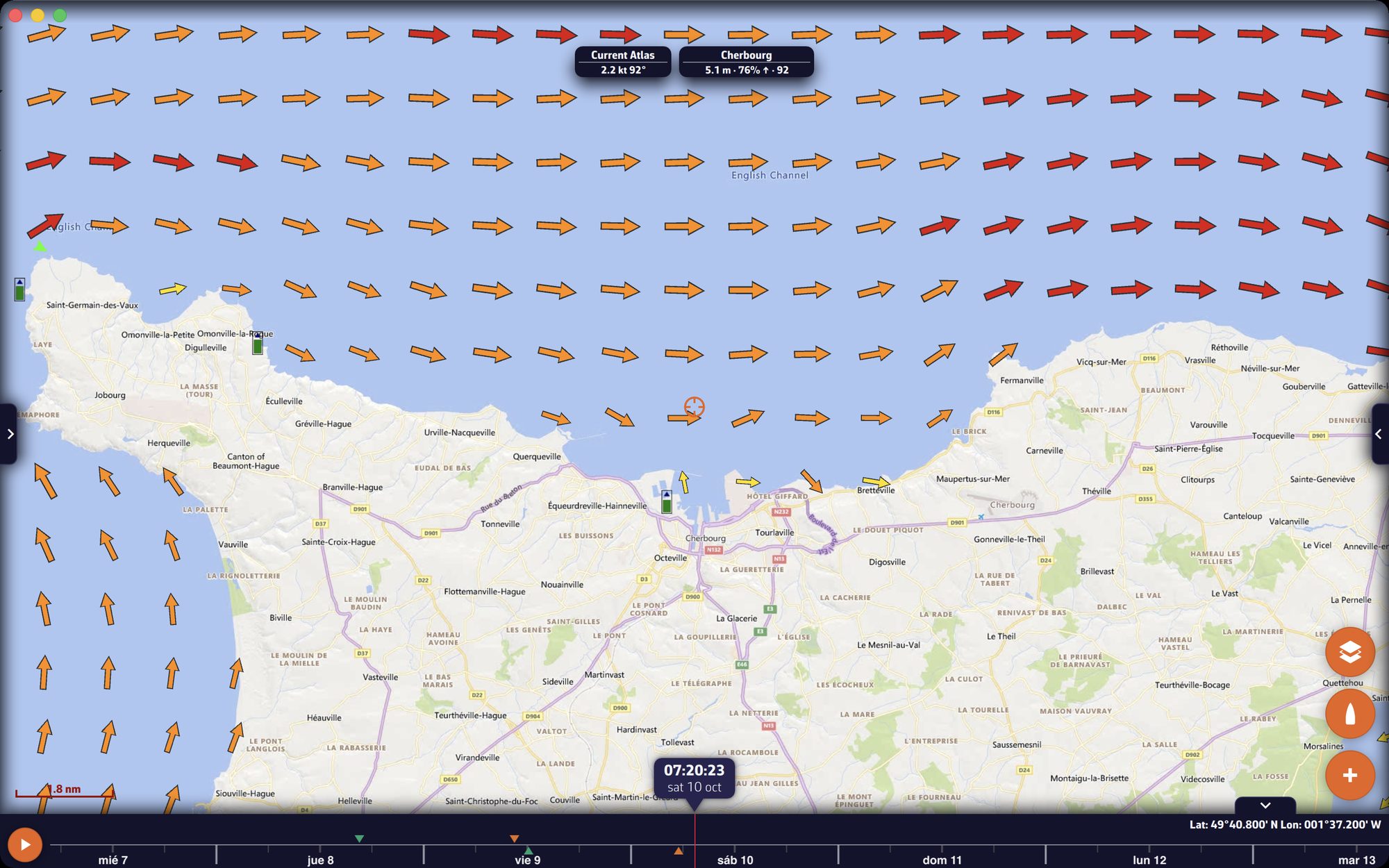
- Tidal current atlases as coloured arrows according to the strength of the current: yellow below 1 knot, orange from 1 to 3, red from 3 to 5, dark red beyond, with a variant for colour-blind mode. No current displays on land any more, nor below 0.1 knot, and arrows shrink below 1 knot. Particles or arrows: the “Currents display” setting decides.
- New wind and current particles, computed by the graphics card: a lighter rendering, whose density is set from 25 to 300% in “Forecast display”.
Instruments: tuned like an instrument system
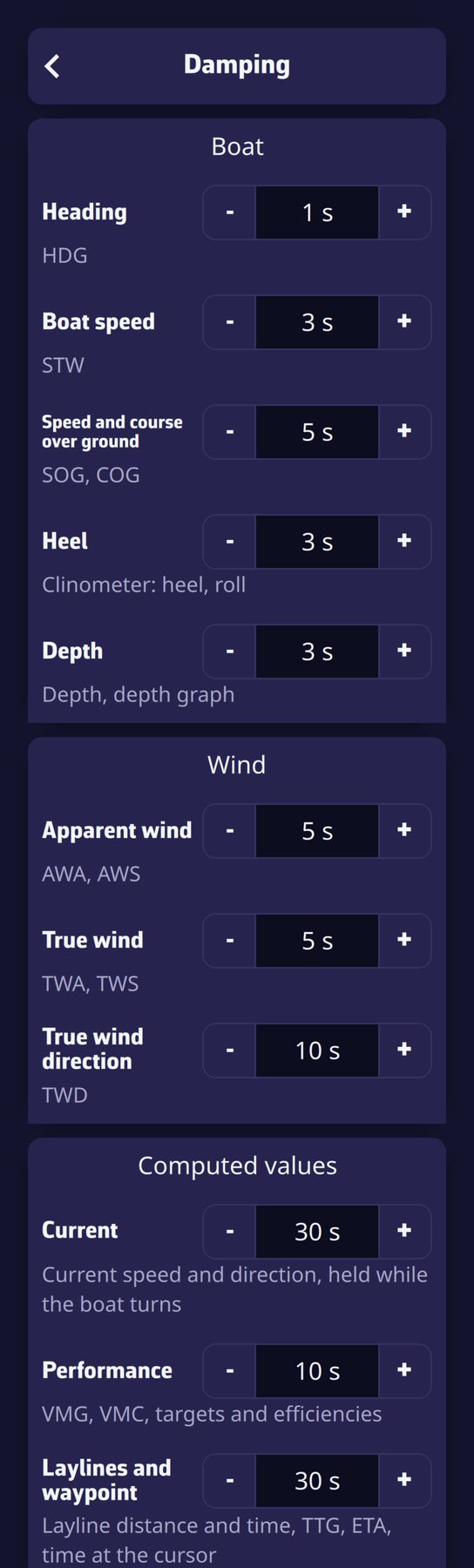
- Adjustable damping, from 0 to 60 seconds, in “Instruments > Damping”. It is set by group: Boat (heading, speed through water, speed and course over ground, heel, depth), Wind (apparent wind, true wind, true wind direction) and Computed values (current, performance, laylines and waypoint). The “Default values” button restores the original settings. Dials, alarms, laylines and the recorded track follow the damped values.
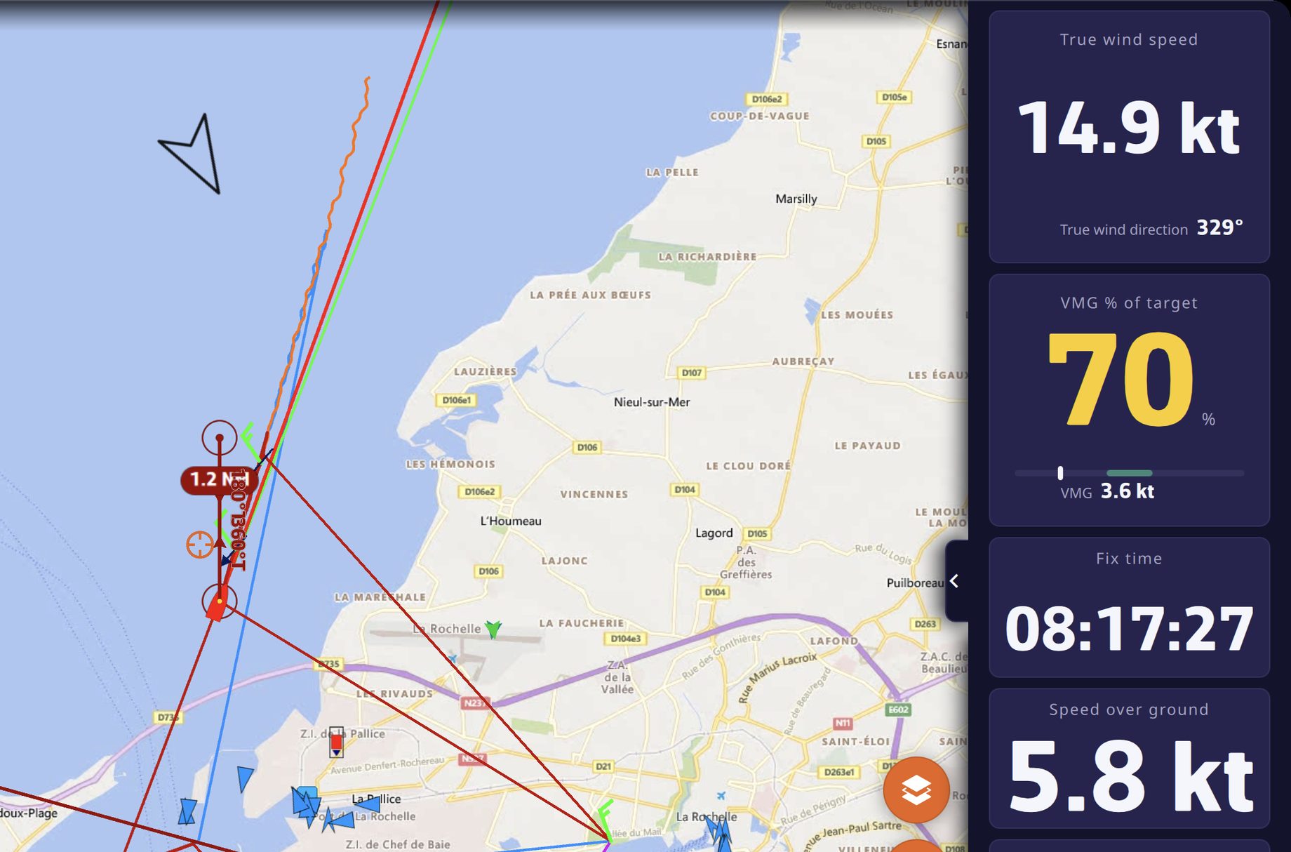
- Dual tile: two values in one tile. Ten pairs to choose from (true wind, true wind angle, apparent wind, speed and course over ground, speed through water and heading, current, waypoint, arrival at waypoint, layline, depth and water temperature), and three comparisons with the polar target: STW % and VMG % of target, TWA deviation from the VMG target. A bar shows the deviation, and turns green when you are on target.
- “Tile titles”: as abbreviations (SOG, TWA, BTW…) or as names, your choice. Abbreviations by default on a screen smaller than 7 inches, names elsewhere.
Also in 2.0
- AIS fleet analysis: build a fleet of competitors from their MMSI, and follow in real time who gains and who loses against you, in distance ahead along the axis, lateral separation and metres gained per minute.
- Chart orientation: north, course over ground (COG), heading (HDG) or bearing to waypoint (BTW) up.
- NMEA 0183 log import: a log file becomes a track, with its complete navigation log.
- Adrena track import (.trz).
- Motoring legs shown dotted on routings.
- Adjustable routing markers: in the “Routings” tab, three settings choose what is marked along the route: wind, current, and their density.
- Polar efficiency: the light-wind and strong-wind thresholds are set in “My Boat”, under the polar (10 and 20 knots by default).
- List menus: a GRIB can be renamed, exported or deleted from its row’s menu. POIs and ZOIs can be renamed or deleted the same way.
- iPhone and iPad: an “Enable C-MAP” switch in the iOS Settings app, to save memory if you do not use C-MAP charts.
- A smoother chart with routings displayed, and many fixes.
Where to get C-MAP?
C-MAP charts are available in NavimetriX on iPhone and iPad, Android, macOS, Windows and Linux. The browser version (nav.navimetrix.com) does not display C-MAP charts.
Fair winds, and enjoy discovering 2.0!