What's new in version 1.24
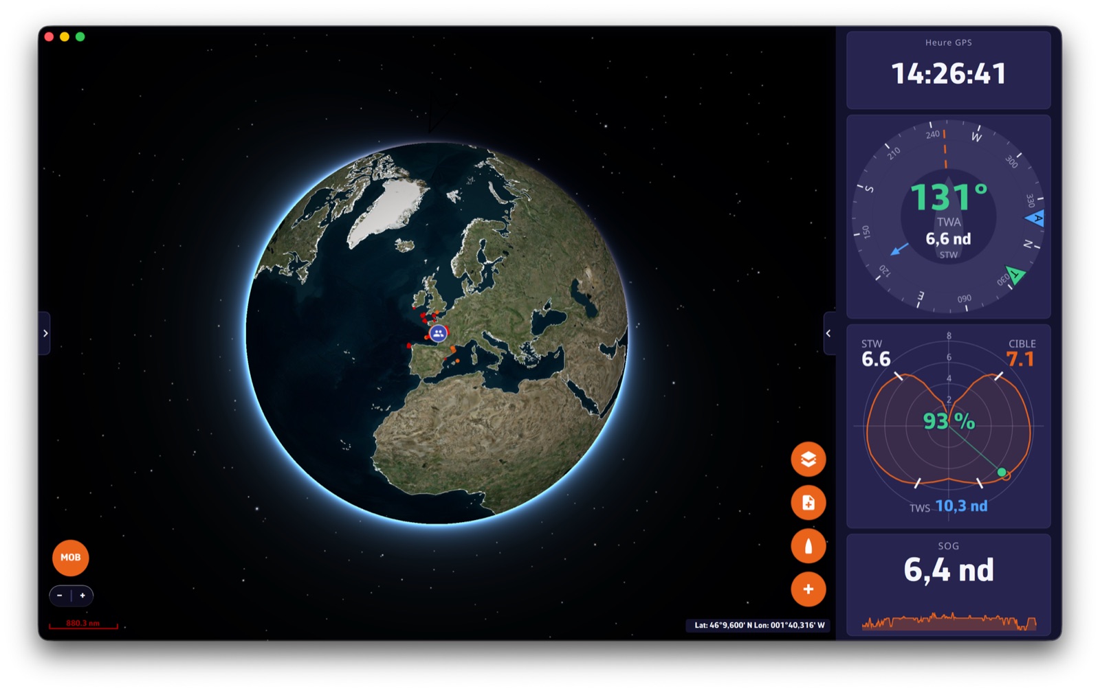
1.24 is one of the biggest updates NavimetriX has ever had. Your boat now has a real logbook, with PDF export. Your trips can be relived with the weather of the day and shared by a simple link, even live from offshore. A barograph keeps an eye on the pressure, and those who work on their performance will find a complete workshop for polars and sail choice. Here is the tour.
The logbook
NavimetriX now keeps your logbook, and takes it seriously.
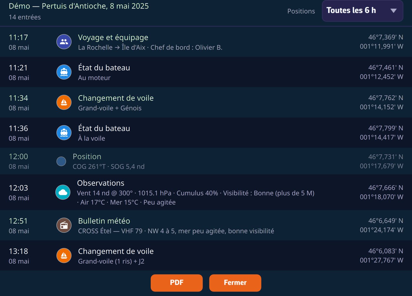
- Eleven entry categories: observation, sail change, status, engine, technical incident, watch handover, safety, weather bulletin received… Every entry is time-stamped and geolocated, entered while sailing or afterwards during a replay.
- Icons on the track: logbook events show directly on the chart, at every zoom level.
- Automatic periodic positions: the app derives a position line from the track at the interval you choose (hourly, 6 h, 12 h or 24 h), with a daily summary (distance, moving time, maxima, engine hours).
- Man overboard: the MOB button, and also the reception of an AIS MOB beacon, create the safety entry on their own, at the activation position, with the beacon’s MMSI.
- Nothing disappears silently: every change or deletion is archived, and the corrected entry carries the note “Edited (rev. N)”, in its details as in the PDF. It is the readable crossing-out of the paper logbook.
Regulatory PDF export
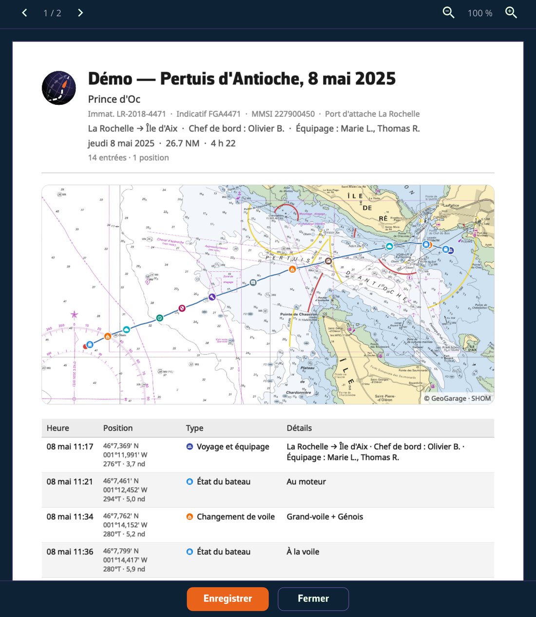
One tap produces a PDF ready to print or archive:
- Cover page with the vessel’s identity (registration, call sign, home port) and the voyage & crew sheet, pre-filled from the previous trip.
- The chart of your route as the page background, built from the chart cache, so it works even at anchor without a connection.
- SHA-256 fingerprint at the foot of the document: the content can be verified.
The logbook follows your account: entered on the tablet, it is on the computer when you get home, with no setting to think about.
For the full story, see the FAQ: How do I keep the logbook of a track?
Relive your trips, with the weather of the day
Trip replay has been completely reworked.
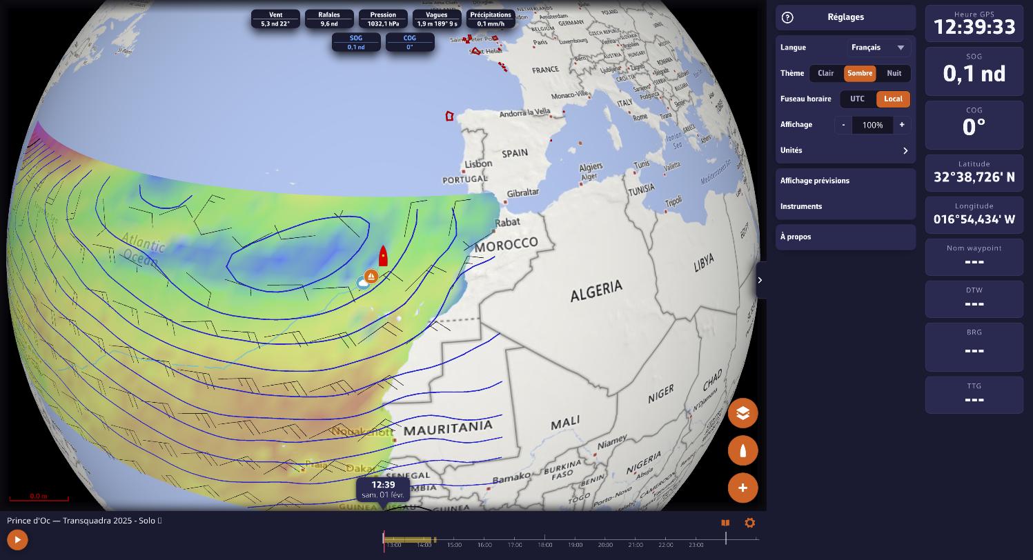
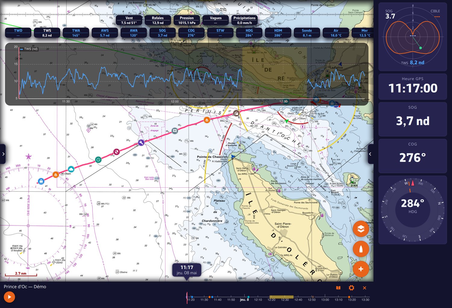
- The weather of the day comes back on its own: open the replay of a trip, and NavimetriX fetches the weather you actually met. Isobars and wind barbs of the day above your track, values along the route, as playback runs. An ocean crossing replays with its lows.
- The AIS targets you met are recorded with the trip and reappear during replay, where they were.
- Redesigned timeline: unfolds with a finger, date label above the cursor, logbook curves under the timeline (two overlaid series, wind barbs, rain as a histogram), column layout in phone landscape.
- Playback speed tied to zoom: no more steps to choose, playback adapts to what you are looking at. Jumps in time are traveled, not teleported.
- The logbook opens from the replay bar: tapping an entry moves playback there; tapping the track on the chart moves the time.
- The trip being replayed stands out in the track list, and your playback settings (camera follow, speed, overlays) are remembered per track and synced between your devices.
- The boat’s polar travels with the trip: the “Polar performance” gauge draws the curve of the boat that actually sailed (target and percentage included), even for someone who opens the trip from a link or a
.nxfile and has configured nothing.
For the full story, see the FAQ: How do I replay a track (Replay)?
Share a trip by a simple link
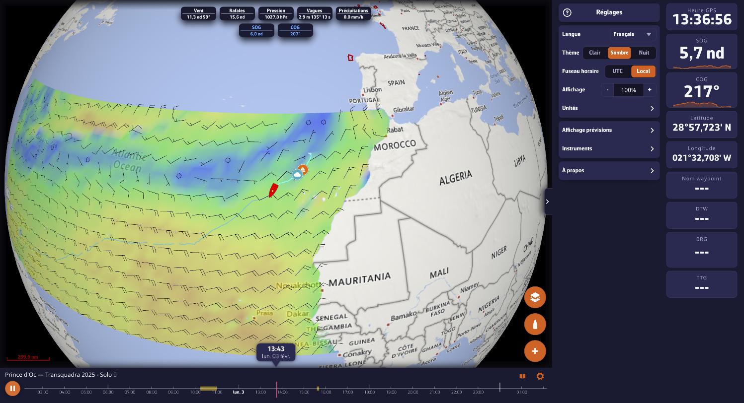
- A trip can now be shared like a web page: the recipient clicks, and NavimetriX opens in their browser, with no account and nothing to install. They replay your trip with the instruments of the day, the AIS targets around you and your logbook.
- And when the boat is at sea, the same link goes LIVE: position, heading and instruments in real time, a “LIVE” badge, and back to the present in one gesture after a detour into the trip’s past. You decide, trip by trip, whether to offer live tracking; otherwise the link only opens once the trip is over.
- The color of your track travels with the link, the chart frames itself, and the viewer is half the size it was: the link opens fast.
- The same link can be pasted as is into the native app, for a full replay on a tablet.
- On iPhone, pin the link to your Home Screen (Share → “Add to Home Screen”): opened from its icon, it fills the whole screen, with no browser bars.
For the full story, see the FAQ: How do I share a track with a simple link, as a Replay or live?
The full NavimetriX in your browser
The share link is only the visible part: the whole application now runs in a browser, at nav.navimetrix.com.
- The same NavimetriX, nothing to install: charts, GRIB files, routing, tracks, logbook, replay. Open it on the office computer, a Chromebook, a courtesy PC at the marina office or a crew member’s laptop.
- Your data follows you: sign in with your NavimetriX account and you find your routes, tracks, routings and settings, exactly as on the tablet.
- For subscribers: access requires a valid subscription on the account.
- What it does not do: the boat’s instruments. A browser cannot connect to the NMEA network. It is the tool for preparing ashore and debriefing back in port, not the chart table at sea.
- Any recent browser will do; Chrome and Edge give the best results. The first routing downloads the coastal mask, about 150 MB, once.
Your tracks, finally in order
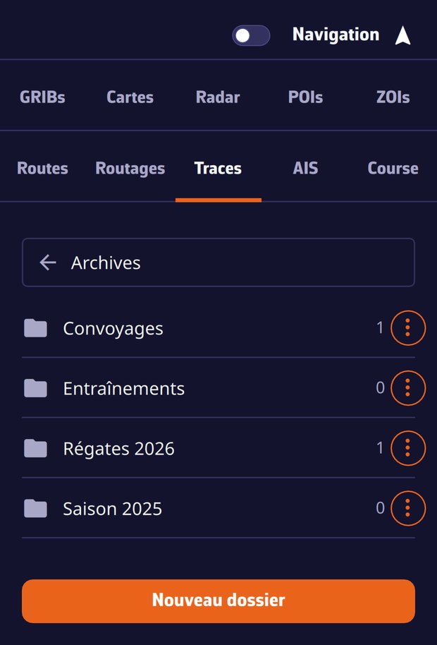
- Archive folders of your own: create “Races 2026”, “Deliveries”, whatever you like, and file away the trips you no longer want in the current list. An archived trip leaves the list and the chart, and can be unarchived in one gesture.
- The filing follows your account: sort your season on the computer, it is sorted on the tablet.
- The
.nxformat: export a complete trip in a single file (track, logbook, replay data, statistics, settings). Where a GPX loses everything but the points, a trip sent as.nxstays named, annotated and replayable for its recipient. And an imported trip joins your account: it appears on all your devices, full replay included. GPX remains available for other apps; a dialog offers you the format when you export. - Local trash: every deletion sets the track file aside for 30 days. A slip of the finger is just a re-import away.
- All your trips go up to your account, including older ones and imported GPX files: the same list, everywhere.
- A trip in progress on another device of your account shows up in the list right away, with the name of the device recording it, and opens LIVE: the boat moves in real time on the chart, instruments running, as if you were on board.
For the full story, see the FAQs: How do I organize my tracks: archive folders, .nx format and trash?, Are my tracks synced across my devices? and How do I display and adjust the track?
The polar workshop and the Sailchart
A complete toolkit for those who work on their performance.
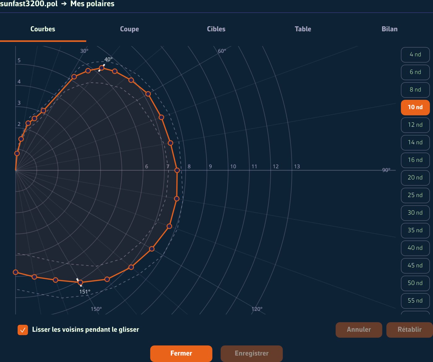
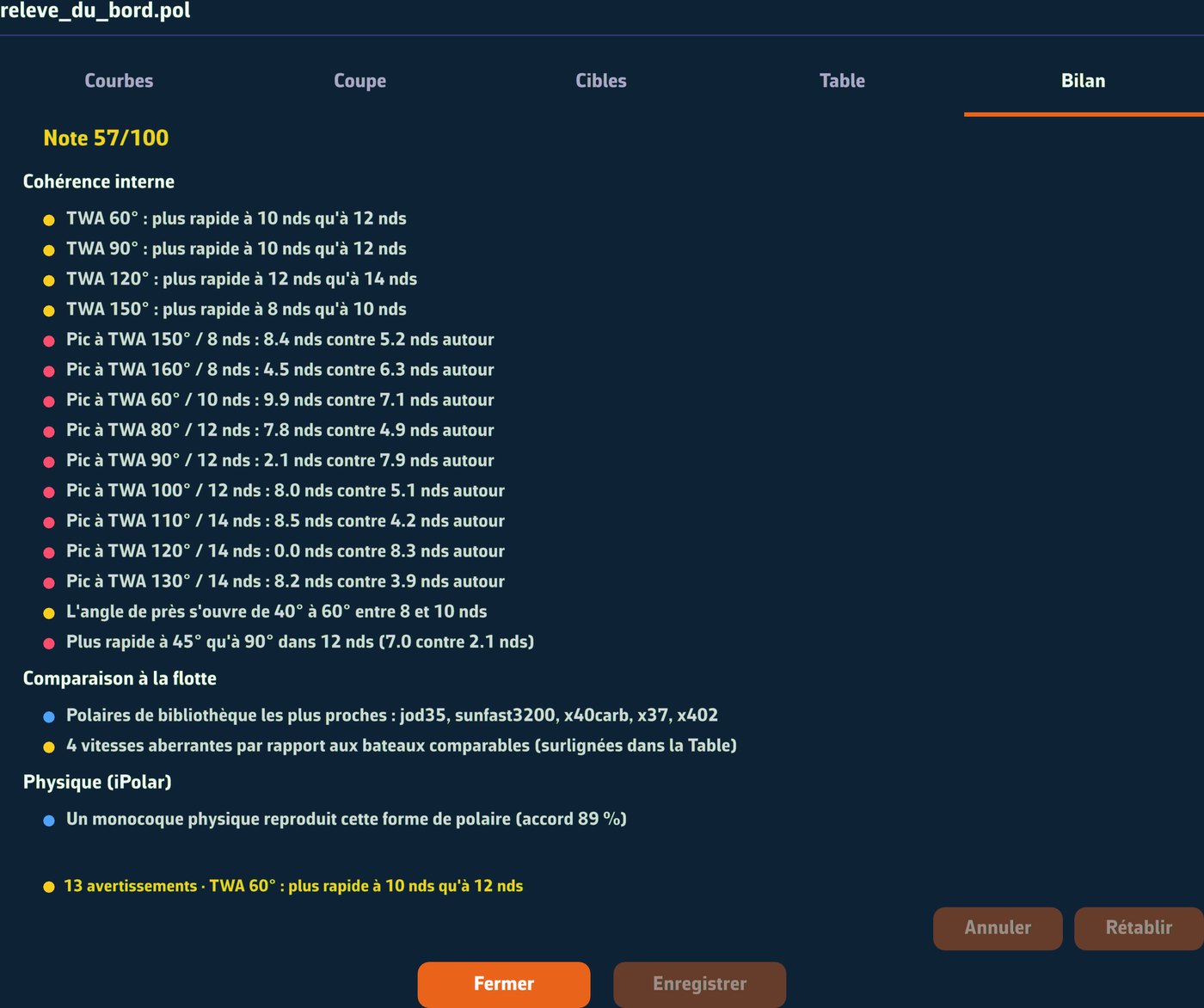
- Polar editor with five views: Curves (zoomable, drag handles), Slice, Targets (upwind and downwind angles and VMG), Table (editable grid with a % scale), and a Report tab that scores your polar, lists the anomalies and takes you in one click to the spot to fix.
- ORC import: type a sail number, a name or a class. The certificates appear (full crew, double-handed, non-spinnaker), and one tap imports the polar.
- Export to SailGrib, Adrena, Expedition, qtVlm and Weather4D from each polar’s menu.
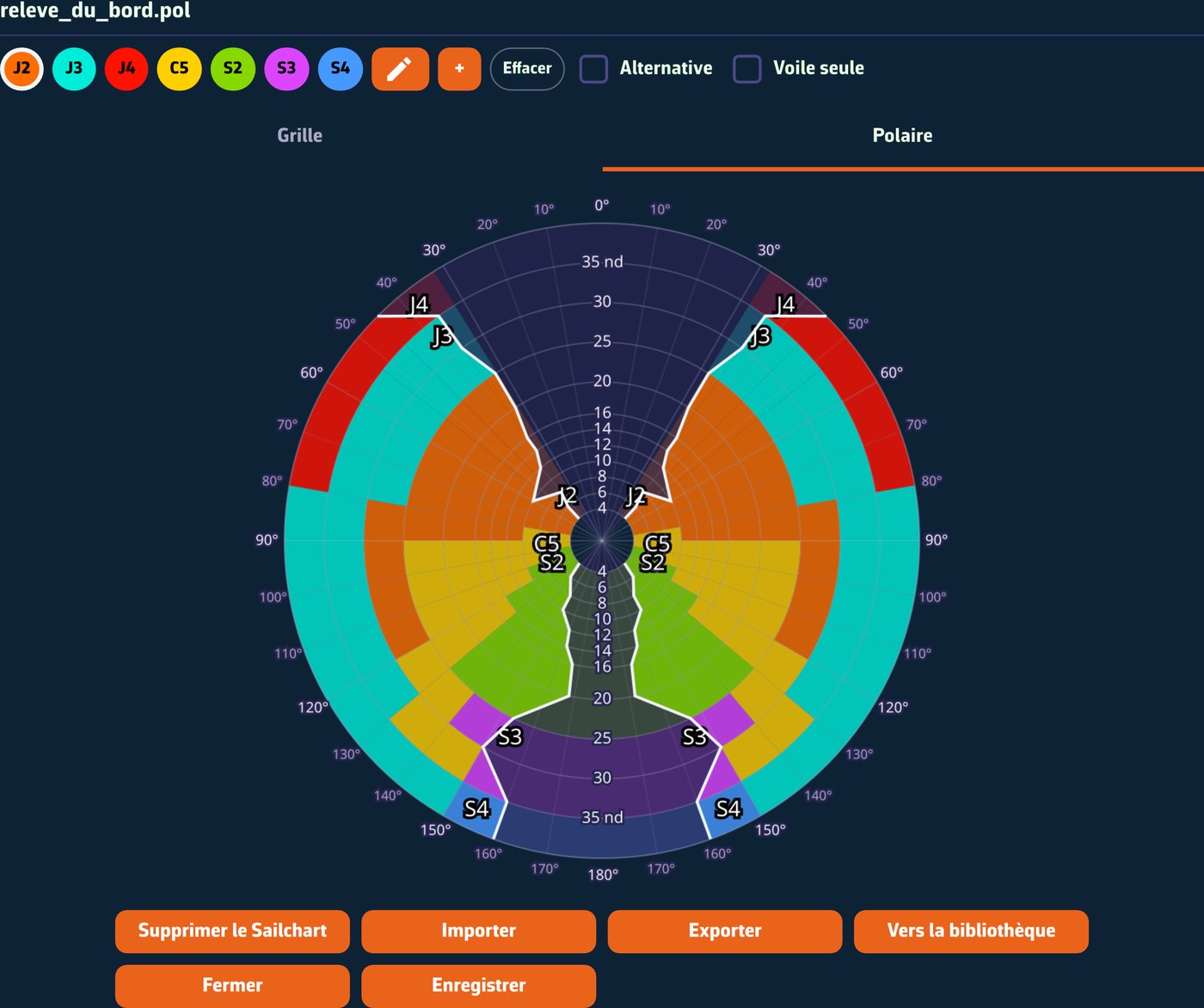
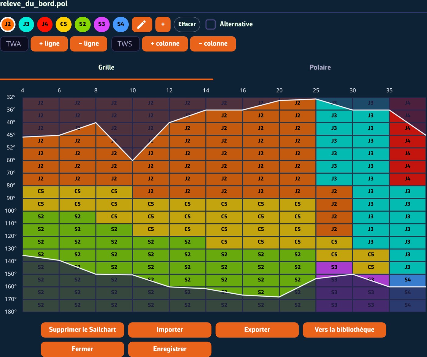
- Sailchart: which sail to carry at which wind strength and angle, in an Adrena-style editor (sails brushed on cell by cell, hatched overlaps, best-VMG boundaries), with bundled sail sets, import of an Adrena Sailect crossover, and automatic generation of a Sailchart from an iPolar polar.
- “Lost sail”: blow out a spinnaker, mark it out of service, and the app builds a degraded polar without it, leaving the original untouched.
Routing and navigation
- Recalculate a routing: the “Recalculate” entry in a routing’s menu runs it again with today’s weather. GRIB files with a newer run are refreshed, a new routing is added next to the old one, and its “Inputs” tab shows what changed.
- Export and import your routings (
.nxroutingfile): a routing can be sent to a crew member, even on another account, and displays exactly as it was, AI briefing included. - New “Course tracking” tile: for each remaining leg, which mark, how far, which heading to steer once current is corrected, at what wind angle, with which sail, at what time. The weather of each leg is read at the time you will be there.
- Mark side: a waypoint can be left to port or to starboard. It is a constraint for the router, and an instruction for the crew.
- The sail inventory is frozen with each routing: changing polar no longer relabels your older calculations. Legs can be colored by routing, by sail or by speed.
- Measuring on the chart now tells you, besides distance and bearing, at what wind angle that heading would be sailed and under which sail: “4.3 NM 219 T · 173 Td S2”.
- The AI weather briefing (Premium) now reads the whole routing: gusts, pressure, cloud cover and instability index, leg by leg, where it used to see only the wind. It exports to PDF, route chart included, to send to the crew or keep on board.
- Routes in RTZ format: import and export of ECDIS routes (IEC 61174 standard), to exchange a route with the bridge of a commercial vessel.
- The active route is shared between your devices.
Weather: archives on demand, and rain forecast by AI
- Historical ECMWF weather on demand (“Load historical GRIB” in the + menu): choose an area and two dates, up to today. Back in port, replay the day you just sailed with the weather it actually had. The dialog tells you before you start what the period will cost (days already prepared, waiting time, grid resolution). Archives requested by hand sync between your devices.
- The grid adapts to the area, no longer to the file size: a quarter degree along the coast, coarser for an ocean crossing. Two weeks of coastal cruising are no longer degraded.
- Rain and lightning forecast by AI: two new European layers, provided by WeatherNCo, forecast rain 3 hours ahead in 10-minute steps (our forecast based on the movement of radar echoes stops at 90 minutes), and upcoming lightning, where strike layers only show strikes that have already happened. See the squall coming before it reaches the deck.
- Rain radar: new European OPERA composite. Spain, Portugal, the United Kingdom, Ireland, Benelux, Poland, the Baltic and Greece are now covered, where the screen used to be empty. Italy is back, and the freshness of every source is checked daily.
- On mobile, the radar no longer downloads in the background: battery and data plan are spared.
Tides and currents
- Tide calculation has been reworked in depth. NavimetriX now models sixth-diurnal constituents and shallow-water constituents, the ones that shape the long high-water stand in the English Channel: no more phantom low water in the middle of a stand.
- Ten more ports, including Ouistreham, Dives-sur-Mer, Trouville-Deauville and Honfleur in the Bay of the Seine, with Ouistreham and Honfleur computed as standard ports instead of being attached to a neighbor. Nine ports are recomputed from the Shom tide gauges, much more accurate in estuaries (Nantes, Cordemais, Rochefort…).
- Chart datums have been rechecked port by port: the heights shown match the official tide tables.
- The tide gauge on the chart appears without having to move the chart, and the level it draws finally matches the figure displayed. The current atlas keeps a stable reference high-water time.
Instruments and onboard data
- Your instruments without Navigation mode: at the pontoon, wind and depth appear as soon as your instruments talk, without opening a track.
- A real barometer on board, even without instruments: your phone’s or tablet’s sensor takes over when no instrument sends pressure. It is sampled in battery-friendly bursts, and calibrates in one gesture against the pressure the weather models give where you are. Calibration absorbs the sensor bias and the height it sits at in one go, and the app warns you if it was measured at another altitude. Pressure can even be rebroadcast as NMEA (XDR/MDA) to the other devices on board.
- Barograph: ten days of pressure history, as a tile or a large gauge, with a pressure drop alarm. You see the squall coming.
- True wind from your instruments: MWV T / VWT / MWD sentences are now used as they are, with your correction tables, instead of being recomputed, with automatic fallback if they stop.
- Reference speed Surface | Ground: fouled log? Switch every calculation (true wind, leeway, VMG, polar performance) to speed over ground with a single setting.
- Instruments that stayed silent are finally read: systems that end their sentences with a bare carriage return, depth sounders whose depth sentence carries one empty field too many. On macOS, NMEA broadcast on the local network is no longer blocked.
- The satellites of the internal GPS now fill the “Satellites in view” and “Satellites used” gauges, with the constellation legend on the gauge ring.
- Remote cockpit (Premium): with “Auto broadcast in navigation”, the boat starts broadcasting as soon as you set off in navigation, and stops when you come back.
- New “Sailchart” tile: the polar view zoomed on your boat, with the track of the last few minutes. You see at a glance whether the wind is building and whether you are nearing a sail change. The prescribed sail also shows as a numeric tile, with its code and color.
Everywhere else
- Colorblind-friendly colors: one setting switches every color that carries meaning (port and starboard, alerts, dangerous AIS targets, time cursor) to a palette everyone can read.
- A “General” menu in the settings groups language, time zone, units, appearance, power saving and the MOB button.
- “Contact support”: describe the problem, the app’s log is sent on its own, and your email carries a ticket number. No more hunting for the file.
- Android: the app now installs on Wi-Fi tablets without a GPS chip, which get the boat’s position over NMEA.
- Redesigned dialogs: finger-friendly, buttons that stack on phones, content that no longer overflows.
- Mobile battery life: timelines, isobars and radar go to sleep when the app moves to the background; the iOS app can be suspended again after a trip.
- Readable night mode: AIS target labels, selection squares and the onboard data panel turn yellow.
- Power saving mode: wind shows as barbs and currents as arrows, two representations far lighter than animated particles.
- On desktop: the window comes back maximized without growing a little more at every launch, stays on the screen it belongs to, and the display scale setting survives sleep.
- French / English / German / Spanish translations for every new feature.
- And a long list of fixes: POIs that show again, chart framing restored at startup, wind barbs that no longer disappear when zooming, a sharp timeline on archives, isobars that no longer flicker during replay…
And finally: take some altitude
We owe you a confession: while some of us were recomputing the tides, someone here spent their evenings placing stars.
- A real starry sky now surrounds the Earth when you zoom all the way out: every star at its real position, magnitude included, not a handful of pixels scattered at random. No, it won’t gain you a tenth of a knot.
- An atmospheric halo rings the planet, as seen from the Space Station. Minus the night watch.
- The polar ice caps appear as you climb, where the projection used to hide them. In case you are planning the Northwest Passage.
It is perfectly useless, and therefore absolutely essential. Tonight, before you close the app, zoom all the way out: great crossings always start by looking at the Earth from afar.
Fair winds, and enjoy 1.24!