What's new in version 1.21
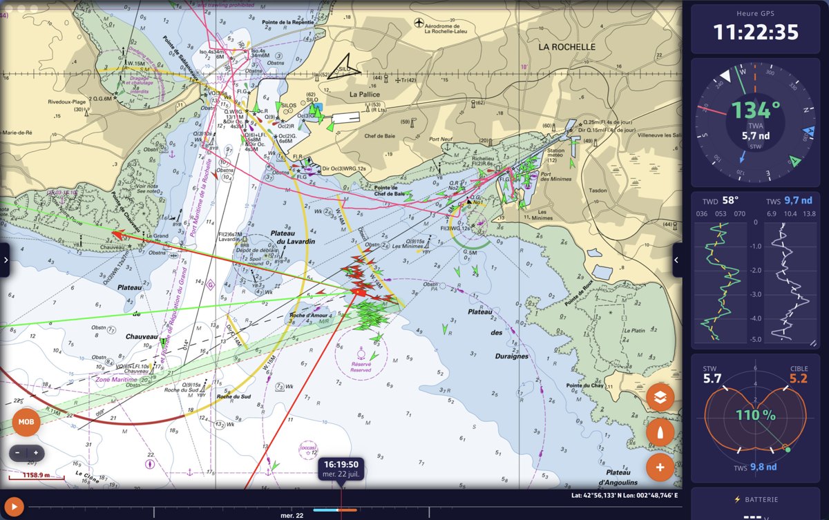
Version 1.21 is the largest NavimetriX update in a long while: a completely redesigned interface, next-generation instruments, AIS weather station display, and much more. Here is the essence of what changes.
A redesigned interface
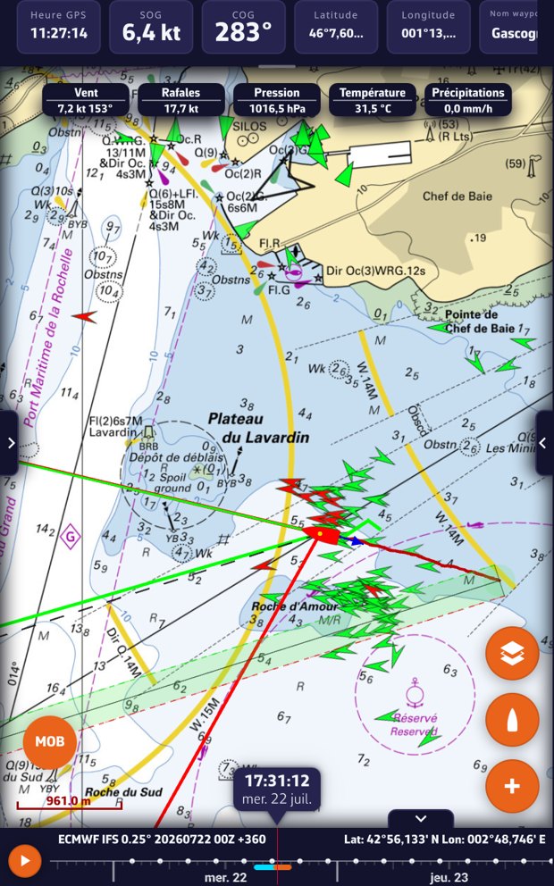
- Full-bleed, edge-to-edge chart: the chart fills the whole screen, and the “chrome” (pills, value bar) floats on top with a glass style. It appears on touch and fades away on its own so nothing is hidden.
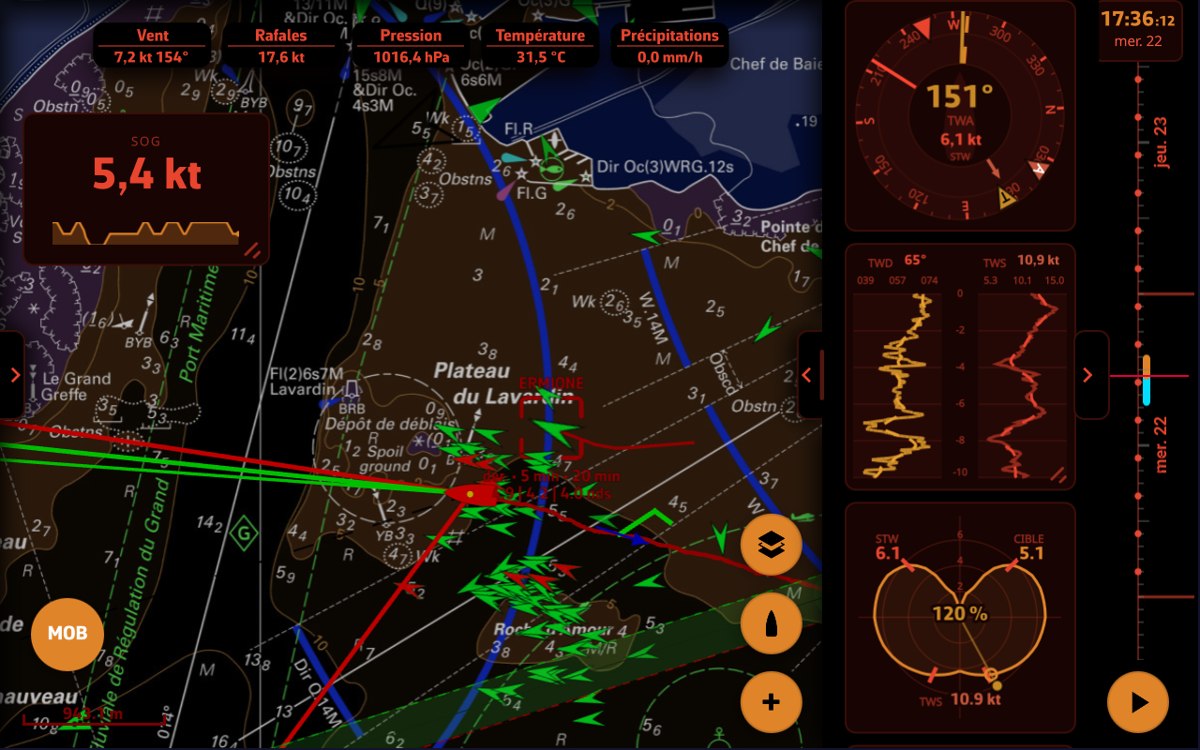
- Night mode in marine red, designed to preserve your night vision.
- Edge-handle drawers (GRIBs, Charts, Settings…), new typography and a design system that is consistent throughout the app.
Night mode tints the entire interface — chart, gauges, instrument bar and timeline — in a discreet marine red:
Completely redesigned instruments
The instrument dashboard has been rebuilt from the ground up.
- A single, reorderable bar, with several instances of the same instrument and drag-and-drop (ghost image, insertion slot, alignment guides).
- 14 gauge types, several of them new: history chart, rudder angle, GNSS satellites, energy / battery banks, polar performance, SailSteer-style analog wind dial, generic needle gauge…
- Per-instrument settings with a live preview, resizable dock, and a different layout in portrait and in landscape.
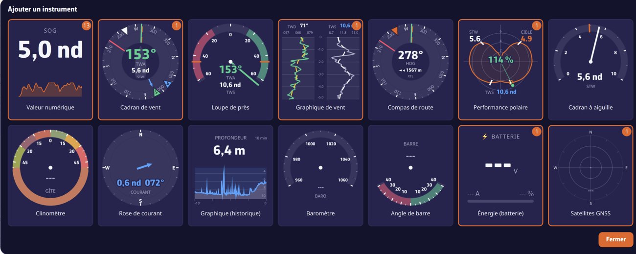
The dashboard works on every platform — here on an Android tablet:
For the full picture, see the FAQ: What are the instruments for and how do I customize them?
A handier timeline
- In landscape on a phone, the timeline becomes a vertical column on the edge opposite the camera.
- Collapse / expand animation, hiding via the chevron, and a built-in date cartouche.
AIS: weather stations and weather ships
- Stations and ships broadcasting weather data are shown in cyan, visible at every zoom level and selectable even zoomed out (long press: wind, pressure, temperatures, current).
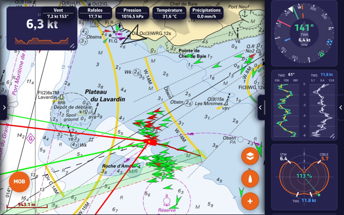
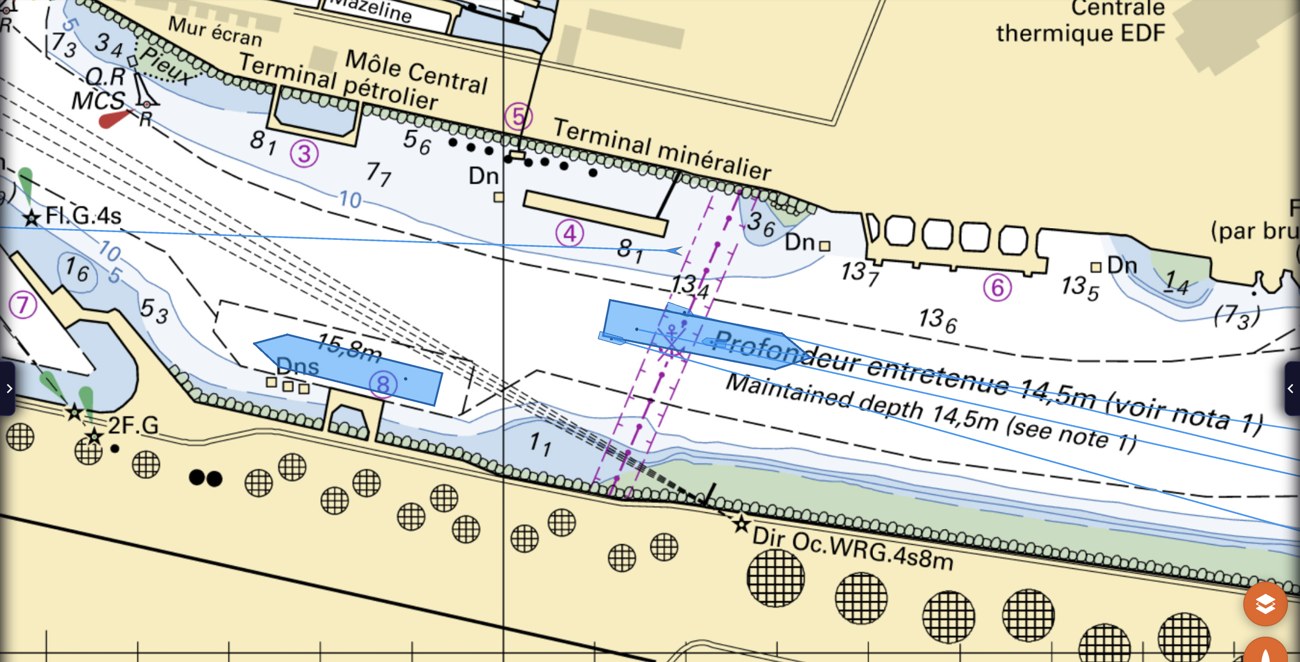
- AIS weather-observation decoding (binary messages), and real-size hull silhouettes at high zoom.
- As a Premium option, broadcast your own position and weather over the NavimetriX network.
At high zoom, AIS vessels are drawn at their real size and heading (hull outline with antenna point):
Measuring and cartography
- Right-click (computer) or two-finger long press (touch) on the chart to add a measure or an instrument at the clicked point.
- New “double bearing” measure style (circles and bearings at both ends).
GRIB: automatic download
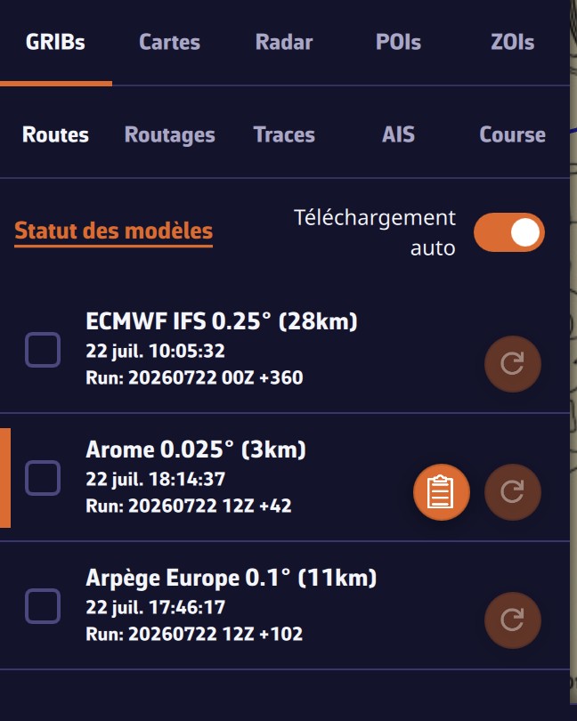
- GRIB files download and update on their own as soon as a new run is available: no more confirming every time. Just enable “Auto download” in the GRIBs tab.
- The panel shows the status of each model (ECMWF, Arome, Arpège…) with its run and forecast range.
Remote cockpit (Premium)
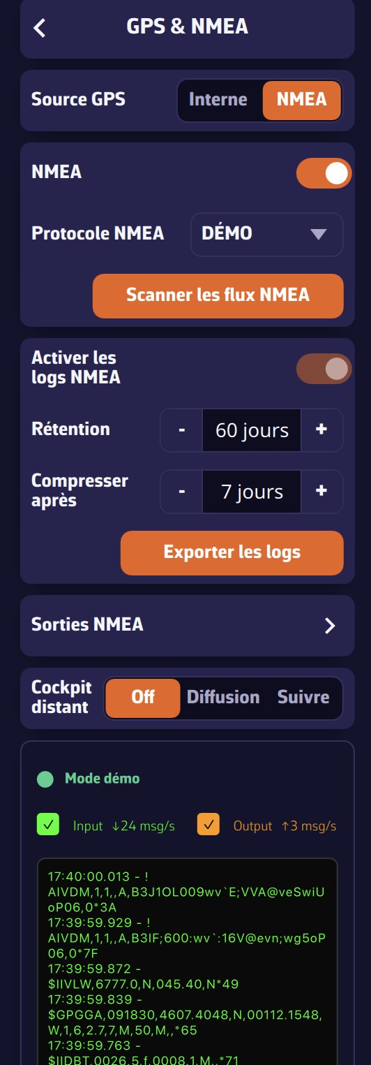
- Follow another boat’s live NMEA + AIS over the network: the app switches to navigation mode and centres on the followed boat.
The setting is in Settings › GPS & NMEA › Remote cockpit — choose Broadcast to share your data, or Follow to receive another boat’s:
For the full picture, see the FAQ: How does the Remote cockpit work?
On mobile
In portrait, the instruments sit in a horizontal bar at the top, and the chart takes up all the rest of the screen:
- Edge-to-edge landscape with safe-area handling (notch / Dynamic Island), camera on the right and recentred handles.
- Full-screen NavimetriX splash screen at startup.
- Many refinements on iPad (full-height chart, dock, instrument column).
Energy-saving mode
- An eco mode lowers the refresh rate to preserve battery on long passages, without freezing the instruments or the chart.
And many fixes
- Stability, gauge legibility at 2–3 metres, units, and a host of refinements.
Fair winds, and enjoy 1.21!