13 new models in NavimetriX
Choosing the right model is half of a good weather decision. Offshore, you want to compare ECMWF and GFS; close to the coast, you want a model at a few kilometres, or even a few hundred metres; and for currents and sea state, you want the best available in each basin. This month, 13 new models join NavimetriX. The library, one of the most extensive on the market, now brings together some thirty models from 14 forecasting services, from the American NOAA to the French Ifremer, available as 87 forecasts to choose from by resolution and area, and all of them are included in the subscription.
The 13 newcomers
Wind and atmosphere, high resolution outside France
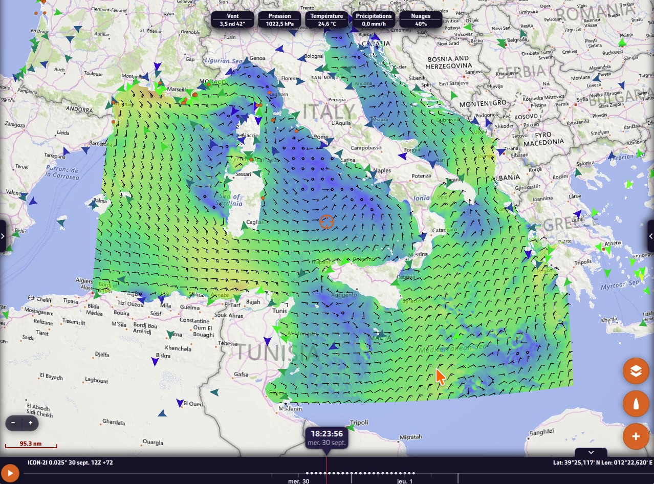
- ICON-2I (ItaliaMeteo): 2 km over Italy, Corsica, Sardinia, the Adriatic and the Tyrrhenian Sea, up to 72 hours.
- HARMONIE (KNMI, the Dutch weather service): 2 km from the eastern Channel to the North Sea and the German Bight, up to 60 hours, with gusts.
- MET Nordic (MET Norway): 1 km over Norway up to the Lofoten Islands, Sweden, Denmark, Finland and the Baltic, with gusts.
Currents
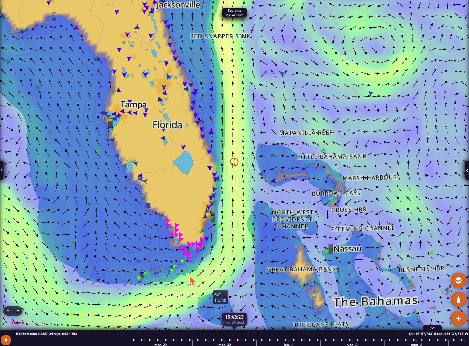
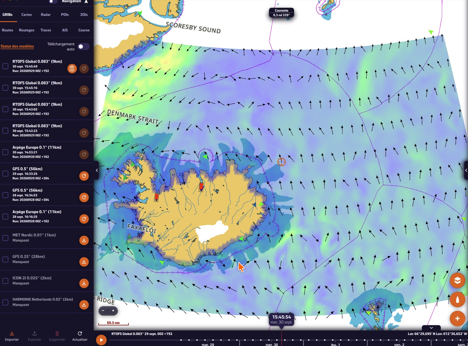
- RTOFS Global (NOAA): surface currents all over the world at 9 km, every 3 hours up to 8 days. Gulf Stream, Agulhas Current, equatorial currents, eddies: everything you need to place your route in the right spot offshore.
Waves
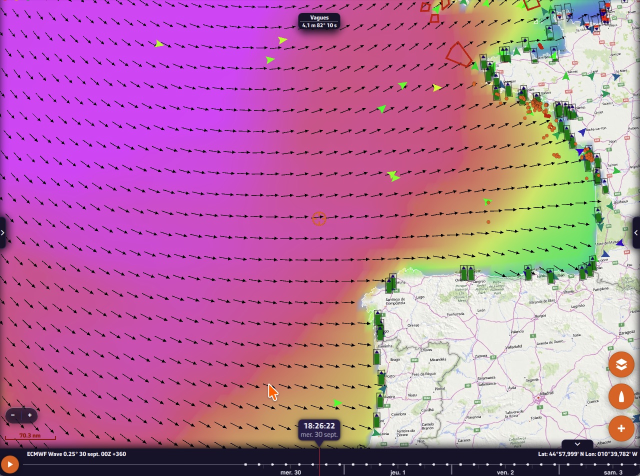
- ECMWF Wave: the waves of the European centre, coupled with its winds, up to 15 days.
- Copernicus Global Waves: waves all over the world at 9 km, with wind sea and swell separated, up to 8 days.
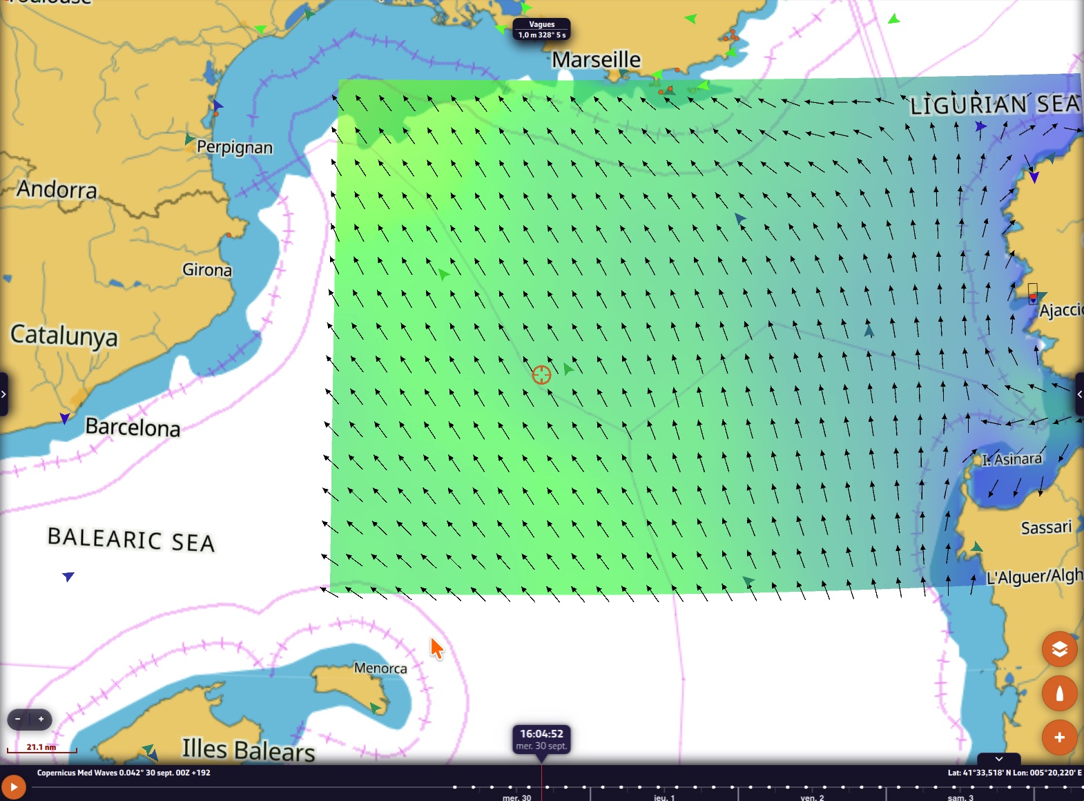
- Copernicus Med Waves: the whole Mediterranean at 4 km, from the Gulf of Cadiz to the Turkish Straits, up to 8 days.
- DMI WAM (Danish weather service): North Sea, Baltic, English Channel and Celtic Sea, hour by hour up to five and a half days.
- Ifremer WW3 overseas, five zones: Lesser Antilles at 5 km, Guadeloupe-Martinique at 1 km, Martinique at 500 m, New Caledonia at 5 km and Reunion Island at 180 m.
What makes the difference
- ECMWF at 9 km, included in the subscription. The high-resolution version of the European model, the offshore reference, is elsewhere kept for the most expensive plans. In NavimetriX, it is part of the subscription, next to ECMWF 0.25° and ECMWF’s AI model (AIFS).
- Copernicus SMOC, tidal currents everywhere in the world. It is the only global current model that includes the tide: where no coastal model exists, you still get the tidal current, on top of the large ocean currents.
Follow the models live
Every model has its own sheet on our status pages, updated every five minutes:
- Models status: the latest run available, when it was published, the next run expected, and the share of runs received over the last seven days. The “Details” button opens the full sheet of the model, with its area on a map.
- Next 24 hours: when the next ECMWF, the next AROME or the next wave run arrives.
- Coverage map: the areas of the 57 regional models on a single map. Hover over your sailing area to see every model that covers it.
How to choose
With so many models, the question becomes: which one for my area? A few guidelines.
- The size of the area sets the resolution. To cross an ocean, a global model at 0.25° or 0.5° (ECMWF, GFS) is enough and keeps the file light. For coastal sailing, a regional model at 1 or 2 km (AROME, ICON-2I, HARMONIE, MET Nordic) sees the coastal effects, the sea breezes and the acceleration around headlands that global models smooth out.
- The forecast length matters as much as the grid. Fine models stop after 2 or 3 days. Beyond that, go back to ECMWF or GFS.
- Comparing two models is still the best way to judge a forecast: if they agree, go; if they disagree, be careful.
The magic wand to get started
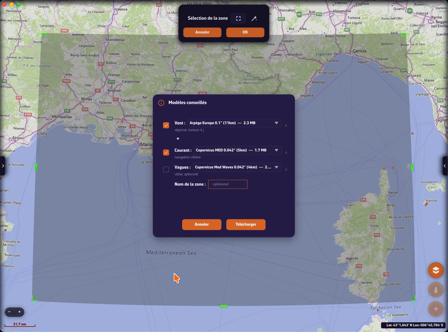
Tap the + button on the map, choose Download GRIB, draw your area, then tap the magic wand next to “Area selection”. NavimetriX suggests a combination of wind, current and waves suited to the area:
- wind: the model whose resolution matches the size of the area, for example AROME for a bay, Arpège Europe or ICON Europe for a passage to Corsica, ECMWF or GFS for an ocean. A regional model that covers the whole area comes before a global one, and the forecast length follows the size of the area, from one day for a bay to 15 days for an ocean;
- current: for coastal sailing, the best regional model, or the SHOM tidal atlas where it exists;
- waves: ticked by default for a large area (from about 350 nautical miles across), offered as an option for a smaller one.
Each line shows the file size, and a tick marks a file you have already downloaded. The drop-down list shows the other models covering the area if you prefer another choice, and the + button adds a second wind model to compare. An optional area name groups the files in the list. Tap Download: the files arrive and the wind is displayed on the map.
The sheet of each model
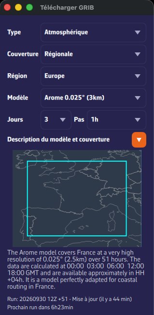
If you prefer to choose yourself, adjust the area and tap OK instead of the magic wand. The Download GRIB window opens and details each model: tap the > button next to “Model description and map coverage” to show its area on a map, its resolution, its forecast length, the times of its runs, the latest run available and when the next one is due.
The complete library
All these models are downloaded with the + button on the map, Download GRIB, over the area of your choice. The forecast lengths shown are the longest available.
Wind and atmosphere: global models
| Model | Source | Available grids | Forecast |
|---|---|---|---|
| GFS | NOAA | 0.25°, 0.5°, 1° and 2° | 16 days |
| ECMWF IFS | ECMWF | 0.1° (9 km), 0.25°, 0.4° and 1° | 15 days |
| ECMWF AIFS (artificial intelligence) | ECMWF | 0.25° and 1° | 15 days |
| ICON Global | DWD (Germany) | 0.125°, 0.25°, 0.5° and 1° | 5 days |
| Arpège World | Météo-France | 0.25° | 4 days |
| GDPS | Environment Canada | 0.15° | 10 days |
Wind and atmosphere: high resolution
| Model | Source | Area | Grid | Forecast |
|---|---|---|---|---|
| AROME HD | Météo-France | Mainland France | 1 km | 51 h |
| AROME | Météo-France | France and neighbouring countries | 2.5 km | 51 h |
| Arpège Europe | Météo-France | Europe | 11 km | 4 days |
| ICON Europe | DWD | Europe | 8 km | 5 days |
| ICON D2 | DWD | Germany and neighbouring countries, eastern Channel | 2 km | 48 h |
| UKV | Met Office | United Kingdom, Ireland, English Channel | 2 km | 5 days |
| ICON-2I | ItaliaMeteo | Italy, Corsica, Sardinia, Adriatic | 2 km | 72 h |
| HARMONIE | KNMI | Eastern Channel, North Sea, Netherlands | 2 km | 60 h |
| MET Nordic | MET Norway | Scandinavia, Baltic | 1 km | 58 h |
| AROME overseas | Météo-France | French West Indies, French Guiana, Reunion-Mayotte, New Caledonia, French Polynesia | 2.5 km | 33 to 42 h |
| NAM | NOAA | North America | 11 km | 3 days |
| HRRR | NOAA | United States | 3 km | 18 h |
Ensemble forecasts
| Model | Source | Grid |
|---|---|---|
| ECMWF ENS | ECMWF | 0.25° |
| GEFS | NOAA | 0.5° |
Offshore waves
| Model | Source | Area | Grid | Forecast |
|---|---|---|---|---|
| GFS Wave | NOAA | World | 0.25°, 0.5° and 1° | 16 days |
| ECMWF Wave | ECMWF | World | 0.25° | 15 days |
| Copernicus Global Waves | Copernicus Marine | World | 9 km | 8 days |
| MFWAM Global | Météo-France | World | 0.1° and 0.5° | 4 days |
| MFWAM France | Météo-France | France | 3 km | 42 h |
| Copernicus Med Waves | Copernicus Marine | Mediterranean | 4 km | 8 days |
| DMI WAM | DMI | North Sea, Baltic, English Channel | 5 km | 5.5 days |
Ifremer coastal waves
| Zones | Grid | Forecast |
|---|---|---|
| Pas-de-Calais, Normandy, Cotentin, Armor, Finistère, South Brittany, Loire, Charentes, Aquitaine | 190 m | 4 days |
| Northern Channel, Southern Channel, Northern Bay of Biscay, Southern Bay of Biscay | 500 m | 4 days |
| Lesser Antilles | 5 km | 4 days |
| Guadeloupe-Martinique | 1 km | 4 days |
| Martinique | 500 m | 4 days |
| New Caledonia | 5 km | 4 days |
| Reunion Island | 180 m | 4 days |
Ocean currents
| Model | Source | Area | Grid | Forecast |
|---|---|---|---|---|
| RTOFS Global | NOAA | World | 9 km | 8 days |
| Copernicus Global | Copernicus Marine | World | 9 km | 5 days |
| NCOM | US Navy | US East Coast, Caribbean, California, Alaska, Hawaii | 3 to 4 km | 3 days |
Tidal and coastal currents
| Model | Source | Area | Grid | Forecast |
|---|---|---|---|---|
| Copernicus SMOC | Copernicus Marine | World | 9 km to 0.5° | 5 days |
| Copernicus IBI | Copernicus Marine | From Ireland to Morocco | 3 km | 5 days |
| Copernicus ENWS | Copernicus Marine | North-west European shelf | 1.5 km | 5 days |
| Copernicus Baltic | Copernicus Marine | Baltic | 4 km | 5 days |
| Copernicus MED | Copernicus Marine | Mediterranean | 5 km | 5 days |
| SHOM | SHOM | Channel-Bay of Biscay, northern Mediterranean | 2 km | 5 days |
| Ifremer MARS | Ifremer | Eastern Channel, Western Channel, Finistère, South Brittany, Aquitaine | 250 m | 4 days |
| Ifremer MARS | Ifremer | Channel-Atlantic | 700 m | 4 days |
| Ifremer MARS | Ifremer | North-east Atlantic | 2 km | 4 days |
| Ifremer MARS 3D | Ifremer | Channel-Bay of Biscay | 3 km | 4 days |
| St. Lawrence | Environment Canada | Gulf of St. Lawrence | 930 m | 3 days |
How to get them
The free version of NavimetriX offers GFS, the reference global model. The Premium subscription opens the whole library: every model, routing up to 15 days and every feature of the app. The new models appear automatically in the list of models the next time you start the app, with no update to install.
The data are provided by NOAA, ECMWF, Météo-France, DWD, Met Office, Environment Canada, ItaliaMeteo, KNMI, MET Norway, DMI, Copernicus Marine (E.U. Copernicus Marine Service Information), US Navy, SHOM and Ifremer.